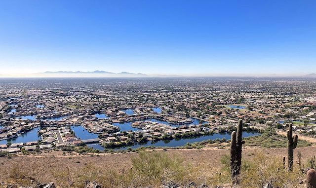
After my annual Halloween hike in Maryland, I start my winter hiking program back home in Phoenix.
I actually have the next six months of hikes planned. I call them “locals hikes”, as I don’t have to spend most of the day driving to & from Arizona’s far reaches. Locals hikes are close to civilization, relatively short, and not unduly rugged. Depending on where you live in Maricopa County, you could even be home by lunch!
Today’s expedition was to Glendale’s 1,185 acre Thunderbird Conservation Park, in the Hedgpeth Hills. According to Glendale, there are fifteen miles of official trails in the park. Good luck finding a map of them, like you can for Phoenix Sonoran Preserve, or one of the regional parks.
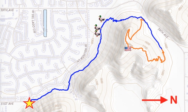
In any case, I planned to hike the eastern portion of Thunderbird Conservation Park: Starting from the pullout on 51st Ave., Coachwhip Trail west along the sedimentation basin to 59th Ave., then north nearly to Pinnacle Peak Rd.; loop clockwise up Arrowhead Point Trail to the summit of Arrowhead Point, then back down to the 59th Ave. pedestrian crossing; and finally back along Coachwhip Trail to 51st Ave.
Coachwhip Trail is typical Maricopa County suburban hiking: rolling Sonoran Desert, speckled with cholla, barrel cactus, palo verde, hedgehog cactus, bursage, creosote and brittlebush. In late fall, no desert flowers at all. In this case, not easily bike-able due to rockiness. High-end housing less than a hundred yards away. (Average home price over $800k, with golf course and Florida-like canals.)
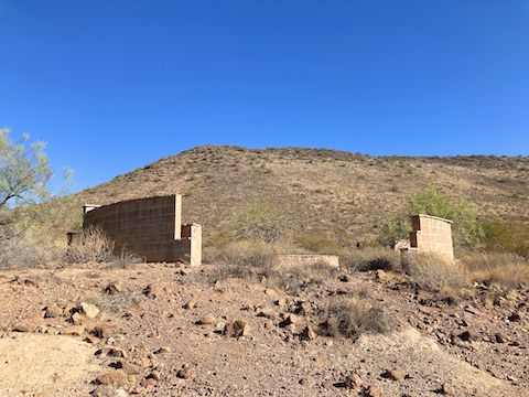
According to eBird, 130 avian species have been spotted in Thunderbird Conservation Park. The most common aquatic species are common merganser, ruddy duck, ring-necked duck, lesser scaup, double-crested cormorant, great and snowy egret, American wigeon, northern shoveler, and hooded merganser. Unfortunately, I don’t carry a tripod and zoom lens, only an iPhone.
From the third bird blind (above), Coachwhip Trail turns north, climbing 170 ft. at an 8% grade. Behold the toilets at the trailhead on the west side of 59th Ave.! The only “toilet” on the east side is the greenery obscuring the sedimentation basin. (Otherwise, there are too many people and no concealment.)
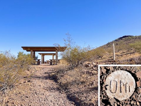
From the cabanas, Coachwhip Trail rolls another 0.4 miles to second Arrowhead Point Trail intersection, near the Pinnacle Peak Rd. trailhead. That was definitely the more popular parking option. Many hikers and dog walkers were doing an up & down, or short lasso, both of which are about 2.4 mi., 460 ft.
Arrowhead Point Trail is a tale of four parts. As I hiked it, the first part climbs 270 ft., is relatively flat for 200 yds., then climbs a short — but steeper — 120 ft. to Arrowhead Point’s summit. Both climbs are very rocky, with multiple step-ups. I found a rock art memorial to “Lisa” on the flat.
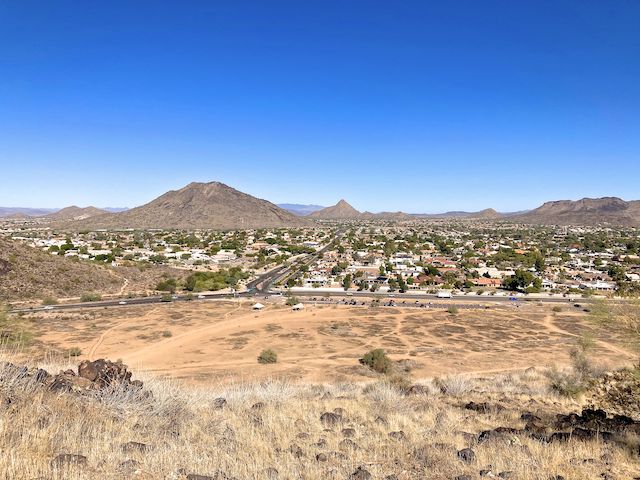
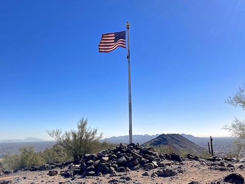
Because of the geology of Arrowhead Point, the summit only had views from east clockwise to west. Nothing northerly. (Those came on the climb, or on the flat.) But the views went a long way, 25+ miles. There were a couple stools built of rock slab resting on gabions. No shade, other than one palo verde which ain’t hardly shade at all. After my customary bajillion summit photos & videos, I bailed.
The fourth part of Arrowhead Point Trail descends 400 ft. It’s steeper still than the way I climbed, but with smoother surface. I jogged much of it. Back by the cabana, I realized my bottle of water bottle disappeared somewhere along the way. It was getting toasty. Luckily, I sill had some water in my Camelbak.
I didn’t jog as much back along Coachwhip Trail, but still made good time, finishing the 2.6 miles in only 56 minutes. (Not counting a bird blind pit stop.)
Directions: Really depends on where you live in the Valley. Personally, from I-17, I took Loop 101 west. Then take exit 20, north onto 51st Ave. In 0.4 miles, park in the pullout where 51st Ave. turns left.
GPS File: Thunderbird_Park_Coachwhip_Arrowhead
Distance: 6.50 mi.
AEG: 959 ft.
Time: 2h 30m
Rumble Video
Vimeo Video
Hiking Thunderbird Conservation Park from Preston McMurry on Vimeo.
