My first trip to Connecticut in five or six years was for the same reason as my last one: An endurance karting race.
Most kart races are done at club level, on the same track every week. If you get good enough, you can move up to a touring series, like World Karting Association. Either way, a given race day will feature many age groups and classes. So, what happens is that you do a 10-lap practice, sit around a few more hours while all the other classes have their practice, do a 10-lap qualifier, sit around for a few more hours while all the classes have their qualifying, then finally get to do a 10-lap race. If you are lucky, your race is first and you can leave early, rather than waiting a few more hours to do your race while everyone else has theirs. You lose a whole day for minimal seat time.
In endurance karting, races are much longer, typically 4-8 hours, sometimes as long as 24. Like World Endurance Challenge or Le Mans, there are multiple drivers per vehicle, but more in karts due to their more physical nature. (Though I have seen several drivers do a whole race solo, including the guy who won this week.)
My last race in Connecticut was at Lime Rock. This week was at Stafford Motor Speedway, in Tolland County, which was set up as a Daytona-like “roval” (infield road course which utitizes part of the big track’s oval).

If you’ve been following my hiking blogs, you are probably aware by now that wherever I go, I hike, be it a weekend in Flagstaff, or a trip to Scotland.
So, I did some research, and it turns out the Shenipsit Trail is only a few miles west of Stafford Springs, with decent spots for my helpful & understanding wife to drop me off at one end and pick me up at the other. My only concern was ticks.
I’ve been paranoid about ticks ever since I got my first one in the Army, 36 years ago, this month. How? Glad you asked. Crapping in some bushes on my first FTX at Ft. Bragg. Bastard latched on to me between my thigh and my balls. 😳
Another time, at Ft. Gordon for Signal Officer Basic Course, in 1991, I got one in my arm pit. I tried the usual methods to get it out, but only succeeded in killing it. I ended up digging it out with a knife. I must have left some parts in, because ever since I occasionally get an itch in that exact spot.
Ticks can carry Lyme Disease, and I was under the impression it was first discovered in Connecticut, so I was even more careful than normal about brushing against any vegetation. (In the end, all that ended up on me was a few small caterpillars.)

The Shenipsit Trail is 50 miles long, starting near Somers (near where I began), on the Massachusetts border, then heading south to Cobalt, CT. The end of this 6.6 mile section is on a gravel side road a few yards north of CT-140, in Ellington.
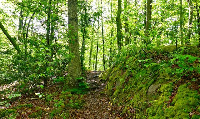
The Shenipsit Trail is a very similar to Wisconsin’s Ice Age Trail: Green, green and more green. The Ice Age Trail is a bit more up & down, whereas the Shenipsit Trail has the bigger climb, such as it is, 300 ft. up Soapstone Mountain. (A fairly steep 300 ft., as it has an equivalent grade to 1000 ft. in a mile.)
Both cross several paved roads. In the Shenipsit Trail’s case, Gulf Rd. a quarter of the way into the hike, about 1.5 miles south of the starting trailhead on CT-190. Just north of Gulf Rd., the Shenipsit Trail passes a large pond; just south of it is a trailhead for the short climb up Soapstone Mountain. If you hiked out to CT-140, then back to Gulf Rd, you would increase your mileage to 10.2 miles, without need for a shuttle.
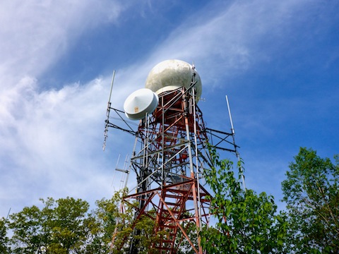
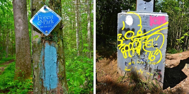
There are two towers on Soapstone Mountain’s summit: One an observation deck, which replaced the old fire lookout in the early 70s, and a fenced off commo / radar tower. The observation deck, for that matter, is also fenced off and the bottom flight of stairs removed. You could climb to the 30 ft. or so to the top, but there is no flooring to stand on. The observation deck is covered in graffiti.

Halfway south on Shenipsit Trail is gravel Webster Rd. A quarter mile west on Webster Rd. is the Parker Rd. trailhead. An out & back hike to either CT-190 or CT-140 would get you about the same 7.1 mile hike distance, without need for a shuttle. Parker Rd. is also secluded, so your car is less likely to get broken into. (That said, Tolland County is much nicer than Bridgeport!)
If you hike this Shenipsit Trail section end-to-end and back, or do the same starting at the Parker Rd. trailhead, summiting Soapstone Mountain both ways, it would make for a very healthy 13.2 miles and 1,900 AEG day. Bring plenty of Off!
Bring Off! anyway. I doused myself, head-to-toe, applying paying particular attention to my waist and ankles (for tick prevention).
I actually started hiking from Galbraith Rd., just west of Sodom Rd., as I was not sure where the Shenipsit Trail crosses CT-190. I ended up walking down gravel Sodom Rd. for a half mile, making several false turns, before finally finding the actual trail.
Shenipsit Trail is a Connecticut blue-blazed trail. Sometimes it is one blue blaze; sometimes it is two. At least on the Shenipsit Trail, one or two does not seem to indicate side vs. main trail. There are numerous other markers as well, including white dots, white arrows, yellow diamonds, yellow diamond with a black arrow, mileage signs and more I’ve forgotten. I continued to make false turns throughout my hike, but found that if I went more than 100 yds. without seeing a blue blaze (of either sort), it was best to return to the previous intersection, and try the alternate direction.

There are some rocky sections, but unlike the Appalachian Trail, the trail never disappears. No worries about ankle breaking or knee blowing.
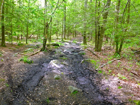
The trail width varies from single track, to double track, to jeep trail. Old jeep trail in some cases, more recent jeep trail in multiple unfortunate cases south of Webster Rd. Several times between Webster Rd. and CT-140, despite blue blazed trails supposedly being foot traffic only, the surface has been so dug up by OHVs that mud bogs have formed.
There’s also a few creek crossings, but they can all be done dry, as most are no more than trickles. Your shoes will get more wet from dew.
I was pleasantly surprised to see a beaver lodge in the pond just north of Gulf Rd. I heard plenty of birds, all morning, but did not see or hear the beaver. There were blessedly few bugs until the small pond just north of Webster Rd. From there to CT-140, there was always something buzzing around, but I escaped the Death Itch I suffered on Oklahoma’s Bison Trail.
The flower porn was Rated G. There were few flowers on the Shenipsit Trail, other than scattered patches of some small white ones. The only other flowers I recall seeing were exactly one blooming dandelion, a couple of dead ones (dead-elions?) and very few of some four leaf purple flower.

There were a few cars at the CT-140 trailhead, and a few more at the Gulf Rd. trailhead, but I only saw two hikers and one dog all morning.
To sum up, the Shenipsit Trail is not a destination hike: It is a enjoyable stroll in the woods that beats riding the bike in your hotel gym. 😉
Directions: From Windsor Locks, CT, head north ~5 miles on I-91 to exit 47E. From Springfield, MA, head south on I-91 to the same exit. Head east on CT-190 for ~10 miles to Sodom Rd., which is on the south side of CT-190, just east of Somers. If you pass by Johnson Memorial Hospital, head back west a quarter mile. Directions obviously vary if you intend on hiking from the south trailhead on CT-140, from the trailhead on Gulf Rd. at the foot of Soapstone Mountain, or from the midway trailhead on Parker Rd.
GPS File: CT_Shenipsit_Trail
Distance: 6.60 mi.
AEG: 910 ft.
Time: 2h 30m
Hiking Video
Hiking Shenipsit Trail, Connecticut from Preston McMurry on Vimeo.

All that green and bird sounds make at all seem peaceful. Wonderful.
It would have been relaxing if I hadn’t been rushing a bit. 😉