
")
Today was my penultimate segment hike of the Prescott Circle Trail, a 56 mile loop around the city of Prescott. “The Other PCT” is mostly dirt, the exception being 1½ roadside miles along Williamson Valley Rd. and another ¾ miles of sidewalk along Willow Lake Rd. Recovered from last Fall’s knee injury, Prescottstyle was along for the hike.
Prescottstyle and I started hiking from White Spar Campground just before 9:00 a.m. Before we even crossed AZ-89, I had to turn around: My shuttle driving wife couldn’t find the vehicle GPS I programmed for our pickup at Aspen Creek Trailhead, on Copper Basin Rd. The “missing” GPS was in our SUV’s back seat foot well.
The White Spar to Aspen Creek segment of the Prescott Circle Trail is mostly along Wolverton Mountain Trail #9415. The first 1¼ miles of Trail #9415 has some decent shade, before crossing FR 9707V, and entering the old Indian Fire burn scar. (FR 9707V is the dirt road to Quartz Mountain.) 🔥
The Indian Fire ignited on May 15, 2002, at the Indian Creek Campground, just outside Ponderosa Park, two miles south of what is now the Prescott Circle Trail. The Indian Fire quickly crowned, exploding north, into Prescott’s Cathedral Pines subdivision. Several homes were lost, but preparedness — including drills just a month before — kept the Indian Fire from being worse. In the end, the Indian Fire burned 1,365 acres (video).
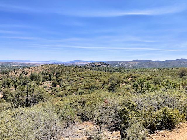
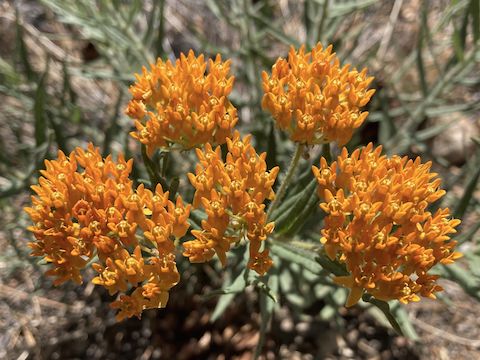
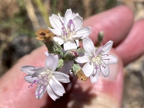
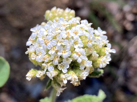
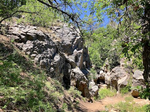
The Indian Fire burned hot, turning ponderosa pine to stubs. Manzanita need fire to reproduce, so they’ve done quite well along Wolverton Mountain Trail #9415. It’s shrubbery & views, instead of trees & shade. Good thing I liberally applied SPF 90 spray back at White Spar. 😅
It’s been eleven years since I hiked Wolverton Mountain Trail #9415. So, I thought Hill 6103 was Quartz Mountain. There is a new, undedicated, rest bench on Hill 6103’s northeast slope, at the 2¼ mile mark. Quartz Mountain is the next hill, a half mile southwest. The rocks on top are whiter, and more numerous, than the rocks atop Hill 6103. Depending on how much you explore, a Quartz Mountain diversion will add maybe a half mile to your hike.
Wolverton Mountain Trail #9415 reaches its namesake hill a half mile west of Quartz Mountain, at the 4¼ mile mark. The “summit”, only 100 ft. above the PCT, has a razor wire-protected abandoned weather station. Wolverton Mountain has some shade. The pet cemetery I found there eleven years ago is now almost indistinguishable. 🪦
An out & back hike to Wolverton Mountain would be 9.0 miles, 1,080 ft. accumulated elevation gain (AEG) from White Spar; 3.8 miles, 400 AEG from Aspen Creek. Out & back to Quartz Peak is 7.2 miles, 820 AEG from White Spar; 6.0 miles, 760 AEG, from Aspen Creek. From White Spar to the rest bench & back is 2.7 miles, 400 AEG.
From Wolverton Mountain, Trail #9415 begins descending. Trail #9415 ends after just over five miles at Aspen Creek Trail #48. Left contours along Mount Francis’s East slope; Prescottstyle and I went right, towards Copper Basin Rd. The final ¾ mile is the shadiest part of this Prescott Circle Trail segment. At the 5¼ mile mark, there is a pretty, small, fall that that unfortunately had no water.
After Prescottstyle & I got picked up by my wife at Aspen Creek Trailhead, we drove back into town on Copper Basin Rd. Good thing I was obeying the speed limit, as two cops passed us heading the other way, towards Copper Basin. At La Casa Prescottstyle, the roasting of weenies, consuming of beer, and petting of dogs — Lily & Olive — commenced. 🐶
White Spar Trailhead: From Courthouse Square in Prescott, head south on AZ-89 / Montezuma St. As AZ-89 leaves downtown, it changes names to White Spar Rd. In 2.9 miles, just after entering the Prescot National Forest, turn left into White Spar. Make an immediate right turn to the trailhead. (Left is the campground.)
Aspen Creek Trailhead: Drive 1.8 miles back towards downtown. At the next light, turn left on Copper Basin Rd. In 4.6 miles, just past Aspen Creek Spring, turn right into the trailhead. The last 1.5 miles are car drivable dirt.
GPS File: PCT_White_Spar_to_Copper_Basin_Rd
Distance: 6.36 miles
AEG: 1122 ft.
Time: 2h 40m
Rumble Video
Vimeo Video
Prescott Circle Trail: White Spar to Aspen Creek from Preston McMurry on Vimeo.