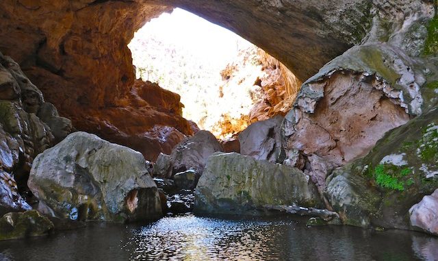
I came up with the idea for this hike last year, after I did the Pine 2 Strawberry hike. I knew Tonto Natural Bridge was not far away from where Hardscrabble Mesa AZT #26 merges into Oak Springs Trail #16 for the final miles east to the Pine TH. (Host of the world’s most awful smelling pit toilet.) The Arizona Trail bends away from Pine Canyon, and it would not be safe to descend from Pine Ridge to Pine Creek without canyoneering equipment. My initial thought was to follow the bottom of Oak Spring Canyon, to Pine Creek, to the Bridge. But on looking at satellite view, I noticed an obvious foot trail leading from Oak Spring to Arrowhead Canyon Estates. Pine Creek itself looked like it might be doable, but as anyone who has hiked in Arizona will be aware, that does not mean much when feet hit the ground. ![]()
My wife and I made it out of Phoenix early enough that I was able to hit the trail at 0740, about an hour earlier than normal. I was hoping I could make what I figured to be a 7.5 mile trip in four hours, and hit the Buffalo Saloon in Payson in time for lunch.
The hike starts by heading back down the trailhead driveway towards AZ-87. Just before the highway, there are two deer / elk crossing culverts, one on either side of the driveway. I chose Door #2, on the right. Where my route crosses dirt Old County Rd., last September there was a decayed, awful smelling, dead elk. It was gone. I did not check on the other dead elk I had spotted a bit further south on the highway. I thought it odd at the time that there would be two dead elk within a few hundred yards of each other, but not in a position that made their death’s due to motor vehicle accident. Turns out the corpses were likely the result of poaching, as I read in the Arizona Republic, back in March. ![]()
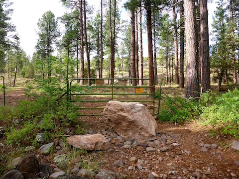
The gate between Old County Rd. and the AZT has been blocked by a very large boulder. No more driving in the forest for local yahoos. Just past the gate is the canyon known as The Narrows. If you try that as as variation on this hike, it definitely requires rapelling.
Other than a mile of minor scrambling at the end, most of this hike is flat or downhill. The only climb is a few hundred feet up a rocky segment from the top of The Narrows to Bradshaw Tank. The next four miles to Pine Canyon is all clean trail surface.
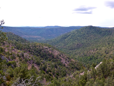
After Bradshaw Tank, at the hike’s high point, the trail traverses some scrub and old burn area as it approaches Oak Spring Canyon. Just before beginning the short descent to the canyon bottom, there is a great vista south, down canyon. Arrowhead Canyon Estates is plainly visible in the distance.
Upon reaching Oak Spring Canyon, I briefly considered hiking the bottom, but decided instead to firmly establish the continued existence of the side trail I had seen on satellite view. (Even in arid climates, trails can disappear.) I continued south on the AZT, as I had last September. Less than a hundred yards from where I had previously turned around, I found the intersection of Walnut Trail #251. It’s a real shady area, with some good sitting rocks, so I took a quick break. Thankfully, I had not forgotten my gorp, energy bars and vinegar chips. ![]()
A couple hundred yards past the Walnut Trail #251 intersection, the trail splits. The split is signed, but the sign is beginning to fall apart. Right is west on the AZT; left is south towards Oak Spring. I went left.
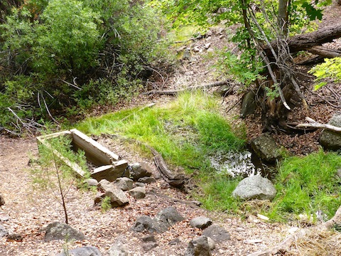
I did not find the Oak Spring source, but the small pools were clear and trickling. The spring box is bone dry, and no longer connected to the spring. It’s a bit unclear where to go from the spring box, but turn right at the spring box’s far — well not that far ![]() — end, across the run off, and up a 10 ft. climb. As you cross a small clearing, the trail will become obvious.
— end, across the run off, and up a 10 ft. climb. As you cross a small clearing, the trail will become obvious.
There is a rubber hose all the way down the trail, but it is broken in a few places, and no longer running water down from Oak Spring.
I don’t know why, but I really, really like the trail between Oak Spring and Arrowhead Canyon Estates. It was a vey pleasant stroll through manzanita, shade trees, and canyon views. Honestly, one of my favorite trail segments I’ve ever done. ![]()
Just above the Estates, there is a gated fence and old metal tank. The fence is not signed. I considered staying outside the fence to Pine Canyon, but it looked like it might tend uphill, and I did not want to get stuck on a cliff above Pine Canyon. Through I went. A locals trail follows the inside of the fence, so I followed that. It appears I was actually still on forest land, as while the fence was to my right, I spotted a few forest boundary signs to my left. The fence does not bound the Estates, as at the south end near the McPhillips Trail sign, it bends west, up slope. The access from the Estates to Pine Canyon is thus open.
Hiking Pine Canyon, make sure you stay as low as possible, in the bed of Pine Creek. If you stray to the side, you could easily find yourself well up slope and facing a tricky descent to get back on track. Pine Creek is dry, except for some pooling at the bottom of the three 15 ft. cascades I encountered between the Estates and the park boundary. Pine Creek has some short grassy and sandy areas, making for a few yards of faster travel, but it is mostly rocky of the ankle breaker size. Go slow, taking care with your foot placement. There’s also a fair number of shady trees, indicating the presence of subsurface water flow. The boulders are mostly a bold, photogenic, maroon. ![]()
I took my second break at one of the cascades, kept company by a spider. (I saw more spiders on this hike than any other critter.) He was speckled grey, to blend in with the rock on which I sat, but had a fat white butt. That makes two of us. ![]()
About 3/4s of a mile down Pine Canyon, a barbwire fence blocked my way. Again, unsigned. The bottom wire is unbarbed, and easy to low crawl. Just past the fence I encountered a family that was looking for the arch. I told them it was back the other way. ![]()
1.25 miles down Pine Canyon, a wire stretches from one bluff to the other. A sign, hanging from the wire, indicates the boundary of the Tonto Natural Bridge State Park. Just past the wire, there is a dirt trail up to the parking lot near the visitor center.
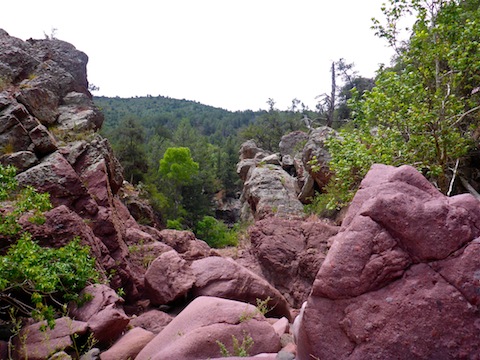
Other than the family, I had seen no one else all morning. From the lot trail, I began encountering more folks. but not so much it was unpleasant. (It was still Friday; I am sure Independence Day it was a mad house.) The maroon boulders, and some trees, also began bearing arrow markers indicating the arch’s direction.
Another couple hundred yards on, about halfway between the dirt trail and the arch, on the south side of the canyon, is a large cave. There’s a lot of nooks and crannies to crawl up or into. I assume that is where Davey Gowan hid from the Apaches in 1877, becoming the first white man to discover Tonto Natural Bridge.
Words cannot describe how enormous Tonto Natural Bridge is. Statistically, it is 400 ft. long, 150 ft. wide and 183 ft. tall. It is the largest travertine arch in the world. There are several large pools, fed by seeps in the walls and ceiling. It’s a shame swimming is prohibited. However, rock climbing is not. Even when dry, travertine makes the rocks slick. It looks like they’ve been painted. But most of the rocks are wet, and some are even covered with algae. I saw a few people fall on their ass. Rather than try climbing down the rocks, I simply slid down them on purpose.
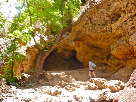
Between the cave and arch, I spent about an hour shooting photos and video. Unfortunately, I did not realize that my camera lens had become blurry from the mist, so my photo quality suffered. ![]()
From the west side of the arch, it is a short, steep, climb up a paved path to the lower parking area / arch OPs. Hopefully you won’t have to waft through skunk funk like I did. ![]()
After rehydrating at a picnic table, my wife & I drove back south. There was not much traffic north of Payson, but both lanes of AZ-87 were bumper-to-bumper from the AZ-260 intersection south four miles to the Jim Jones Shooting Range* Rd. Phoenix: Getting away from it all by all going the same place. ![]()
* Yes, that is it’s name. ![]()
GPS File: Pine_to_Tonto_Natural_Bridge
Distance: 8.09 mi.
AEG: 628 ft.
Time: 3h 59m
Hike Video
Hiking Pine to Tonto Natural Bridge, Gila County from Preston McMurry on Vimeo.

Your trip logs are really outstanding.
Hopefully I don’t blab too much!