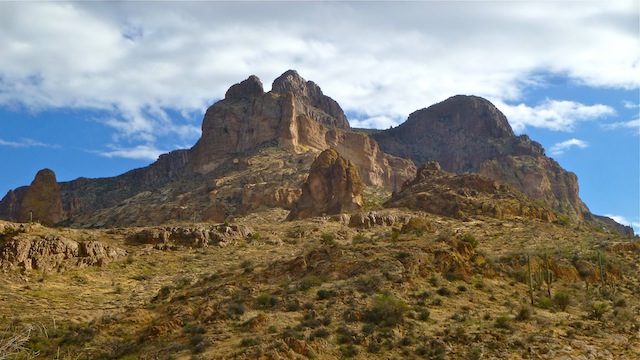
The last time I was out here, in June, 2012, I aborted due to time constraints. (And not because a rather large western diamondback was blocking the path; nope, had nothing at all to do with it. ![]() ) Since I don’t like leaving unfinished business, and was looking to do several out of town hikes at warmer elevations than Wilhoit, I decided on several Superior/Globe hikes, of which this is one. (I hope to hike up Picketpost on Christmas day, since my wife is in the Netherlands, visiting family.)
) Since I don’t like leaving unfinished business, and was looking to do several out of town hikes at warmer elevations than Wilhoit, I decided on several Superior/Globe hikes, of which this is one. (I hope to hike up Picketpost on Christmas day, since my wife is in the Netherlands, visiting family.)
I started south on the AZT, dropping — all of 10 feet — into Alamo Canyon where the summit trail begins. Alamo Canyon is easy walking: No brush, and a surface of marble to golf ball size rocks. Just south of where the AZT actually intersects Alamo Canyon is Picket Mill Well. I was surprised to find a solar-powered electric well pump. The constant pumping is why the metal tank is not only over-flowing, but clean. (The metal tank runoff is siponed into a dirt tank, which was also full, and looking pretty clean.)
After checking out the corral and the mechanicals, I rejoined the AZT, where I caught with a group of about eight retirees, about where I’d previously run into Cerberus. They waved me by. Maybe they knew of his reputation, and wanted me to walk point? ![]()
When the AZT turns south, I continued east towards Telegraph Rd, which I followed for a bit before following the wash into Telegraph Canyon. Oh my. ![]() I had no idea something so lush was anywhere near Superior. Ran into a couple of Canucks — one of whom looked like he lost a fight with a mountain lion — who were putting out trail ribbons. Not really necessary, as the trail is pretty obvious. Also mostly non-stabby. (So, not sure how the one guy’s arms were all cut up, unless it really was a mountain lion.
I had no idea something so lush was anywhere near Superior. Ran into a couple of Canucks — one of whom looked like he lost a fight with a mountain lion — who were putting out trail ribbons. Not really necessary, as the trail is pretty obvious. Also mostly non-stabby. (So, not sure how the one guy’s arms were all cut up, unless it really was a mountain lion. ![]() )
)
The official route takes you up out of Telegraph Canyon for about a half mile, which is not necessary. Instead, follow the cairns over about a 50 foot slope. (See my alternate route.) Also, hiking back to the Picketpost TH via Arnett Canyon is much more attractive than traipsing through the outskirts of Superior. ![]()
When I reached the Arboreteum Tank, I turned west, proceeding up a small spur, then across a short saddle to the trailhead.
My Garmin 60csx reported the AEG as 2322 feet, of which I was extremely skepitcal. The official route claims 2700-something feet. No way. 900-something is much closer to the mark. GPS must have problems in the narrow parts of the canyons.
Picket Mill Well was a cool surprise, in an otherwise boring first half of the hike (**). The second half, in Telegraph Canyon, Arnett Canyon, then up the saddle, made it all worth it (*****). It was awesome. If you have not been there, check it out. (Soon! While the leaves are still up. ![]() )
)
GPS File: Picketpost_Circumference
Distance: 11.04 miles
AEG: 939 ft.
Time: 4h 24m
Hike Video
Picketpost Mountain Circumference Hike from Preston McMurry on Vimeo.
