Ludden Mountain

That got a bit too steep ...

Ludden Mountain, viewed from 67th Ave. My intended route, was from the knob on the left, up & right along the lighter band, to the top of the lower black mass, then a left turn to the summit.

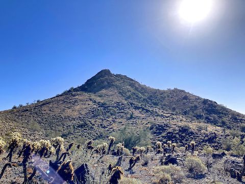
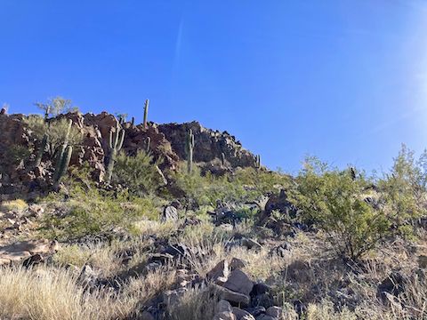
Ludden Mountain is a double-peaked formation in far northwest Phoenix. The northern false summit is 2,043 ft., while the southern true summit is 2,197 ft. The latter with a prominence of about 770 ft. above Happy Valley Rd. Last year I intended to climb both summits, but bailed when I saw the 40% slope off the cholla-strewn south side of the false summit.

A day short of a year later, I decided to take a direct crack at Ludden Mountain’s true summit. As before, I parked behind the Walgreen’s on the northwest corner of Happy Valley Rd. and 67th Ave. It’s the closest legal spot, as there is construction ongoing on the north side of Happy Valley Rd., between 56th Ave. and 62nd Ave., at the foot of Ludden Mountain.

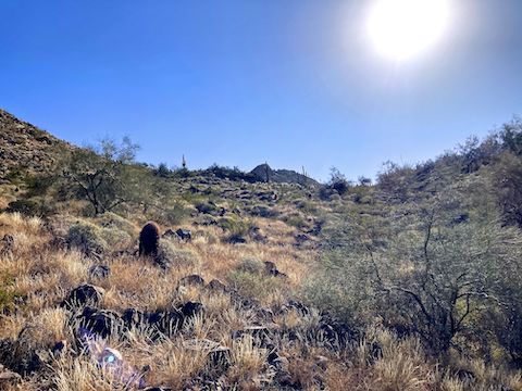
From the Walgreen’s, I walked a sidewalk mile north along 67th Ave. to Jomax Rd., bent east along Pyramid Peak Pkwy. for a few hundred yards, then crossed 64th Ave. and Weir Wash to begin my actual Ludden Mountain hike. I meant to follow Mountain Matt‘s down route up, but the terrain led me left by 200-300 ft., as I aimed directly at Ludden Mountain’s summit.

Ludden Mountain's summit peeking -- Ha! Get it? -- above the cholla saddle. My route climbed 325 ft. in 0.4 mi. (15% slope) to the saddle, about the same as North Mountain, except off trail.
Ludden Mountain’s summit peeking — Ha! Get it? — above the cholla saddle. My route climbed 325 ft. in 0.4 mi. (15% slope) to the saddle, about the same as North Mountain, except off trail.
Ludden Mountain: I negotiated the cholla without being stabbed. I crossed the upper part of the draw on the left. There were no cholla on the other side.
I negotiated the cholla without being stabbed. I crossed the upper part of the draw on the left. There were no cholla on the other side.
Looking back at the south face of Ludden Mountain's false summit. I'd heard reports of decent flowers around Phoenix, but other than a some nice brittlebush, I only saw a few desert globemallow and Emory's rock daisy.
Looking back at the south face of Ludden Mountain’s false summit. I’d heard reports of decent flowers around Phoenix, but other than a some nice brittlebush, I only saw a few desert globemallow and Emory’s rock daisy.
Ludden Mountain: The south side of the draw pitches up, gaining 221 ft. in 0.15 mi. -- a 28% slope. (Black Mountain is only 21%.) Just above a small boulder field, I bumped into a stone "fort" / shelter. If you test them first, boulders actually provide useful foot brakes. Behind me, I used momentum to avoid backsliding on pebbles.
The south side of the draw pitches up, gaining 221 ft. in 0.15 mi. — a 28% slope. (Black Mountain is only 21%.) Just above a small boulder field, I bumped into a stone “fort” / shelter. If you test them first, boulders actually provide useful foot brakes. Behind me, I used momentum to avoid backsliding on pebbles.
I slipped my way upwards to this point, 170 ft. below Ludden Mountain's summit. I guessed it was a 45% slope: It's actually 54%. Yikes. Not what I was expecting. Past my comfort zone. I had exercised. I was good. I bailed.
I slipped my way upwards to this point, 170 ft. below Ludden Mountain’s summit. I guessed it was a 45% slope: It’s actually 54%. Yikes. Not what I was expecting. Past my comfort zone. I had exercised. I was good. I bailed.

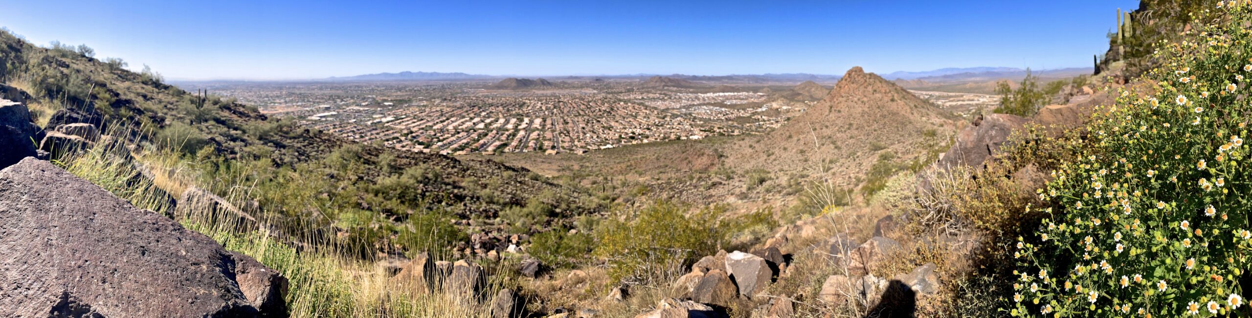
It had taken me 64 minutes, including photo breaks, to hike the two-thirds of a mile from Weir Wash. I took a ten-minute breather, picking out a less slippery-looking down route. (Pano looking down.) Still, it took me 25 minutes to descend the first 150 ft., as I butt-scootched most of it. On my feet the rest of the way, I made Weir Wash in another 30 minutes, and the Walgreen’s 24 minutes after that. It was 82℉.

For a small peak, Ludden Mountain is challenging, but I probably won’t try it again.


Directions: From Loop 101, I took exit 18 north onto 67th Ave. In 3.0 miles, after crossing Deer Valley Rd., turn right into the Walmart / Walgreen’s parking lot. Alternately, from I-17, take exit 218 west onto Deer Valley Rd. In 5.0 miles, at 67th Ave., turn right into the Walmart / Walgreen’s parking lot.

GPS File: Ludden_Mountain_True_Summit_Bail

Distance: 4.16 mi.

AEG: 651 ft.

Time: 2h 01m


Rumble Video


Vimeo Video

Hiking Ludden Mountain (true summit?) from Preston McMurry on Vimeo.