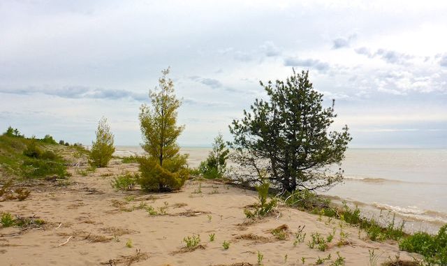
This is the fifth straight year I’ve hiked the Ice Age Trail in Wisconsin.
Not the whole thing, mind: The Ice Age Trail curls 1,200 miles from St. Croix Falls to Door County. Roughly half of the trail is paved, the rest is actual trail (some single track, some multi-use).
Since my wife and I base out of Sheboygan County — currently at the excellent Inn on Hillwind — I’ve been hiking the unpaved parts of the Ice Age Trail nearest Plymouth: Glenbeulah to Parnell Tower (2015), Parnell Tower to Crooked Lake (2016), Crooked Lake to New Fane (2017) and New Fane to Kewaskum (2018). 📆
I have no interest in hiking paved ‘trail’. Neither to do I want to drive nearly to Minnesota to hike on dirt. So, this year, I turned north, to hike the Point Beach Segment of the Ice Age Trail from Two Rivers, past the Rawley Point Lighthouse, to Lake Shore Road — about 10 miles. (My hikes are usually ~10% more than the official distance due to wandering back & forth taking pictures.)
Because a 20-mile out & back hike is a lot — even in terrain that varies only 25 ft. per mile — I’ve broken the Point Beach Segment of the Ice Age Trail down into three 3-3.5 mile sub-segments that can be combined into distances for any hiking ability.
Neshotah Park to Viceroy Road (3.4 mi.): If you don’t feel comfortable with roadside parking on Park Rd., there’s plenty of parking lots along Zlatnik Dr. in Neshotah Park. There’s also porta potties. It is a ½ mile walk on low traffic streets to the end of Park Rd. (The Lake Michigan shore north of Neshotah Park is no trespassing private property for several hundred yards.) 200 yds. after entering the woods, split right onto a boardwalk towards Lake Michigan. Then follow the trailless shoreline two miles north. I found the best footing to be at the water’s edge, where the sand was moist (not wet) & firm.
At 0.5 miles, there is a creek crossing. Depending on tide, you may be able to jump across it, or have to wade through the calf-deep water. I was there about midway between high & low tide. I didn’t want to get my wet feet so early in the day, so I dragged a an old log over, then flopped it across as an ad hoc bridge. Most people turned around and headed back to Neshotah Park, as there were few tracks north of the creek. 👣
At 2.0 miles, the Ice Age Trail turns inland, rather than cross Molash Creek, which is significantly larger than the one I logrolled. The mouth of Molash Creek is another ½ mile north, if you want to test your fording abilities. There are several signs, a bench and a boardwalk at the turn into the treeline. Note that the Ice Age Trail is marked by a single yellow blaze, with directions indicated by a yellow arrow. Other colors are other trails.
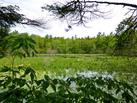
200 yds. before Viceroy Rd. the trail turns to wide gravel bike path. 100 yds. before Viceroy Rd., the official Ice Age Trail route turns right, also along wide gravel path, across a wide wooden bridge. There was a bench & some good Point Beach Segment trail maps available at the intersection. Roadside parking at Viceroy Rd. is legal.
Viceroy Road to Red Pine (3.5 mi.): Crossing the wide wooden bridge, I noticed a bench — there are many along the Ice Age Trail’s Point Beach Segment — half buried in Molash Creek’s bank, being reclaimed by the bayou. If I’d had a hiking partner to take my picture, I would have waded through the muck to sit on it. 😁
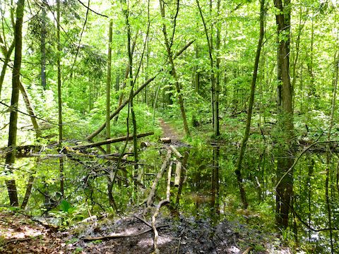
0.4 miles from Viceroy Rd., at the Swiggum Bench — most benches seem to be memorials — split right off the wide gravel path onto the dirt single track, which basically follows the north bank of Molash Creek, opposite the first sub-segment. A couple of hundred yards later, I came to the obstacle you see in the picture above.
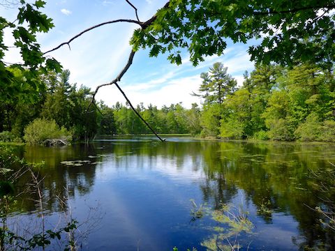
At 1.3 miles, the Ice Age Trail bypasses Coenen Cabin and Fetchbaw Cabin. The adjacent cabins both have picnic tables, fire rings, his & her pit toilets, etc. I saw at least one well pump, which had plenty of clear water despite the pump being extremely rusty. At 1.5 miles, the trail crosses the gravel cabin access road.
At 1.8 miles, the Ice Age Trail does a brief ⅓ mile inland loop before continuing to follow Lake Michigan from just inside the tree line. You might be better off following the shoreline, as I encountered an even wider water obstacle than I had 30 minutes earlier. 🤔
Once across Molash Creek, there are numerous small trails to access the Lake Michigan shoreline, and it is legal to hike along it, all the way to Rawley Point Lighthouse, if you prefer to sand to swampy water crossings.
At 2.5 miles, where the trail again turns inland, there are two official wild camping sites known as Kayak Camp. Each has a fire ring, and one has single seat pit toilet with two trailside walls and no roof. Take a walk on the wild side! Or a sit, as the case might be. 💩
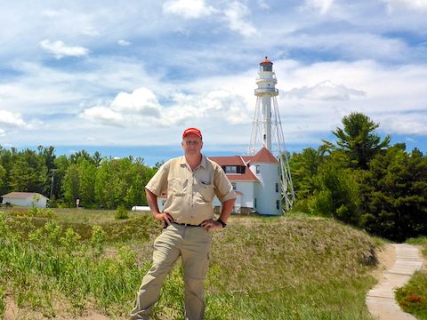
The next ¾ mile to the Rawley Point access road winds between more bayous. Upon reaching the road, either turn right towards the Rawley Point Lighthouse, or left for the final ¼ mile to the Red Pine Lot on the opposite side of County Highway O.
Rawley Point Lighthouse (0.5 mi.): Current vehicle access is $8 for WI plates; $11 for out-of-state plates, but unlike the Red Pine lot, there are toilets and water. I didn’t check for cell phone reception — my servce is Verizon — but it was very spotty along the remainder of the Point Beach Segment. The impressive truss-supported lighthouse is tall, and narrow. The lighthouse, light keeper’s building, and surrounding grounds are unfenced, but no trespassing. I didn’t expect to ab able to go to the top of the lighthouse — though that I would have rocked! — but not to be able to get close to it was a bummer. 😕
Red Pine to Lake Shore Drive (2.9 mi.): Now roughly a ⅓ mile away from Lake Michigan, the sounds of waves are replaced by traffic on County Highway O. (Though the traffic is much lighter than it will be on the Loop 202 South Mountain Freeway!) Being slightly further inland, the first two miles to County Highway V were the driest of the Point Beach Segment.
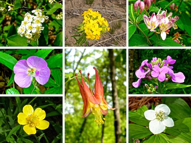
Despite all the Ice Age Trail signs, I managed to get off track twice, doubling back the first time, then saying “screw it” and continuing on the second, until the snowmobile trail eventually recrossed the Point Beach Segment. It was the same distance either way.
At 1.3 miles, there is a “stay on trail” sign, as the Ice Age Trail is crossing private land. As my Boy Scout troop discovered hiking the Ice Age Trail from Glenbeulah in November, 1972, it’s not a good idea to be in the woods during deer season. If it isn’t deer season, and you hear gunfire between Red Pine and County Highway V, that is a skeet club a half mile west of the trail. 🦌
North of County Highway V, is Rahr Memorial School Forest, which belongs to the Manitowoc Public Schools, and is dotted with Eagle Scout projects.
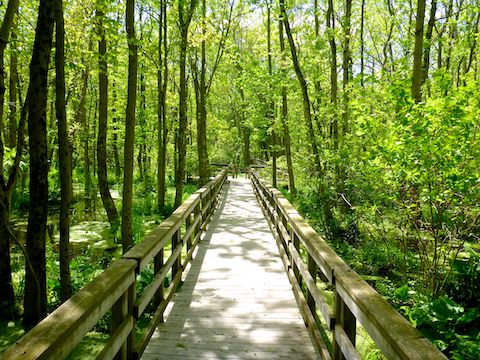
At 2.3 miles, there is a ⅓ mile long, wetlands-protecting, boardwalk across a beautiful swamp. From the west end of the boardwalk, it is only another ⅓ of a mile to Lake Shore Rd., with legal roadside parking.
After my wife picked me up on Lake Shore Rd., we doubled back to Two Rivers for a late lunch / early dinner. Linner? Dunch? Besides trying to hike every where I travel, I also like to try new restaurants, and today’s choice was Kurtz’s Pub & Deli. We quickly got a bowl of plain potato chips with Kurtz’s equivalent of Horsey Sauce, which was a tasty difference from nachos. The Homemade Buffalo Chicken Dip was hot & yummy. The Brat Reuben was okay, nothing wonderful. The service was AWESOME! Being a German place, Kurtz’s has a great selection of Deutsch brau: I made sure to properly rehydrate with three of them. 🍻
GPS File: Point_Beach_Segment_Ice_Age_Trail
Distance: 11.93 mi.
AEG: 261 ft.
Time: 4h 18m
Hike Video
Hiking Ice Age Trail: Two Rivers to Rawley Point from Preston McMurry on Vimeo.
