Directions: North I-17, exit 232. West New River Rd. ~3.4 miles to TH. Gate is left open, so you can get in before sunrise.
Report: I started hiking the Black Canyon Trail at 5:14 a.m. Well, I actually started at 5:05, but could not find the trail gate, and had to remove an early cholla ball. So, got started in earnest a few minutes later. The vegetation is more mixed north of the road than south of it. Just after starting, I crossed El Paso Gas Pipeline Rd., which is more like a slightly rocky runway. (It is that wide.) No pipeline in evidence, so it must be buried. BCT #2 starts out single track, and continues that way for just under three miles, as it crosses, and recrosses, a wash. About 1.6 miles in, the trail crosses a small, informal, firing range. Just after that, the trail climbs a bit as it curls east around a small hill. On the north edge of the hill, the trail turns north, crossing yet another wash, then intersecting with several jeep trails at the 2.85 mile mark.
I took the right/northeast jeep trail, which parallels a long ridge, some distance east. The trail turned east, and at the base of the long ridge, at the 3.7 mile mark, split. The right split goes up the ridge and is an extension of Gasline Rd. (Which is not the same as the earlier El Paso Gas Pipleline Rd.) At the top of the ridge is very dense patch of broken glass. Probably hundreds of bottles worth. If you want to start BCT #3 from the south end, this would be your start point. Back at the bottom of the ridge, take the left split north. At the 4.0 mile mark the trail again splits. Left does the Boy Scout Loop clockwise; right does it counterclockwise. (There’s a sign there with a map.) I went right.
The trail changes back to single track, crosses a wash in a one-sided canyon, then begins climbing the east side of Hill 2575. (There is no elevation indicated on the topo, but contour lines are 50 feet, and as the Army taught me, you take half about the final contour to give a close estimate of elevation.) As you draw west of Hill 2325 you will cross a barbwire fence, with a closed gate. The fence continues well east and west. Up until I crossed a saddle at about the 4.9 mile mark, the whole way to this point, I could still hear freeway traffic, even though I-17 is 3+ miles away. At about 5.5 miles the trail splits again. Right is north up BCT #3, left continues southwest along BCT #2. Just west of the split, the trail peaks out at 2309 feet. (Emery Henderson TH is 1876 feet.)
A few hundred yards later, BCT #2 returns to (very rugged) jeep trail and begins descending. You can see Anthem — and even the trailhead! — from that point, without binoculars. At the 6.1 mile mark, the jeep trail splits west and south. West goes towards Bonnie Bell Mine, and is alternate to the main loop. South is the formal way. I went south, re-crossing the fence I had seen earlier. There was no gate there, nor at any of several trail crossings further west. Just past the fence, I turned west, between two small hills. I was looking for a mine. First I found a PVC pipe sticking up out of the ground. I figured it might be a vent, but did not feel any air. 330 degrees north of the vent, about 150 yards, on the spine of a small ridge, are the two mine shafts. Both are filled with debris, though there are several rather recent claim markers of some sort. (One a metal disk, another a barcoded stake.)
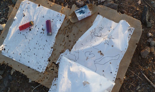
Going cross country here was not difficult at all, but I could tell my energy was starting to drop, so I went north off the ridgeline, to the west jeep trail I had split from a bit earlier. I continued west on that jeep trail, crossing the ungated fence several more times. At N33.928666 W-112.181045, where the jeep trail heads south to meet up with the main trail is a *HUGE* informal firing range. A good 300 yards, maybe more if you include the slope north of the trail. Last week, on BCT #1 Figure 8 Loop, west of the federal prison, I saw thousands of shot shells, but they were spread along the trail. This week, just west of Bonnie Bell Mine, I saw many times more expended shells, and all concentrated within a 100 yard square: .22 long rifle, .357 magnum, 7.62 x 39 (someone was popping AK rounds), 7.62 x 51, 9mm and, of course, shot shells. And beer cans, because nothing says “redneck” like playing with guns when you are drunk.
I began a desultory search for the nearby Bonnie Bell Mine, but was continuing to wear down, so quickly called it off and headed south down the jeep trail. About a mile south of the firing range, I reconnected to the main BCT #2 trail. Rinse, wash, repeat back to the trailhead. (With ever decreasing speed.)
Overall, the jeep trail parts are enh, but the single track parts are okay. Probably better for fast mountain biking, as I encountered four groups. I am on holiday the next week, so today was the first hike of five over the next nine days. (I plan on going out every other day.)
Distance: 12.03 mi.
AEG: 1,166 ft.
Time: 3h 58m
