It’s been four and a half years since I hiked in the Pinal Mountains. (I lost my GPS exploring the Bellevue Ghost Town & Gibson Mine.)
I first considered climbing Pinal Peak from Pioneer Pass on Pioneer Trail #196. My research revealed it had really nice Fall colors, so I decided to save that for late October.
So, I decided to hike East Mountain Trail #214, which also utilizes Pioneer Pass as its trailhead. Because my unfortunately non-hiking wife would be staying behind, I instead parked at the Pioneer Pass Campground, which is spread for along FR 112, just north of the pass.
Now, East Mountain Trail #214 does not actually summit East Mountain! Instead, it passes just west of the summit, about 350 ft. down.
That gives you some options, depending on whether you go clockwise or counterclockwise; start from Pioneer Pass, the campground, or the FR 112 pullout; summit from the north, or the south via the old fire line; etc.
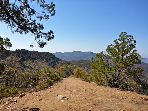
If you do a loop, regardless of where you start, your mileage (5.8) and AEG will be the same (1,150). The only difference is that counterclockwise will be a more gradual ascent; clockwise will be steeper.
Summiting from the north is shorter & steeper; summiting from the south, via the old fire line, requires watching your feet steeping over old, dead, manzanita.
Parking at Pioneer Pass has great views. At one of the camp sites, toilets, picnic tables, bear boxes and shade.
Here’s some examples of distance and elevation gain:
- Pioneer Pass to East Mountain summit via old fire line, out & back: 3.5 mi., 750 AEG.
- East Mountain Trail #214 & FR 112 Loop, no summit: 5.8 mi, 1120 AEG.
- FR 112 pullout to East Mountain summit, out & back: 5.2 mi., 1550 AEG.
FR 112 was twisty and narrow, but I kept my speed to 10-15 mph, and there was no traffic either way, at 8:00 a.m. FR 112 is car drivable at least as far as Pioneer Pass.
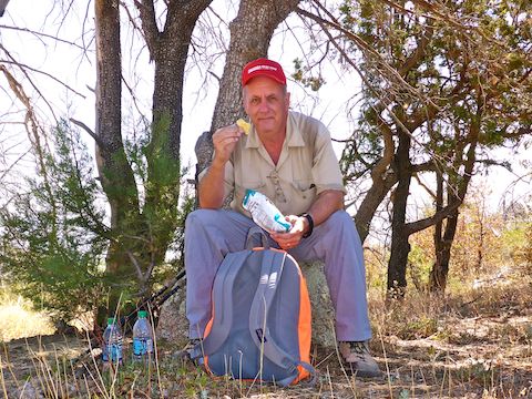
After dropping my wife and car off at the Pioneer Pass Campground, I hiked up FR 112 to the pass. There’s good views there, but they get even better as I began hiking south down FR 112.
I checked out what the topo shows as a building, but most topos were last surveyed 60+ years ago, and there was no longer any sign of it. The views would make it a good road side camp spot, though.
A bit further down FR 112, and slightly upslope, the topo showed adit and mine shaft symbols. But the slope was was steep & brushy, so I skipped it. Mine exploring was a possibility, not the day’s main course.
Back at Pioneer Pass, I started north up East Mountain Trail #214. The trail was shaded, well groomed and free of obstacles.
I spotted a cigarette butt, which I picked up. It was old, but it the carelessness still ticked me off, as it could have easily caused a fire.
0.6 miles from Pioneer Pass there is a wooden v-gate. You don’t see that very often: Usually v-gates are metal. Just past the v-gate is a hill top: That is a false summit, not East Mountain.
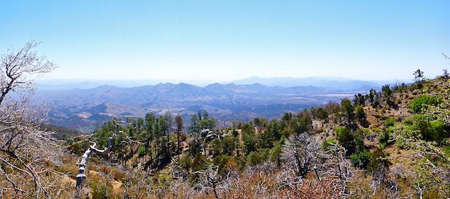
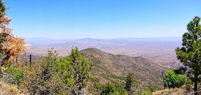
Past the v-gate, were the best views of the hike, east across AZ-77 and Pinal Pass to the San Carlos Apache Reservation. I could see several isolated ranches and mining operations.
There were lots of flies around the campground, which is not unexpected, but they persisted pretty much throughout the entire loop, even when I was a mile away and 1000 ft. higher. I didn’t smell death, or see any dead critters, so it was not only irritating, but rather odd. I wished I had a swaggie hat, with dangling corks, to keep out the flies, but eventually settled for simply ignoring them while taking care not to hork any.
I spotted a number of black bear turds along East Mountain Trail #214, with at least a half dozen truly humongous turds around the summit.
I took the old fire line up the south summit spur of East Mountain. I had to step over a large manzanita slash pile just off trail, but after that, it was not bad. The old fire line was a mixture of large grey manzanita stumps and small green baby manzanita.
I saw only three flowers all day, all of them in the old fire line: Two prickly pear cacti with yellow flowers and one tiny Arizona Thistle.
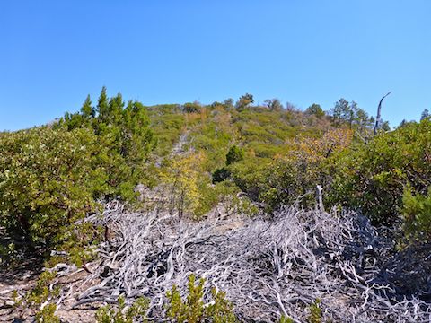
Just below the summit was a good size shady area, that would make an awesome camp site.
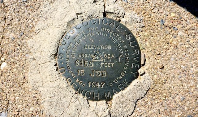
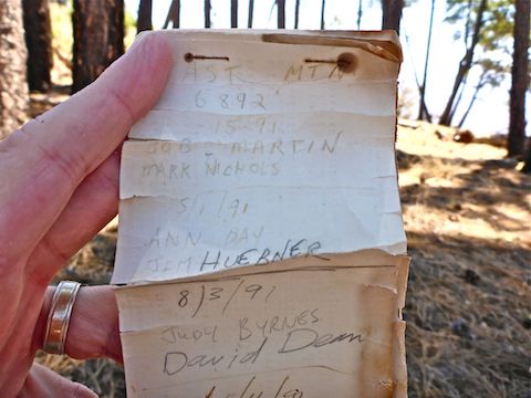
The summit itself was exposed. The summit cairn and summit log are on the north side of the bush which marks the summit, next to a small depression that looked like a collapsed Army fox hole. It was getting so warm, I perused the summit log back in the shady area.
The first log was started by the famous Bob Martin in 1991, when he was 70 years old. (He climbed until he was 85, passing away at 88 in 2008.) The last entries were in 2016. I signed the summit log, plugged my twitter feed, bemoaned the flies and lauded the views.
I didn’t see an any sort of trail off the north side of the summit, so I headed back down the old fire line.
East Mountain Trail #214 curls around the west side of the summit. On the north side of the summit, I marked what looked like a good way to head back up. (Turns out that exact spot is where several folks have summited.)
After that spot, Trail #214 was still smooth, but obviously got much less traffic. There was more debris, and I had to duck under at least three deadfall trees. Standing back up after ducking under the trees, I got light headed. It was getting that warm.
East Mountain Trail #214 had plenty of switchbacks to mitigate the steepness descending from the summit to Pinal Creek. I took a couple of more breaks, including by a sand-filled cement spring box, and another when I reached the FR 112 pullout.
Despite the massive antenna farm on adjacent Pinal Peak, Verizon reception at the Pioneer Pass Campground was only ❙ 1x. A little further north, at the FR 112 pullout, later in the day, my connectivity varied from ❙ 1x to ❙❙ LTE, depending on which way I pointed my iPhone 5. (Yeah, I’m old school.) Up on the East Mountain summit, I had ❙❙❙ LTE.
Thankfully, I did have some connectivity at the FR 112 pullout, so I was able to text my wife and ask her to pick me up. I could have hiked another .75 miles and 100 AEG to the Pioneer Pass Campground, but I just didn’t feel like it. Lazy, I know, but I had exercised and it was getting very warm, in the low 90s, even a mile high.
I’ll be taking the next two weeks off from doing ‘away hikes’ to maximize my World Cup viewing time. ⚽️📺
But I’ll still be posting videos, including Phoenix Asshole Drivers #27, to tide you over! 👍
Directions: From Mesa, head east on US-60 through Gold Canyon, Superior, Miami and Claypool. In Globe, turn right on Hill St. (the first road after crossing the bridge over the railroad culvert). At the bottom of Hill St., turn right on Broad St., then make an immediate left onto Ruiz Canyon Rd., then another quick left onto Jesse Hayes Rd. at Connie’s Store. In 0.9 miles, split right onto Ice House Canyon Rd. In 3.7 miles, Ice House Canyon Rd. changes from pavement to dirt. FR 112 is car drivable, but is narrow and very, very twisty, often with unrailed steep dropoffs. Keep your speed at 10-15 mph. Pioneer Pass Campground is spread along FR 112 beginning at 5.3 dirt miles. Park at any camp site, or continue to Pioneer Pass and park there.
GPS File: East_Mountain_Trail_214
Distance: 8.06 mi.
AEG: 1,417 ft.
Time: 3h 35m
Hiking Video
Hiking East Mountain Trail #214 from Preston McMurry on Vimeo.

Are you sure that wasn’t a Baby Ruth bar?
I let these guys figure it out …