FERN-O-RAMA!
Another last minute throw together. Wanted to do something in Prescott, but with the rodeo there and me *hating* crowds — and traffic ![]() — I figured Payson area would be better. I started with Grasshopper’s recommended route, but adapted it to travel the entire length of both East Bear Canyon, plus the entire length of the return canyon. (Travelling counterclockwise.)
— I figured Payson area would be better. I started with Grasshopper’s recommended route, but adapted it to travel the entire length of both East Bear Canyon, plus the entire length of the return canyon. (Travelling counterclockwise.)
With 110° predicted for the Valley, and 95° for Payson, I figured maybe 90° for a high on the Rim. It was 75° when I started at 8:30 a.m. and 90° when I finished at 12:45 p.m.
Other than the highly civilized bit between AZ 260 and Woods Canyon Lake, I had never been on Rim Rd. When I crossed it a few times during last week’s Railroad Tunnel hike, it did not seem bad at all. However, the first four miles east of AZ 87 were very bumpy, while the next miles to the battle memorial were bumpy low in corners. The last couple miles to FR 300G were fine. All along the 15 miles it was maybe 1.5 lanes wide at best. It took me about 40 minutes to drive from AZ 87 to FR 300G. I would not drive a car on it.

After parking, I walked down to “Dude Lake”, which was a dry tank. I then started down the head of East Bear Canyon. It was narrow, with larger boulders, but smooth sailing. When I got to a small meadow, I picked up an animal trail. Tons of Elk poo and prints from that point to the turn-around.
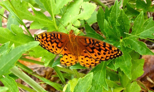
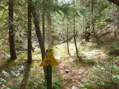
East Bear Canyon was easy travelling. 3-5′ above the water channel, on one or both banks, there was a 10-25 yard wide shelf, so the plentiful deadfall was easily avoided. No pricklers to speak of. Lots of greenery, particularly ferns, but few flowers. LOTS OF BUTTERFLIES. ![]() I was suprised to bump into a VV88 sign, and .15 miles further on, a VV89 sign, as I thought they were Crook Trail markers, and Crook Trail is a mile southwest (according to the always fallible topo).
I was suprised to bump into a VV88 sign, and .15 miles further on, a VV89 sign, as I thought they were Crook Trail markers, and Crook Trail is a mile southwest (according to the always fallible topo).

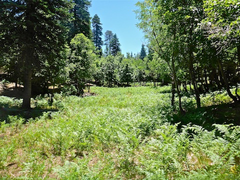
The fall, just up the return canyon from the turn-around, was dry. I bypassed it to the right. As the return canyon was rather narrow, and heavily obstructed, I stuck to a contour about 30 feet above the canyon bottom for the first mile. A small bug joined me for lunch opposite Grasshopper’s canyon exit. Probably 50% of my energy expenditure was in that first mile, but after that the canyon started getting wider and less brushy. Smooth sailing, especially through a half-mile long fern patch. (Where the creek bottom was sandy.) The final mile was on FR 300G.
Finally, my crappy Garmin 62S lied, telling me I had hiked 1.13 miles further (7.71) than MapDex calculated after I uploaded my track. That’s a healthy 15% error. ![]()
GPS File: East_Bear_Canyon
Distance: 6.58 miles
AEG: 562 ft.
Time: 3h 06m
Hike Video
Hiking East Bear Canyon, Mogollon Rim from Preston McMurry on Vimeo.

There’s nothing wrong with your gps, you love to hate that thing!