My first hike in quite some time involving both AEG and elevation. (Though not quite as much elevation as the 65,616 feet claimed by my crappy Garmin 62S. ![]() )
)
I’ve been having some chafing problems with my new hike shirt, so following marathoners’ lead — not that I would actually run a marathon ![]() — before I set out on my hike, I greased up my nipples. (Don’t get your hopes up for the photoset.)
— before I set out on my hike, I greased up my nipples. (Don’t get your hopes up for the photoset.) ![]()
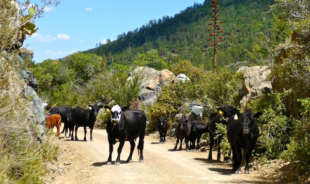
We drove up Walker Rd., but I was not sure where to turn for Five Corners. When we arrived in Potato Patch, I knew I had missed the turn as Potato Patch was my intended destination, not start point. Walker Rd. has small washed out sections and is a bit rough. Car drivable, but not in the best condition. Certainly not as good as I recall last year. We back-tracked. Big Bug Mesa Rd. was the road we wanted. Despite having a lower-level topo symbol than Walker Rd., it was in much better condition. Easily car drivable all the way to Five Corners. Post-hike, we exitted via Poland Junction Rd., avoiding the traffic snarl in Prescott on our way to the traffic snarl on I-17 south. Poland Junction Rd., despite having an even lower level topo symbol than Big Bug Mesa Rd., had the best surface of all, but is very twisty and quite narrow. You really need to go slow. Not just for traffic, but cows — about 10 of whom blocked our way for five minutes.
Driving from Five Corners to the southern trailhead is only an option if you have 4WD and high clearance.
Starting out from Five Corners and doing only Dandrea Trail #285 could either add a mile to your hike (if you walk down FR 706 to the unmarked trailhead) or subtract a mile from your hike (if you take the FR 261 shortcut). Likewise at the north end, in Potato Patch, you could add about .75 miles to your hike by walking out to the community park on Walker Rd. There’s picnic tables, so it is a good place to stop for a snack. I did all the extra distance.
The southern half of the trail is oak and shrub. There is some shade, but it is infrequent, small and not very dark. Mostly exposure, being on the south side of the hill. It is rocky in places. Compared to the northern segment, it is not as rocky or slippery, but it is steeper. The vegetation changes after crossing FR 261, into pines without much undergrowth. There’s several camp spots with fire rings — one of which was big enough for a human sacrifice. It took me 1:10 walking time to get up. It only took me another 2:27 to finish the final 3/4s of the hike.
At the Trail #284 saddle, the Boy Scouts sign is missing and the post is down. I thought at first the famous cross tree — the one you walk under — was also down, but it is still there, it was just around another corner. The northern half of the hike, down to Potato Patch, is yet a third type of vegetation, still pines, but with lots of undergrowth, turning to aspens in “town”. (Many of which have been carved up with names. ![]() ) Lots of good shade in the northern half.
) Lots of good shade in the northern half.
Two creeks on the south segment, and one on the north, were trickling.
Back at the saddle, I ate lunch. Despite being 7000 feet up, it was quite warm on the hike back from the saddle down to Five Corners, due to facing the sun and not much shade.
Distance: 8.38 mi.
AEG: 1,918 ft.
Time: 3h 37m
Hike Video
Hiking Dandrea Trail#285, Bradshaw Mountains from Preston McMurry on Vimeo.
