I noticed Colton Crater when I was out here last year, hiking SP Crater. Whereas SP Crater is tall, steep and slippery with volcanic rock all the way around, the side of Colton Crater visible from SP Crater Road is lower than the rest of the caldera, and grassy. Further research seemed to indicate Colton Crater’s lava dome would be easily hikeable, whereas the floor of SP Crater is only accessible with climbing equipment.
Drive ~25 miles north of Flagstaff on U.S. 89. Just after the highway changes from four lanes to two, at Hank’s Trading Post, turn left on SP Crater Road. Stay on the main dirt path for 7.70 miles until the road turns right at a barbwire fence. Instead, turn left. Half a mile south, park at the gate. The wire on the gate was wrapped too tight for me to open. If you are able to open — and close! — the gate, you could drive a half mile south on the jeep trail, parking just before the track pitches up 160 ft. in .10 miles. That far is SUV-accessible. I’d only proceed to the rim with an ATV or Razor. Cars could get as far as the split on SP Crater Road; maybe as far as the gate.
I was hoping it would be, at worst, a partly cloudy day. Instead it was overcast, windy & occasionally drizzly. I could deal with the temps, but the conditions made for poor lighting. Maybe not such an issue today, but I would take the devil’s deal if it cleared up before my fall color hike on Abineau-Bear Jaw Loop tomorrow. ![]()

I’d forgotten my windbreaker, so I started hiking in my wife’s jacket. By the time I reached the top of the caldera, I was sweating buckets. I didn’t feel like lugging the jacket in my pack, so I tied it to a bush, waymarking the location just in case. (A safeguard only if I actually remembered to pick up the jacket on my way out of the crater.)
I had picked out two possible routes down, into the caldera: Each a saddle, the first on the north rim, at the jeep trail, the other on the northeast rim, just south of Hill 6791. As I stood on the north rim, that route did not look bad at all. Any other route is very steep, and protected by cliffs, though probably doable by a more skilled hiker.
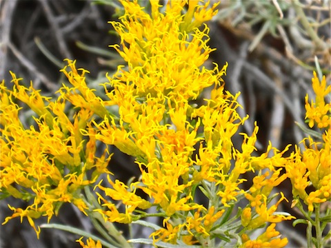
I turned west, following the ever fading jeep trail up this hike’s only real ascent, 800 ft. in a mile. (When the dirt track disappears, follow the crushed / bent grass.) Even if you lose the jeep trail, moving cross country is not difficult, as the ground is covered with low growth rather than slippery cinders. I was surprised at the variety and quantity of flowers.
By the time I reached an open, flat, area that would make a good camp site, the clouds had closed in so tight that I could no longer see into the caldera, let alone the San Francisco Peaks. Visibility was 150 yards, at best.

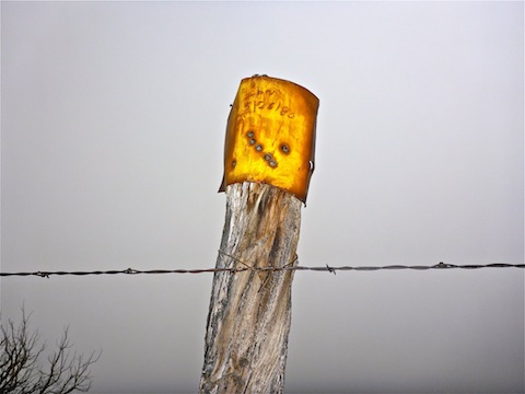
Just past the camping area, I picked up a barbwire fence that runs southeast, just over the outside of the rim, for a quarter mile to the rim’s high point, Hill 7368, which is just outside the fence. Despite the fog-shrouded lack of views, being anal I had to cross the fence to “summit”.
From the summit, the fence turns northeast for a half mile, before downhill, east along the Coconino National Forest boundary.
As I followed the fence northeast, the grass & flowers grew scarcer, and the ground more cindery. But it was still easy travel, until I reached the east rim, and began a steep 400 ft., .40 miles descent to the saddle at the foot of Hill 6791. I was so concentrating on my footing that I almost stepped on a rattler. It took me a few moments to figure out why the slithering thing was making noises at me, but thankfully the rattler preferred to go on about his own business, finding shelter under a nearby bush. I’m not sure what species it was, but it definitely was not a western diamondback. (The tail was not black & white.) I had no idea rattlers lived at 7000 ft., or would be active in such chilly weather!
At the saddle, I took a look at my alternate descent. It was mild the first hundred yards, but got steeper after that, so I skipped it, heading instead up Hill 6791.
On the summit of Hill 6791, I found a wireless fence — nothing but old posts, in a line — which took me back to the northern saddle.

Despite being 350 ft. in .30 miles, the northern saddle is the easiest descent. About a third of the way down, I picked up an obvious use trail, that had not been visible from the saddle. The use trail angles to the right, rather than heading straight down. By heading right, I was heading for the shortest floor-to-top-of-lava-dome difference. (A worthwhile consideration when climbing cinders.)
There was an interesting boulder on the west edge of the lava dome. Given its location, it did not fall off the rim, but must have been ejected from the volcano landing, against odds, in a vertical position. From the boulder, I headed to the top of the lava dome, where I took a break.
I followed the use trail all the way back up to the rim, where I remembered to retrieve my wife’s jacket. ![]()
After reuniting with my always patient wife at the trailhead, we headed to our usual haunt in Flagstaff, the always excellent B&B, The Inn at 410, on Leroux, followed by yet another delicious Korean dinner at Na-D-Li, on San Francisco St. Post-hike meals don’t always need to be burgers or pizza! ![]()
GPS File: Colton_Crater
Distance: 5.60 mi.
AEG: 1,652 ft.
Time: 2h 46m
Hike Video
Colton Crater, San Francisco Volcanic Field from Preston McMurry on Vimeo.

Nice job as always. A great resource for others.
Thanx. That’s one of my objectives: Not just describe how I felt, like most blogs do, but like you said, create a resource that others can use to pick interesting places to hike.