The main event of my weekend. My purpose for being up north. A hike I’ve been planning for a couple of years, ever since someone mentioned passing by it on their way to Comanche Point (or was it Cape Solitude?). Almost didn’t make it due to having a coronary over the $30 entrance fee. ![]()
Glad I didn’t attempt to SUV my way down the switchbacks: The surface was nasty.
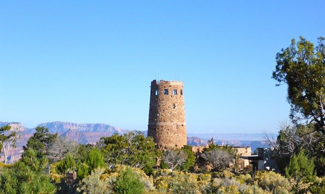
I took my time heading out, enjoying the scenery and getting the lay of the land. Nice views towards the Grand Canyon itself, but other than a few terrain features — Comanche Point (which I thought was Cape Solitude), Desert View — I didn’t know much what I was looking at until I got home and mapped my photos. I did know the hills near Flagstaff. ![]()
As I neared Cedar Mountain, it looked much different than I expected from sat view: Rather than being barren, it had plenty of vegetation on top and on its slopes. The north and south rims were protected by small cliffs. But at the top of a grassy area on its west slope, was a small saddle. My initial plan was to loop around the base of the mountain, looking for a good ascent and, time permitting, do so. Otherwise, return to do my chosen route in the future. Instead, I chose to hey-diddle-diddle straight up the middle.
The actual summit is 100 yards left of the crack I climbed through. According to my GPS map, it was on a boulder, about 50 feet from the west rim. But the west rim looked slightly higher. I searched the area, but could not find a summit cairn / log. Luckily, I had a small notepad, covered in clear packing tape for protection, and several pens. (The first of which failed after a few lines.) So, I created a summit log. I placed the log and (operational) pen in a ziploc sandwich bag, then placed that in a larger ziploc quart bag. I placed the bag on a thick foundation rock, then piled more rocks on top of that. The cairn is by a dead tree, and is noted on the official route.
I felt a real sense of accomplishment, especially since I was the first Hazard up top. Little did I realize that since I had last looked at the then blank description, Hippy had been up in May. Oh well, it was a great feeling at the time. ![]()
After many pictures, and almost losing my lunch — the wind almost blew it away, rather than me blowing chunks ![]() — I took a tour around the rim. There were awesome views of Comanche Point, the Palisades of the Desert, Straight Canyon, the Little Colorado River gorge, Cedar Canyon and the Gray Mountains. I could also spot Shadow Mountain 18 miles away, as well as Sunset Crater, the San Francisco Peaks and Kendrick Peak (all 44+ miles away).
— I took a tour around the rim. There were awesome views of Comanche Point, the Palisades of the Desert, Straight Canyon, the Little Colorado River gorge, Cedar Canyon and the Gray Mountains. I could also spot Shadow Mountain 18 miles away, as well as Sunset Crater, the San Francisco Peaks and Kendrick Peak (all 44+ miles away).
The lower eastern end of the summit was much less windy. Personally, I think it would be an awesome place to camp, especially since you are guaranteed to be alone. Plus the stars would be awesome.
After my tour, I made it from the crack back to Desert View in 1h 55m, including breaks. I hauled. And I felt strong, despite the altitude and distance. I had a Choco Taco at the gift shop, while my wife told me about her people watching. (Tourists. ![]() ) We rolled back into Flag about 4:00 p.m. Since my wife claimed my B.O. was not offensive, I skipped the shower, and we headed straight down to Alpine Pizza for dinner, and First Friday Art Walk people watching. It did my heart good to see so many parents out with their young children, instead of all with their noses buried in their smart phones, like you see so much in the Valley.
) We rolled back into Flag about 4:00 p.m. Since my wife claimed my B.O. was not offensive, I skipped the shower, and we headed straight down to Alpine Pizza for dinner, and First Friday Art Walk people watching. It did my heart good to see so many parents out with their young children, instead of all with their noses buried in their smart phones, like you see so much in the Valley. ![]()
GPS File: Cedar Mountain
Distance: 11.97 miles
AEG: 1,967 ft.
Time: 5h 0m
