

I started my winter, lower-elevation, hiking program last week at Peoria Sunrise Mountain Preserve. When I finished around 1 p.m., it was a toasty 87℉. I endured, but it was just a tad too warm. Today, Phoenix was again supposed to be into the 80s. So, I decided to head north.
Me: Checking the forecast for Wednesday (11/12), and try to figure out why Stoneman Lake (el. ~6700) is supposed to be ~10℉ warmer (80-70) than Roosevelt Lake (el. ~2200)? I’d expect Stoneman to be ~10 cooler … 🤔
NWS Flagstaff: Where are you retrieving that information? Based on our forecast (http://weather.gov) that is incorrect. The High for Stoneman Lake on 11/12 is 59°F and Roosevelt Lake is 81°F.
Me: Stupid google, when you type a location & “weather”. Your data makes MUCH more sense (of course). Thank you! 👍
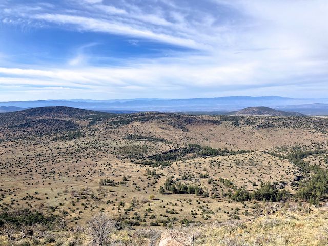
Apache Maid Mountain is on the Mogollon Rim, 30 miles south of Flagstaff, a few miles east of I-17, near Rocky Gulch, Mullican Canyon, Jacks Canyon and Wet Beaver Creek. Apache Maid Mountain is free-standing, with the next nearest named formations — Hog Hill and Round Mountain — three miles away. Being relatively isolated, Apache Maid Mountain’s views are outstanding.
If you hike Apache Maid Mountain from T-Bar Tank #2, it is a 8.8 mi., 950 ft. AEG (accumulated elevation gain) round trip. Hiking from T-Bar Ranch, it is a 8.2 mi., 940 ft. AEG round trip. Hiking from the intersection of FR 620 and FR 620D, it is a 5.1 mi., 890 ft. AEG round trip. Even less if you start from one of the two hang glider launch spots along the summit road.
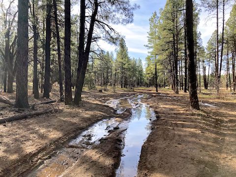
With the right vehicle, and if the fire lookout is open, you could drive to the summit of Apache Maid Mountain, via Stoneman Lake Rd., FR 229, FR 644E, FR 620D and FR 620. FR 644E is a bit lumpy, and FR 620D has quite a few mud bogs. Car not recommended past T-Bar Tank #2, at the intersection of FR 229 and FR 644E. I stopped my SUV halfway along FR 644E, but I did see three SUVs at the intersection of FR 620D and FR 620. Most folks will stop at T-Bar Ranch, and walk the rest of the way.
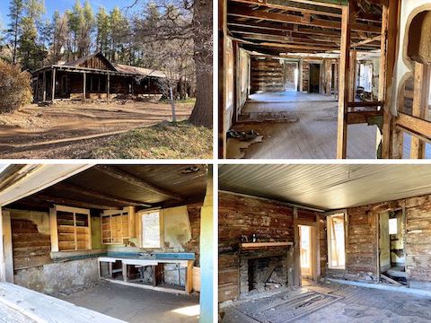
T-Bar Ranch was quite the spread. The main cabin is huge. There is also a small side cabin across the Rocky Gulch creek. Unfortunately, the small cabin is collapsing, and has quite a bit of graffiti. At one time, both cabins had electricity and running water. Watch out for piles of pack rat poo, which may contain hantavirus. Give yourself an extra 30 minutes to explore both T-Bar Ranch cabins.
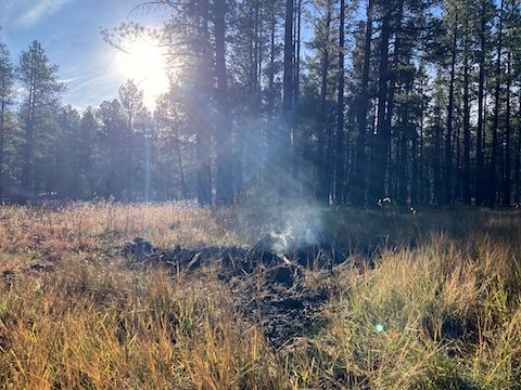
The first 1.6 miles of the Apache Maid Mountain hike are on FR 620D. A good portion of the Rocky Gulch prairie is now protected by a log-rail fence. There are quite a few cattle on the prairie. FR 620D even had a roadside memorial. At the base of FR 620, there is a map board. Sign says trailers not recommended. I briefly chatted with a couple of guys who were planning to hang glide around 1 p.m. One of them had a four hour glide yesterday. I don’t know diddly about hang gliding, but that’s impressive! 🪂
It is a twisty 2.6 mile climb up FR 620 to the Apache Maid Mountain summit. FR 620 is really well laid out, so the slope — 6.6% overall — never gets too onerous. In 1/4-mile increments: 5.4%, 6.6%, 8.3%, 8.9%, 8.8%, 5.1%, 4.9%, 6.1%, 3.9%, and 8.5%. For comparison, North Mountain (in Sunnyslope) is 15% overall. Personally, despite a recent lack of elevation gain, I didn’t need my hiking poles, nor get winded. There is enough room to park one vehicle at the seasonal gate 0.6 miles below the summit.
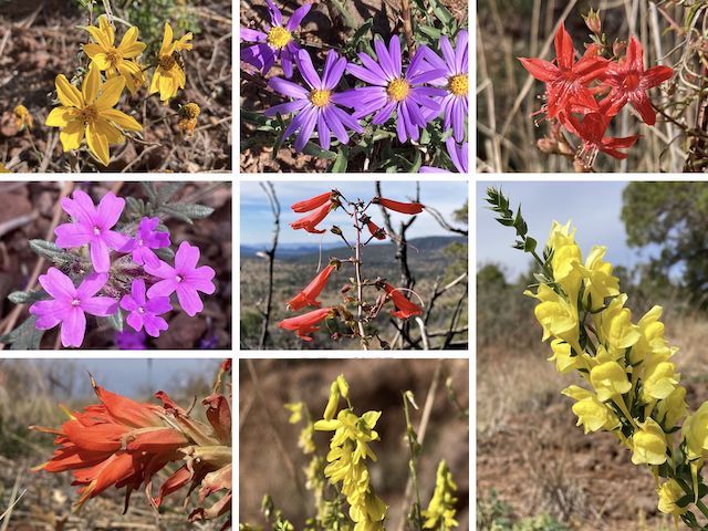
Top Row: showy goldeneye, hoary tansy aster, skyrocket.
Middle Row: Dakota mock vervain, scarlet penstemon, Balkan toadflax.
Bottom Row: foothill paintbrush, yellow sweet clover. (More high country flowers.)
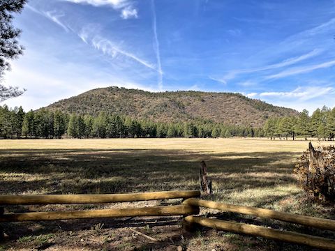
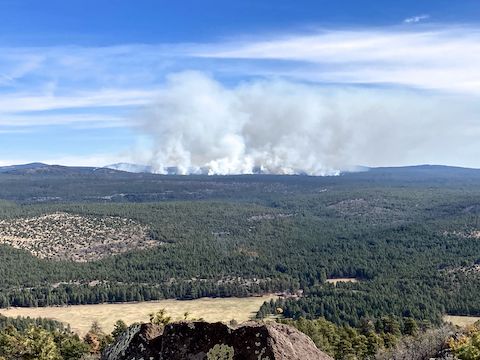
There are great views along FR 620. The true Apache Maid Mountain summit, at the survey marker, is a bit brushy. If the fire lookout is open, head up! If not, you can still get up it 20 ft. for 360° views. There is also a good observation point behind the pit toilet. I cannot begin to list all the terrain features visible along the road, or at the summit: Bill Williams Mountain, Kendrick Peak, San Francisco Peaks, Wet Beaver Creek, Verde Valley, Oak Creek Canyon and more!
After eating lunch at the summit picnic table, I headed back down FR 620. Along the way, I passed the two hang gliders rucking their rigs up Apache Maid Mountain, and a pickup, with his dog jogging alongside. Moving with a quickness, I made the 4.1 miles back to T-Bar Ranch in only 72 moving minutes (3.4 mph!). Despite feeling good when I finished, I was really sore when I got home. Go figure. 🤷🏻♂️
Directions: From Phoenix, head north on I-17 almost to the top of the Mogollon Rim. Take exit 306 onto Stoneman Lake Rd. / FR 213. After 6.3 paved miles, at the t-intersection, turn right onto dirt FR FR 229. In 3.5 miles, just past T-Bar Tank Number Two, turn right onto FR 644E. In a quarter mile, park at the T-Bar Ranch ruins.
GPS File: Apache_Maid_Mountain
Distance: 9.78 mi.
AEG: 998 ft.
Time: 3h 32m
Rumble Video
Vimeo Video
Hiking Apache Maid Mountain, Arizona from Preston McMurry on Vimeo.