My son lives in Hagerstown, just 15 minutes north of Sharpsburg, around which the battle occured, so every couple of years I do a battlefield tour. Every other time, I’ve done it by car. But, in the past year or two, I found out there are actual hiking trails on the battlefield. How cool is that!?
So, I put together the various trails in a sequence that would allow me to visit most of the battlefield on foot, mostly on trails, and in the same order the battle occured, at the same times of day. The only hangups were that we visit for Easter, not mid-September, and the weather — which was is much chillier than in September. And, on this particular day, howling winds and 90 minutes of rain in the bargain. Not like the battle, but I made do. ![]()
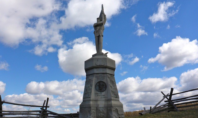
I do a lot of my triplog in the photo captions — photos are useful memory jog ![]() — so … the first interesting thing I found was a memorial for a Union private. In contrast to the granite and bronze statues and monuments to generals and regiments, it was small, private and informal. Just like a roadside memorial. I googled, and could not find any other picture of it. Hard to believe no one has seen it before. Maybe not many people hike the battlefield? Other than some joggers, everyone else I saw all day was visiting in cars.
— so … the first interesting thing I found was a memorial for a Union private. In contrast to the granite and bronze statues and monuments to generals and regiments, it was small, private and informal. Just like a roadside memorial. I googled, and could not find any other picture of it. Hard to believe no one has seen it before. Maybe not many people hike the battlefield? Other than some joggers, everyone else I saw all day was visiting in cars.
The slight drizzle began increasing in volume, and the wind getting more howly, as I exitted the Cornfield. By the time I hit the West Woods, it was nearly sideways. It was brutally cold, and all I had on was a windbreaker and a baseball cap. I sheltered in the lee of a small tree for a few minutes, before continuing. My paper maps were trashed. By the time I got to the Philadelphia Brigade Park, the rain had stopped. The howling wind was pushing the clouds east, and some sun was poking through.
I met up with my wife at the Visitor Center, but left sooner than I wanted to as two tour buses barfed their contents of incredibly obnoxious Virginia Tech ROTC cadets into the building. ![]()
By the time I got to Bloody Lane, the clouds were making for great contrast with the sky. It was still quite chilly, but I swapped my windbreaker for a Celtic jersey, so I could pose next to the Irish Brigade monument. That was the highlight of my day. Up at the top of the adjacent observation tower, the wind was at its worst. ![]() (Wait until you listen to the video …) Holy cow, it was cold. But at least it was not raining.
(Wait until you listen to the video …) Holy cow, it was cold. But at least it was not raining.
The Sherrick Farm Trail, between the north and south sectors of the battlefield, is the only trail that actually looks like what most of us would consider a trail: Narrow, dirt, with many roots, on the side of a hill. The Snavely Ford Trail seemed to go on forever, even though it was little more than a mile. I actually met some Snavely family members at the ford. Small world.
I ended my hike at the Burnside Bridge parking area, just as the two tour buses full of obnoxious cadets arrived. We did not stick around long, but it occured to me that they all must be future quartermaster, transportation or medical services officers as here I am, nearly 53 years old, humping it in howling wind, and no small amount of rain, with no more than a windbreaker, 10+ miles, at a good rate of speed, with bad knees — which I tweaked … twice — while they are 20 years old, riding in luxury and wearing snivel gear. ![]()
GPS File: Antietam National Battlefield
Distance: 10.79 miles
AEG: 810 ft.
Time: 3h 51m
Hiking Video
Including a version of “Battle Hymn of the Republic” that will give you shivers and put a lump in your throat …
Antietam National Battlefield from Preston McMurry on Vimeo.
