

It’s a long drive from Sunnyslope to Queen Creek, so it’s been three years since I last hiked San Tan Mountain Regional Park. Back then, in March, there were a few desert flowers at the south end of the park, by the Malpais Hills. Hiking a month earlier, at the park’s north end, I was hoping to at last find some of the brittlebush, creosote and African daisy currently blooming in Sunnyslope.
Dynamite Trail (DN), and most of Goldmine Trail (GM), would be new to me. It’s hard to avoid San Tan Trail (SA) when you are in its namesake park, so I would hike at least part of it for the fourth time in four visits. I last hiked Moonlight Trail (ML) in 2010, before I started documenting my hikes.
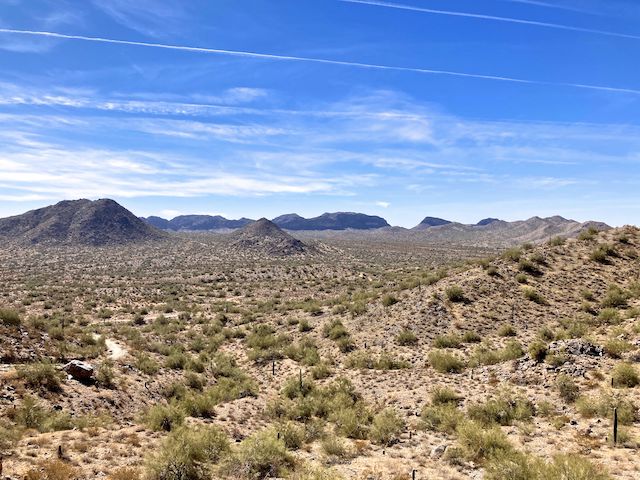
Dynamite Trail is rated moderate, strictly for the elevation gain: 300 ft. AEG (accumulated elevation gain) in 1¼ miles as I hiked it, south from Goldmine Trailhead. Hiking north from San Tan Trail, Dynamite is steeper, 250 ft. AEG in ½ mile. Overall, Dynamite Trail is 2⅓ no more than slightly rocky miles. The few saguaro are young, and I saw no flowers. Nice views from the Daryl Sparks memorial bench saddle.
San Tan Trail is somehow rated “moderate-difficult”. Maybe that is for mountain bikes at the south end of the park? I dunno. At the north end, it is wide, smooth and fast. Also popular. As are all the trails between Goldmine Mountain and Rock Peak Wash. Plenty of dog walkers, trail runners, retiree hiking groups, mountain bikes and horse riders. Though San Tan Trail loops 6⅓ miles around most of the park, I was only on it for a mile.
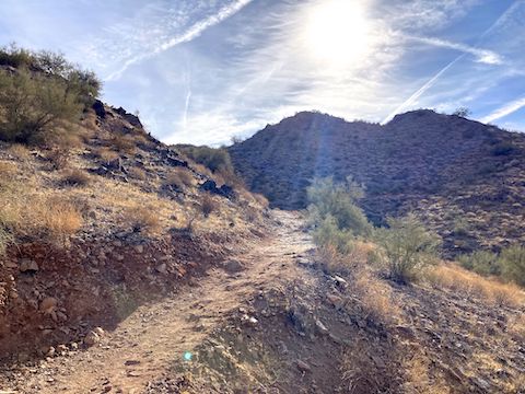
Moonlight Trail is rated moderate. Really, though, it is easy: West-to-east, Moonlight rises only 130 ft. AEG in 1⅓ miles, ending at the San Tan Mountain Regional Park welcome center. Heading west, it would be a zippy mountain bike ride. Still no flowers, but I did enjoy the saguaro.
I was wearing my Camelbak, but feeling a bit parched, so I stopped in the welcome center for a Gatorade and a water. I chugged the Gatorade before I even made it to the cash register. 😅
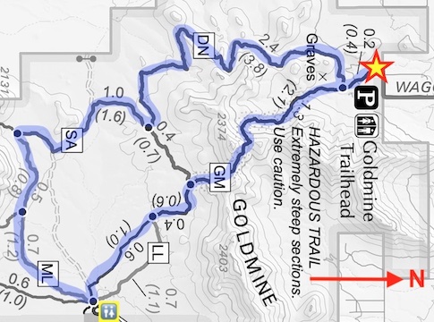
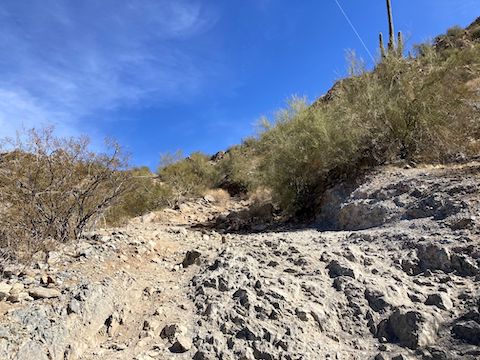
Goldmine Trail is rated difficult — which is fair, especially for the middle third of it’s 2½ miles. On the park map, Goldmine Trail is also noted as “hazardous”. That depends.
Hiking north, the first mile gains 160 ft. It is wide & smooth, and zippy downhill mountain bike run. So, keep your head on a swivel. North of the San Tan Trail junction, Goldmine Trail gains a steep & broken 295 ft. in ½ mile. Didn’t see any bikes on that.
There’s two saddles, both with rest benches. At the second, more northerly bench, there are several informal trails. The one to the north is a steep little climb to a small hilltop observation point (OP). I elected to save it for a future hike.
Descending north from the second bench is where I believe Goldmine Trail gets it difficult and “hazardous” rating: The initial ⅒ mile (528 ft.) drops a whopping 170 ft. And it is slippery. Be careful going down, as slippery is easier going up. After that initial drop, Goldmine Trail descends “only” 400 ft. in the next half mile. Positively level!
I arrived back at Goldmine Trailhead about 12:30 p.m. The temp was 75℉, but it felt warmer. Supposed to be in the 90s next week! 🥵
Goldmine Trailhead Directions: San Tan Mountain Regional Park is in Queen Creek, in the far southeast Phoenix metro, twelve miles from the nearest freeway. From the San Tan Freeway / Loop 202, take exit 42 south onto Val Vista Dr. In 4.8 miles, turn left on Riggs Rd. In 2.0 miles, turn right on Higley Rd., which curls left, becoming Hunt Highway. In another 3.5 miles, turn right on Wagon Wheel Rd. Goldmine Trailhead is at the end of the road. Admission is currently $7 per vehicle.
Park Map: San Tan Mountain Regional Park (pdf)
GPS File: Dynamite_San_Tan_Moonlight_Goldmine_Trail
Distance: 8.54 mi.
AEG: 1,028 ft.
Time: 3h 10m
Rumble Video
Vimeo Video
Hiking San Tan Mountain Regional Park from Preston McMurry on Vimeo.