

Back in July, my January, 2016, Webber Mine exploration video started increasing views to 30 per day, then 50, then what is now a nearly logarithmic curve. It had 381 hits today, which is more than most of my hiking videos ever get. That blows my mind. I’m practically Psy. 😁
Meanwhile, for quite some time I’ve had my eye on hiking along the US-93 corridor. There’s some spectacular terrain in the Black Mountains.
So, I decided to combine the two, putting together what began as a 10 mile, four mine, exploration: Weepah Mine, Homestake Mine, Big Stick Mine and Waters-Sunset Mine. Before I left home, I had already dropped Waters-Sunset, as I suspected Homestake might just have an unbarred adit. If I was able to make entry, I would not have time to climb a mountain to Waters-Sunset.
While doing a map recon, I noticed a cemetery by my trailhead, so I added that to my itinerary.
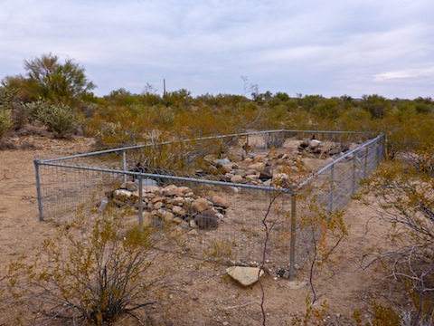
After parking just off US-93, I hiked along the dirt road for a quarter mile to the Santa Maria Cemetery. It had four graves: Versevi Ferra (1891), his sister Dalfina Ferra (1891), Francis F. Aryola (1807) and Mother Black. The kids died at 12 or 13 of influenza, as did Phoebe “Mother” Black, a family friend who died caring for them. The stone for Francis misprints his name, it was Fracisco Ferra Arriola, and date of death, which was 1907. He was the childrens’ father.
I then walked back to my car, gave my wife another kiss, and headed west down the Santa Maria River. (The route attached below, shows a path that does not cross any no trespassing signs.)
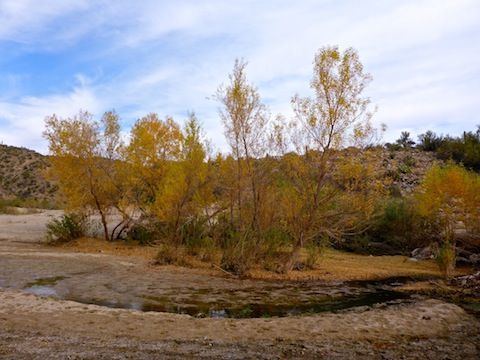
As long as I could, I walked through a small river bottom forest. There were enough trees, that leaves crunched underfoot, but the trees still had pleasant fall color. (Which I had noticed driving US-93 to & from Las Vegas last week.)
Eventually, I had to get in the Santa Maria riverbed, which was slow going as it was so sandy. There are actually dunes in spots. There was no running water, but plenty of near surface water. After a bit, puddles started appearing in the sand, some big enough I could detect very faint flow. Despite the short day, on the way back to the trailhead, trudging through the sand wore my legs out.
A mile and a half west of US-93, where the Santa Maria River bends south, I spotted Weepah Mine up a bluff. I needn’t have low crawled the unsigned barbwire fence, as it was open just over 100 yds. to the west. The climb was short, but steep and very slippery. Whatever jeep trail that may have once been there, has washed away.
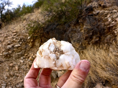
Once at the Weepah Mine, I initially thought the adit was collapsed, which is what I was expecting, as satellite view had not shown any non-tree, non-boulder shadow where the topo had the >– adit symbol. I did find some interesting rocks, though. As I turned to descend, stepping in a fresh cow patty, I spotted the open adit behind a palo verde. Sweet!
The Weepah Mine adit was small, but I could enter by stooping. The drift tunnel descended fairly quick, but not nearly enough to qualify as an inclined shaft. It also got tighter as it went deeper. After about 200 ft., and without any backup, I decided it was getting too small. Rather than low crawl, as I had at Webber Mine, I turned back. Weepah Mine struck me more as an exploratory tunnel than one designed to extract saleable ore.
From Weepah Mine, I could see Homestake Mine on the south side of the Santa Maria River. I carefully descended the slippery slope, jumped a few puddles across the river, climbed a much smaller bluff, then crossed a small plateau to Homestake. (According to schematics I found online, there were a number of drill holes on the plateau, but no detectable sign of them remains.)
The Homestake Mine was once owned by Tom Campbell, Arizona’s second governor. Sometime in the last 20 years, it was for sale for “only” $400,000 — cash — with the realtor swearing there were 80,000 ounces of gold somewhere inside. Which at current prices is over $100 million. Mines are called “claims” for a reason. 😉
There are two roads through the Homestake Mine, one lower, one higher. The higher one still has an easily bypassed vehicle gate. (There is no fence.) On the lower, all that’s left is a pole and dangling lock. I went left.
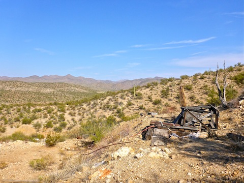
I first found what appeared to be a leaching pit. Adjacent to that was a small red barn / tool shed in decent condition, which contained some barren shelves and piles of white powder all over the floor. (Not that kind!) Next to the barn was a gazebo of indeterminate usage.
Across the jeep trail from those three was Homestake’s mill. There’s nothing left but the flooring and, off to the side, some small — as such things go — bolted blocks. The silver water tank, which in the realtor’s advert had appeared between the barn and gazebo, lay in the middle of the mill. (Given how often Google Earth updates its rural satellite imagery, it’s been there at least three years.)
There is a ‘Whazzit?’ behind the mill, across a small wash. I forgot to check it. I never did find the brick ovens shown in the realtor’s advert. I wonder if they are actually at the Big Stick Mine?
At the base of the hill, the Homestake Mine is an obvious, large, adit. If you are in any doubt what adit you are looking at, painting around the frame even says “Santa Maria Homestake”. Best of all, it was not welded shut, like Buckeye Copper Mine. I dropped my pack, grabbed my large police-type Maglite, and headed for the hole.
That’s when I noticed, just inside, rebar gate. Damn. Then, I thought maybe I could squeeze through the gap on the left. Easy peasy, even for this fat man.
The Maglite was the best illumination source I’ve so far used while mine exploring. Not great, but best. It illuminated very well, and wide, at short range, but beyond 10 ft. tended to become dim, while the dark dot in the middle got bigger, filling more of the illuminated space. It also tended to occasionally fritz out, which became concerning the deeper I went. Especially after I crossed some boards over an inclined shaft. But a smack on the wall easily corrected that.
The walls, floor and ceiling were solid rock, with almost no collapse, or even gravel underfoot. Just a thin layer of sand. There were no ore cart tracks in the 500 ft. drift level, so everything must have been hauled out by hand.
I found an empty electrical panel, and near the end of the drift level, an actual light bulb. Too bad it didn’t work. There was aluminum stove pipe tubing, probably for ventilation, scattered on the floor. No bad smells inside, despite finding a pile of bones bundled up into a ball by webs. I’m glad I didn’t meet that spider! 😳
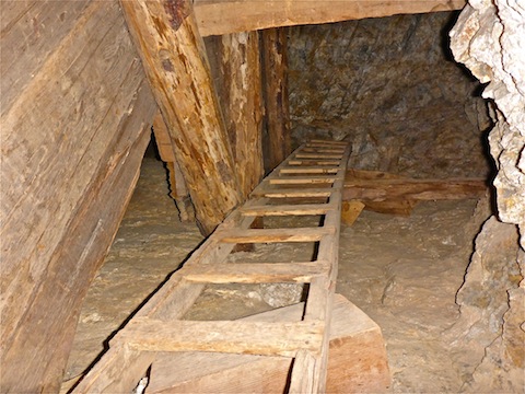
There were several small, timbered stopes in the ceiling. The webbed bones were at the bottom of an ore chute next to one stope. There was an inclined shaft, with a ladder going up, a hopper on the floor, then continuing down. Not sure if to a winze, or another drift level. No ladder to climb down.
There were flourescent orange markings throughout the drift level, including one that seemed to indicate Homestake Mine was last worked in 1986.
Back outside, I climbed the hill, finding two shafts, one of of them the top of the inclined shaft, with a small, dry-rotted head frame, in back of which was the cement anchor for a lift.
Finally, I checked out the Homestake Mine camp. It consists of a collapsed home trailer, a small bunkhouse and an outhouse with an actual porcelain toilet and plastic shower stall. I bet them boys were purty.
Afterwards, because I had seen enough cool stuff at Homestake Mine to fill a video — and then some! — I skipped Big Stick Mine, saving it for another day. (And video. 😉)
Directions: From the Hassayampa River bridge in Wickenburg, head northwest on US-93 for 38.6 miles. Just after the highway turns into separated freeway, turn right onto the paved road. In 150 yds., where the pavement turns to dirt, park in the pullout.
GPS File: Weepah_Homestake_Explore
Distance: 5.57 mi.
AEG: 522 ft.
Time: 2h 43m
Mine Exploration Video
Exploring Weepah Mine & Homestake Mine, AZ from Preston McMurry on Vimeo.
That is a great video. I liked the commentary.
Thanx, decided to try something different with the intro and outro. Glad someone liked it!
Very cool to watch your adventure!
Thanx. Glad you enjoyed it! 🙂