

When I hiked Green Mountain Trail #21, on Mount Lemmon, last year, it was the beginning of my occasional effort to range further afield with my Arizona hikes. I can only hike the Mogollon Rim so often.
My problem, as I discovered on the Potato Patch Loop, in the Hualapai Mountains, two weeks ago, is that I am out of elevation gain shape. Too many flat hikes spinkled between my neighborhood walks. And Mount Lemmon’s trails are all about elevation gain (AEG). ⛰
After digging around, I hit upon the idea of an out-and-back hike on Marshall Gulch Trail #3 and Wilderness of Rocks Trail #44 to the Upper Lemmon Canyon Pools. There would be decent mountain temps, shade, enough AEG to stretch my current limit, and a nice payoff at the end. (Actually, midway.)
The Marshall Gulch trailhead is at the very end of the Catalina Highway, about a half mile south of the ski village of Summerhaven, on the slope of Mount Lemmon, in the Santa Catalina Mountains (aka, “The Catalinas”). There’s not much parking, and when my wife & I arrived at 9:00 a.m. it was already full. (On a Friday!) Luckily, there was still space in the small overflow lot at the Marshall Gulch Picnic Area, a hundred yards back.
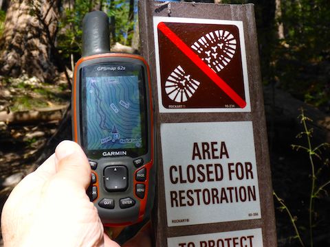
I try to park where there are toilet facilities, so my wife is comfortable while I am gone. As I was waiting for my crappy Garmin 62S to find satellites, another hiker remarked that there were no flies in the pit toilet. I responded, “Because the stench killed them.” 😁
I started by up a trail behind the pit toilet, but that petered out after a few hundred feet. The way was blocked by deadfall and a “Area closed for restoration” sign. Damn. What now?
Turns out there is a very obvious trail just to the right of the pit toilet, complete with all kinds of signs, that I missed. Egads.
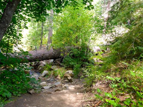
Marshall Gulch Trail #3 climbs 500 ft. in 1.3 miles to Marshall Saddle. It’s a moderate angle of 373 ft. per mile. It climbs for a couple hundred yards, levels out for a bit, then climbs again. The climby bits up Marshall Gulch have somewhat tricky footing with multiple roots, or off camber slick rock crossings. On the other hand, there are no footing concerns on the level bits.
It quite lush lower down on Marshall Gulch Trail #3. There are several wash crossings, which vary from damp to puddled; all can be crossed dry.
Higher up, Marshal Gulch Trail #3 starts catching a little more sun, as burnt areas higher up on Mount Lemmon expose the trail as it meanders through fern patches and infant pine trees. 🌲
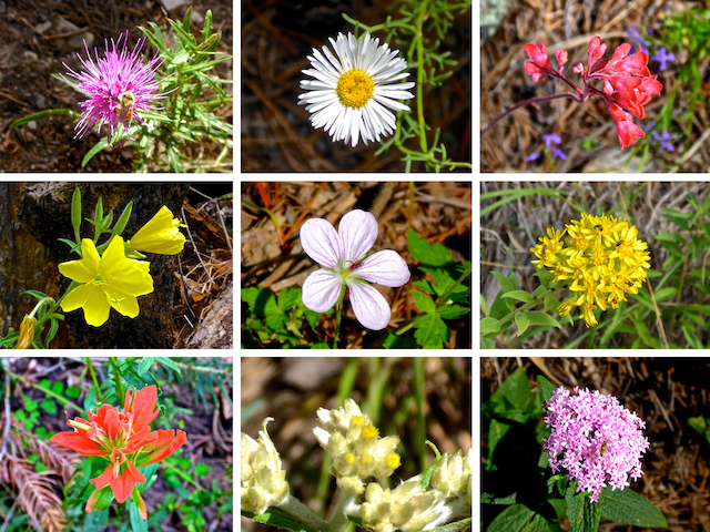
The #flowerporn was light on the hike to Upper Lemmon Canyon Pools, but the majority of the flowers were found on Marshall Gulch Trail #3. I saw maybe a dozen species, with New Mexico Thistle, by the far most common, being evenly distributed on both sides of Marshall Saddle. The largest patch of Yellow Columbine I’ve ever seen was located about halfway up Marshall Gulch.
At Marshall Saddle, there is a 5-way trail intersection: A sharp right turn onto Mint Spring Trail #20 follows the Mount Lemmon contour for 1.7 miles back to Summerhaven. Either left or right is Aspen Trail #93: Right takes you up 1000 ft. in only a mile to the summit of Mount Lemmon; left loops back to the Marshall Gulch trailhead in 2.2 miles. (I saw quite a few older folks hiking the Aspen Trail #93 loop.) Marshall Peak is an easy summit, only 200 ft. above Aspen Trail #93.
I went for the fifth option, straight across Marshall Saddle, onto Wilderness of Rocks Trail #44, into upper Lemmon Canyon. (Lemmon Canyon eventually empties into Sabino Canyon at the 4,200 ft. level.) 🧭
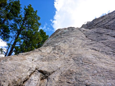
Wilderness of Rocks Trail #44 descends 860 ft. in 2.4 miles. Despite being a hair shallower than Marshall Gulch Trail #3, it felt steeper. The first mile or so had a surface similar to Marshall Gulch Trail #3, but the last 1.5 miles was pretty good tread. Besides the huge boulder formations which give the wilderness its name, the surrounding terrain was piney & more open, low to the ground. There were a number of good sitting logs that came in handy on the return trip.
I thought about scrambling up several formations in Lemmon Canyon, but decided I needed the energy to actually climb back out. Lemmon Rock Trail #12 intersects Wilderness of Rocks Trail #44 1.7 miles down canyon from Marshall Saddle. Trail #12 is a very healthy 1,800 ft. climb in only 2.2 miles to the observatory & antenna farm on the summit of Mount Lemmon.
There are about a dozen wash crossings between the saddle and the pool where I stopped, but it was after Lemmon Rock Trail #12 that the crossings started getting feet-bottom wet, with occasional tiny pools and trickling flow. Unlike the Romero Pools, at least initially, the Upper Lemmon Canyon Pools are not obvious & out in the open. Some minor scrambling & bushwhacking was in order. But it was well worth it. 🤗
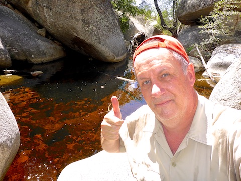
¾ of a mile below Lemmon Rock Trail #12, I found a decent size pool that was at least four feet deep, being fed by a very loud pour. There was a reclined scoop on the edge of the pool that I could sit in while dangling my feet in the water. I would have taken a nap there, except lack of overhead cover was frying me quick like. It’s a great spot!
After a half hour of relaxation at the pool, I slowly hiked my way back up Lemmon Canyon. Grey clouds were rolling in, but it didn’t start sprinkling until just before I reached Marshall Saddle. Wanting to avoid a possible deluge, I booked it 1.5 miles back to the trailhead in only 37 minutes! 🏎
Directions: From I-10 in Tucson, take Exit 256. Head east on Grant Rd. for 8.5 miles. Turn left onto Tanque Verde Rd. In 3.3 miles, turn left onto the Catalina Highway. In 30.5 very twisty miles (speed limit 35 mph), just after the ski village of Summerhaven, the road ends at the Marshall Gulch trailhead.
GPS File: Upper_Lemmon_Canyon_Pools
Distance: 8.51 miles
AEG: 1,538 ft.
Time: 3h 58m
Hiking Video
Hiking to Upper Lemmon Canyon Pools from Preston McMurry on Vimeo.