It’s been three years since I’ve been up to Sycamore Canyon, I need a few more miles — I put on 5 lbs. the last six weeks! ![]() — and I didn’t want to risk bailing on a hot hike at medium altitude, so I figured this fit the bill.
— and I didn’t want to risk bailing on a hot hike at medium altitude, so I figured this fit the bill.
Just east of Bellemont, in the east bound lanes, there was a SUV rollover. Posessions strewn all over the freeway. Young lady talking to DPS. Even money a few minutes before she was texting while driving. A few minutes later, exitting at Parks, east bound I-40 had a semi with a fully-engulfed tractor cabin. Two other semis had stopped to assist, so I proceeded across Garland Prairie. The abandoned ranch in the southwest corner of the prairie, on the southeast corner of Garland Prairie Rd. and FR 338, has been been occupied as recently as September 22, 1979. (As evidenced by the newspaper I picked up in the living room.) It had been a nice place, at one time. The smoke from the semi fire was a couple hundred feet in the air, and clearly visible from seven miles away. We checked out FR 56, to see if it went all the way to Sycamore Vista, but no go, so I started from the same pullout on FR 338 that Darth Stiller and I used last time.
Before I forget to ask, has anyone hiked the loop by going through the canyon, rather than along the rim?
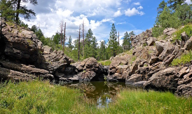
It was sunny when I started, but clouds soon started rolling in. I hiked counterclockwise so I would have the sun to my left, or back. Clouds soon started rolling in, though not directly over me. By the time I took my first break, at Vista Point, it was thundering and raining about 2-3 miles south of Sycamore Canyon. Thankfully, the rain seemed to be heading east, rather than north. There was enough sun actually on the canyon, that I was able to blow through a roll of virtual film taking cloud photos. ![]()
There were rock piles all along the loop, but they looked less like cairns than like simple piles of rocks cleared from a very clean trail.
Unfortunately the only rock climber I encountered all day had already packed up and started heading for home. The only other people I saw were at Sycamore Falls, but they were just hiking. Rather than follow the trail, I actually hiked up Pomeroy Tanks for a bit, scrambling where necessary. I missed the turn up Isham Spring Canyon, heading west a bit by accident. So, I got up on the flat, following the west rim of Isham Spring Canyon until I got past the Overland Rd, before rejoining the trail. The next mile north of FR 150, was accompanied by the dulcet tones of a logging operation. It had gotten darker, and I felt a few drops, but thankfully avoided the downpours occuring around me. There was lightning to the south.
The top of KA Hill was disappointing, as I was expecting there to be a clear view of the San Francisco Peaks, as I remembered, but I could not find a decent view until I was halfway down the east slope.
On the way home, heading south on I-17, there was another rollover. Thankfully it had happened awhile earlier, otherwise I would still be stuck on the freeway!
Distance: 12.53 mi.
AEG: 1,160 ft.
Time: 4h 46m
Ghost Ranch Video
Hike Video
Sycamore Canyon Rim Loop, Kaibab National Forest from Preston McMurry on Vimeo.
