
| Description | Dist. | AEG | Type | Loc. | A/B |
|---|---|---|---|---|---|
| Geronimo Trail #240 & East Webber #289 | 10.26 | 1690 | IO | W | B |
| General Crook Trail General Springs to FR 137 | 8.14 | 1051 | SH | 12 | A |
| General Crook Trail FR 9361K to Baker Lake | 8.03 | 839 | SH | W | A |
| West Chevelon Canyon | 7.93 | 596 | LP | 34 | A |
| General Crook Trail Baker Lake to Kehl Spring Campground | 7.59 | 648 | SH | 0 | A |
| West Leonard Canyon | 9.69 | 712 | LP | 22 | A |
| Knoll Lake & East Leonard Canyon | 6.98 | 706 | LP | 23 | A |
| East Clear Creek & Quaking Aspen Canyon | 8.05 | 544 | LP | 5 | A |
Dist.: Routed distance, not hiked distance.
AEG: Routed accumulated elevation gain.
Type: Loop (LP), lasso (LA), in & out (IO), shuttle (SH).
Loc.: Rim Rd. milepost of beginning trailhead, if above Rim. Else, general location west, middle or east.
A/B: Above (A), Below (B), Climbing (C) or Descending (D) the Rim.
National Park Service Hike Difficulty: https://www.nps.gov/shen/planyourvisit/how-to-determine-hiking-difficulty.htm
Elevation Gain x 2 x distance (in miles). The product’s square root is the numerical rating.
For example, a 10-mile hike that gains 2,200 feet in elevation:
2,200 x 2=4,400
4,400 x 10 = 44,000
Square root of 44,000=209.8
Does not take into account elevation where hike starts, or reaches its maximum.
Does not take into account the difficulty of the surface (broken, logs, rocks, etc.)
doesn’t take into account wind, heat / cold, precipitation, etc.
I modified formula to take the sqrt of (AEG * 2) * Dist * (Max El / 100) …
for this ride (350 * 2) * 15.6 * (7200 / 100) = 700 * 15.6 * 7.20 = √78,624 = 280.39 or just 280
waterline trail from schultz pass to the pumphouse (2250 * 2) * 18.4 * (9450 / 100) = 4500 * 18.4 * 9.45 = √782,460 = 884.57 or 885 or roughly three times as hard. don’t know if that is quite accurate, but we shall at some point see.
for comparison in Phoenix I do a (340 * 2) * 17.15 * (1480 / 100) = 680 * 17.15 * 1.48 = √17,260 = 131.38 or 132
~~~~~~~~~~
I modified formula to take the sqrt of (AEG * 2) * Dist * (1+(Max El / 20,000)) …
the blue factor for 1400 el would be 1.07, but for 9400 el would be 1.47 (roughly 50% more difficult), that’s roughly the oxygen ratio in this chart: https://hypoxico.com/pages/altitude-to-oxygen-chart
for this ride (350 * 2) * 15.6 * 1.36 = √14851 = 122 .
waterline trail from schultz pass to the pumphouse (2250 * 2) * 18.4 * 1.47 = √121,716 = 349 .
for comparison in Phoenix I do a (340 * 2) * 17.15 * 1.07 = √12,478 = 111 .
(760 * 2) * 18.6 * 1.33 = √37,602 = 194 .
~~~~~
https://www.wmicentral.com/260_connection/veteran-s-headstone-from-1880s-moved-to-rightful-location-on-rim/article_a40f7409-51e6-5b96-afc1-6290f30aec1c.html
After nearly 60 years, a headstone has been placed in its rightful place atop the Mogollon Rim.
The quest to commemorate the resting place of veteran Andres Moreno, who was murdered in 1887 along the General Crook Road, ended this fall as Coconino National Forest Mogollon Rim District recreation staff moved and reset a Veterans Administration marker installed May 10, 1964 at the request of Moreno’s grandson Frank.
Starting in the mid-1960s, there was some question whether or not this grave site near the summit of Baker Butte was the correct spot where Moreno was buried.
Military and other transport roads of the 1800s often had piles of basalt cobbles nearby that outlined what could be a grave, but local historians had long questioned Andres Moreno’s resting place. Payson historian and author Stan Brown, using primary sources and interviews with Moreno’s grandchildren, found evidence suggesting the marker on Baker Butte was in the wrong location. It is because of Brown’s persistence, and the extended Moreno family, that Moreno was finally memorialized in the proper spot in late 2022.
In his columns for the Payson Roundup, and in his books, Brown documented the life of Moreno along with his murder and internment along the General Crook Road.
Moreno was born in Sonora but moved to Tubac in his teens. He enlisted in the Arizona Volunteer Infantry in 1865 and was assigned to Company E at the new Camp Lincoln, a precursor to Fort Verde in Camp Verde. In 1866 he was wounded in a conflict on Grief Hill, near Camp Verde, and in August of that year he was mustered out.
After almost 15 years of working as a rancher, freighter, deputy sheriff in St. Johns and starting a family, Moreno moved with his wife Delfina and seven children to the Globe area and began a freighting business. In 1887, he was moving Dr. H.C. Cook and his family to Flagstaff, along with an Alabama bookkeeper named Knox Lee, who said he was beginning a teaching position in Flagstaff.
During the five days it took to go from Globe to the Baker Butte area on the Mogollon Rim, using the road from Strawberry north to the 1872 General Crook Road, there allegedly was tension between Moreno and Lee and the disagreements ultimately led to the shooting death of Moreno. After a cursory autopsy by Dr. Cook and an onsite coroner’s inquiry, Lee was arrested and Moreno was buried alongside the military road, which loosely follows and intersects today’s Forest Road 300, crossing the Coconino, Tonto and Apache-Sitgreaves national forests.
The 1887 murder trial of Lee was reported in the Arizona Journal-Miner of Prescott, and Lee was convicted of involuntary manslaughter, even though there was some testimony from Dr. Cook that Moreno was shot from behind, and Lee was sent to the Yuma Territorial Prison. The bookkeeper’s lawyer gathered testimony that Lee was a man of fine character and after one year and four months of prison, Territorial Governor C. Meyer Zulick pardoned Lee and he disappeared from Arizona history.
In the 1990s, historian Stan Brown and his wife Ruth started hiking along the Rim Road, finding several grave sites, and began comparing testimony from eyewitnesses to the crime, photographs taken at the inquiry and descriptions of the terrain at the time of the murder. Brown pointed out that even though FR300 generally follows the Crook Trail, the road had been realigned and there were other changes. Local Forest Service personnel interested in history also investigated the terrain, road changes and accounts from the time and agreed that the Moreno grave marker on Baker Butte was probably not in the correct location.
With prompting from the Moreno family, Coconino National Forest archaeologists took a renewed interest in confirming the actual resting place of Moreno. They asked Chris Adams, zone archaeologist for the Black Range Ranger District, Gila National Forest, to visit the site because Adams has experience using state-of-the-art metal detecting units to investigate historic battlefield sites. The equipment results interpreted by Adams suggested there was a burial at the new site, and USFS staff agreed this was a more accurate location based on research.
In 2018, Adams invited Patrick Horn to help investigate the site. Horn is the founder of the Missouri Region C Technical Rescue Team; he trains search and rescue dogs and works with law enforcement and other agencies to locate human remains without excavation. Both men have broad experience and have collaborated for years to locate unmarked graves on historic battlefield landscapes.
Horn brought two of his trained dogs to search the area and both independently indicated there was a burial beneath the rock mound. Based on Stan Brown’s research, historic records, topography of the area, and now with confirmation by the trained dogs, this location in all probability is the true resting place of Moreno.
In late 2022, under the direction of Mogollon Rim Ranger District Recreation Specialist Donald Branch and with oversight by Coconino National Forest Archaeologist Peter Pilles and District Archaeologists Melissa Julien, Cameron Maurin and Kristin Francis, the 1964 Veterans Administration headstone was removed and moved to a new concrete base next to the rock mound. The Moreno family used this opportunity to hold a large family reunion attended by relatives from all across the country and ended with a remembrance ceremony at the actual grave site.
Over the years, many U.S. Forest Service personnel, as volunteers, have hiked and surveyed the Mogollon Rim and east Verde Valley landscapes, recorded accounts, and conducted their own research by finding and organizing files, oral histories and boxes of photographs. Some of these USFS researchers whose work is in the permanent record include: Fred Croxen, Jay Cravens, Alvin Teague, Jesse Fears, James Blackburn, Bob Williamson, Bill Stafford, Dan Derrick, Karen Malis-Clark, Shannon Clark, Scott Wood, Barbara Dalton, George Pickett, Ralph Fisher and Shirley Payne.
Brown, whose publications and research are available at the Rim Country Museum store and online through the Payson Roundup, deserves most of the credit for keeping this project in the forefront by corresponding for years with Frank Moreno, Steve Moreno, Chuck Sawyer and Ysabel Fisk Rennie, all Moreno descendants passionate about their ancestor’s legacy. He was, and is, determined in his search for the truth, using oral histories and historic records.
The late Arizona Republic columnist James Cook, State Historian Marshall Trimble, Bill Cowan, Jerry Ehrhardt, Bob Boze Bell, Sam Palmer, Jinx and Jayne Pyle, Dese Muller, Dorothy Pyle, Ed Childers, David Grasse, Eddie Armer and Payson Roundup staff writers Teresa McQuerrey and Peter Aleshire have also contributed articles on Rim Country heritage. Many local historians have publications available at the exceptional Rim Country Museum store. Visitors to the area who are interested additionally help further an understanding of history and why it matters to a community.
Finally, Sandy Carson and the dedicated volunteer interpreters of the Northern Gila County Historical Society have also ensured that this wounded veteran with the Arizona Volunteers of 1866 is remembered, and an important chapter in Arizona has been corrected and added to the archives for Rim Country posterity and generations to come.
Peter Pilles is the Coconino National Forest Archaeologist and Melissa Julien is the former Mogollon Rim District Archaeologist, now with Joshua Tree National Park.
~~~~~
| Segment | Blog | Date | Miles | GPS | Video |
|---|---|---|---|---|---|
| 1 | Carefree Hwy. to New River Rd. | 2020-01-02 | 6.37 | .gpx | Vimeo |
| 2 | New River Rd. to Boy Scout Loop | 2020-02-10 | 10.34 | .gpx | Vimeo |
| 3 | Boy Scout Loop to Table Mesa Rd. | 2020-04-09 | 8.13 | .gpx | Vimeo |
| 4 & 5 | Table Mesa Rd. to Black Canyon City | 2016-02-28 | 13.23 | .gpx | Vimeo |
| 6 & 7 | Crown King Rd. to Black Canyon City | 2016-04-15 | 10.97 | .gpx | Vimeo |
| 8 | Crown King Rd. to Bumble Bee | 2017-03-10 | 4.36 | .gpx | Vimeo |
| 9 | Bumble Bee to Government Spring | 2018-03-26 | 6.47 | .gpx | Vimeo |
| 10 | Government Spring to Cordes | 2020-12-11 | 5.00 | .gpx | Vimeo |
| 11 | Cordes to Big Bug Creek | 2021-04-22 | 7.71 | .gpx | Vimeo |
| 12 | Big Bug Creek to Brushy Wash | 2022-03-23 | 9.78 | .gpx | Vimeo |
| 13 | Brushy Wash to Orme Rd. | 2022-04-29 | 10.41 | .gpx | Vimeo |
| 14 | Orme Rd. to Old Cherry Rd. | 2023-11-08 | 8.29 | .gpx | Vimeo |
Stub test experiment fiddle check evaluate inspect try
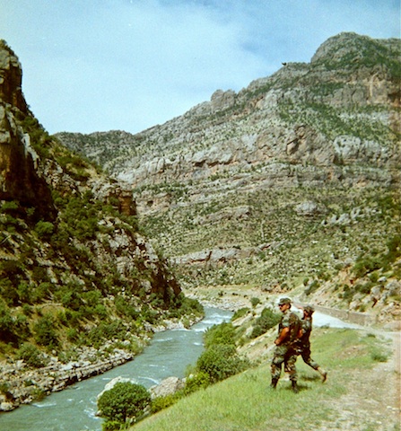
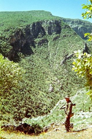
I really like the scenery on this stub page.
That is a brilliant comment!