

After Woods Canyon Lake, I stopped in Pinetop for lunch at Aliberto’s. (Alot like the {fill in blank}berto’s here in Phoenix, but I liked it better than the chorizo burrito I had the next day at Los Corrales.) Like I do when I travel anywhere, I read the local real estate magazines. Fancy “rustic” looks … odd … but it appears there are some good deals on horse properties in places like Concho and Linden. I had not expected to check into my motel — Mountain Haven Inn (next to the Super 8 ) — until 2:30, so after eating, I called ahead and asked if I could check in early. Even though the owners were at their daughter’s soccer game, Don came over to let me in, which I really appreciated. Stay there if you are in the area. ![]()
Springs Trail #633 is a small town, with trees and water, equivalent of hiking the Phoenix Mountains Preserve. Located north of, and immediately adjacent to, the faux log “cabins” of the Pinetop Lakes Country Club, it is a locals’ trail rather than a destination hike. If you combine it with the extensively interconnected White Mountain Trail system, you can get more distance and AEG, but at least in this segment it is still urban — or at least as urban as Pinetop gets.
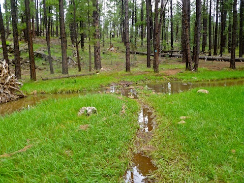
From the trailhead, I turned left (south) to begin a clockwise loop. Most of the trail has some wear, so it is about 4-6 inches below the surrounding ground, and will be quite muddy after any rain. In a few minutes, I crossed Thompson Creek. It’s the first of several creek crossings, but you can get across all of them without getting wet. (Even after heavy rain.) After a half mile, the trail turned west, away from FR 182, as I completed my first “climb”. (All of 40 feet. ![]() ) As the log “cabins” came into view, I descended to a marshy area, passing under some power lines, then crossing Billy Creek on a wood “bridge”. Traffic noise from Hwy 260 became audible.
) As the log “cabins” came into view, I descended to a marshy area, passing under some power lines, then crossing Billy Creek on a wood “bridge”. Traffic noise from Hwy 260 became audible.
The trail widened out along Billy Creek. Fletcher Tank is the highlight of the hike, with lots of yellow flowers. Because the hike is almost entirely near water, of some sort, there are mosquitoes everywhere, but especially here. You might want to spray some Off! before you start, but the skeeters are not as numerous, large or aggressive as in upper Midwest, so maybe not. After Fletcher Tank, and about 1.5 miles, the trail turned north, recrossing Billy Spring, for my second “climb” of the hike. (Another 40 feet or so.)
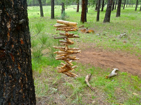
As I descended to Thompson Creek, the traffic noise lessened, being masked by the burbling water. Just after the pond, I crossed north across the creek. The trail split: Stay right, or you will find yourself on the connector to the Blue Ridge Loop, as I did. After backtracking, then taking the right split, I crossed back to the south bank of Thompson Creek for my penultimate 40-foot “climb” at the 3-mile mark. Then I crossed Thompson Creek one final time, performed your final ascent, avoid a booby trap, and was back at the trailhead in under 90 minutes.
This probably took me longer to write than it will take you to hike it. Basically, if you are from out of town, use it for the same reason I did: As a way to get in a few quick miles, to warm you up for bigger things, and to acclimate to the elevation.
It got really dark as I hiked, and there was much thunder to the east, but I avoided any rain, which was a good thing as the trail was muddy enough.
Both here, and earlier at Woods Canyon Lake, I really noticed the affect of elevation on my cardio, and within a few yards at that. Post hike my BP was 100/72 with a pulse of 104.
Upon returning to the Mountain Haven Inn, I found a pinkie nail-sized blister on my right heel. No big: I was looking forward to the next day, and a pair of 6.5 milers (Ice Cave Trail and Timber Mesa Trail.)
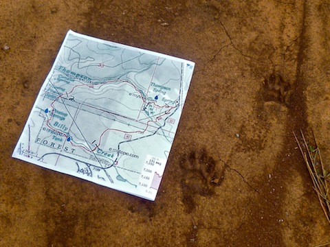
Distance: 3.92 mi.
AEG: 270 ft.
Time: 1h 19m