

I’ve been doing my usual three or four neighborhood morning walks every week, and just managed to get my 50 miles for August — the 45th straight month I’ve done so. (If you don’t count my stroll along the Wild Goose State Trail on our recent visit to Wisconsin, it’s been six weeks since my last real hike, Beaver Canyon on the Mogollon Rim). Nonetheless, I decided to hike the Potato Patch Loop in the Hualapai Mountains, just south of Kingman.
I’ve had my eye on the Hualapai Mountains for several years, but never quite got around to hiking there due to their distance, a three hour drive from my home in Sunnyslope. (Not counting pee stops in Wickenburg & Wikieup.)
A large part of the range is encompassed by Mohave County’s Hualapai Mountain Park, which includes Aspen Peak, Camp Levi Levi (not a misprint), Hayden Peak and Potato Patch itself. Hualapai Peak (8,442 ft.), the range’s high point, lies just outside the park boundary.
Besides Potato Patch Loop, I also planned to summit Hualapai Peak, which would make for a relatively short hike (8.0 miles), but with some good elevation gain (2,500 ft.).
I started hiking at 9:30 a.m., just behind some chatty girls (“We’re from the Mojave Desert!”). A few minutes after filming the intro to my hike video, I caught up to them already taking a sit down break. I never saw them again. Flatlanders. 🙄
Not that I am Reinhold Messner. 🏔
You’d have to try hard to get lost in Hualapai Mountain Park: The trails are obvious and copiously signed. Plus there is a very handy trail map available at the park gate. Because of all the signs, the map is most useful to explain what biomes you are travelling through, and what terrain features are visible from the various trails.
That said, there are numerous short side trails off the main Potato Patch Loop, and I wandered off trail several times. No big. Easy to turn around & head back a hundred feet. Besides, like I always say, “You are never lost unless you both don’t know where you are and don’t know how to get to where you are going.”
Hiking Potato Patch Loop clockwise, as I did, the trail climbs 800 ft. in the first 1.8 miles. Counter-clockwise, 800 ft. in 1.5 miles. There are plenty of switchbacks either way, and shade too, even on most of the southern slope of Aspen Peak, which the trail circumnavigates.
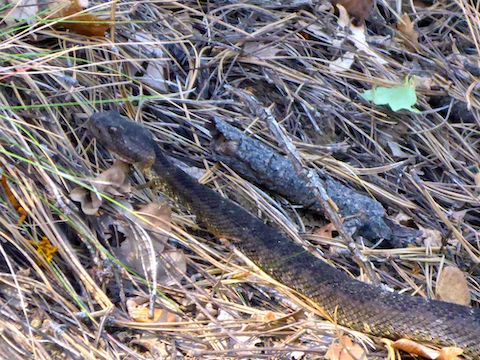
On one of the early switchbacks, I got rattled by a snake. A rattle so brief, I wasn’t sure it was a rattle. I didn’t even jump. It was an Arizona Black Rattlesnake (crotalus cerberus). I wonder if the brief rattle was random, or if the species has a shorter rattle, as the western diamondbacks and speckled rattlesnakes I usually encounter tend to have quite lengthy rattles.
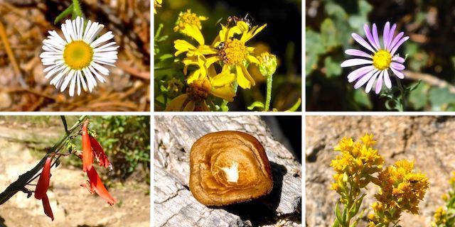
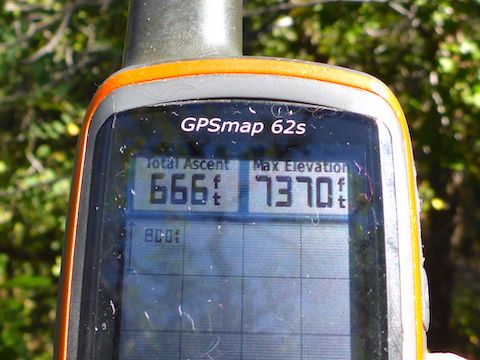
The fluffy yellow flower clusters (lower right, above) were the most common of the sparse floral pickings, with most of the patches found in the open, grassy, area around the Pine Lake Overlook. The overlook has great views east towards the Aquarius Mountains, on the far side of US-93. I took a short break on the bench, as I was already feeling the elevation. (Potato Patch Loop starts at 6,700 el.)
Just past the overlook is Storm Shelter 1. Not sure why storm shelters are needed in the Hualapai Mountains, of all places. I’ve never seen them anywhere else. Indeed, the only other trailside shelters I’ve seen are for camping along the Appalachian Trail or Wisconsin’s Ice Age Trail. Definitely not for storms. ⛈
I was already noticing that every time I looked up, then back down to the trail, I was briefly experiencing visual anomalies. Not from looking at the sun (I wasn’t). Though not nearly as bad as the heat exhaustion I experienced hiking from Table Mesa Rd. to Little Pan Loop back in 2011! I figured best not to push too much, and decided to skip Hualapai Peak, or any of the other nearby summits.
Camp Levi Levi is composed of several camp sites, stretched for a ½ mile along the jeep trail between Potato Patch Loop’s intersections with trails to Hualapai Peak and Hayden Peak. Each site has a small toilet building, picnic tables, a metal-covered fire ring, a well handpump and other odds & ends. I checked three well hand pumps, and each gushed water, two of them without a single pump, just by lifting the handle! 💦
There were also two porta-potties at the Hayden Peak trail junction. I didn’t use them, as I rarely pee when hiking. (After starting my hike at 9:30 a.m., I didn’t pee again until passing back through Wickenburg on the drive home.)
After eating lunch at one of the Camp Levi Levi picnic tables, I started back to the trailhead, along the northern slope of Aspen Peak. Even though the temps were very reasonable at 7,600 el. I planned it that way for maximum afternoon shade.
The 1.5 miles downhill from Storm Shelter 4 — what happened to 2 and 3? 🤔 — went much quicker than it’s opposite earlier in the day. Less than an hour, in fact. And that despite stopping several times to wander off trail to enjoy some nice views. (If Kingman could be considered attractive.)
Halfway down I passed a lady & her pooch on the way up. Even though she had some, she asked me about water. So, I told her about the gushing well handpumps.
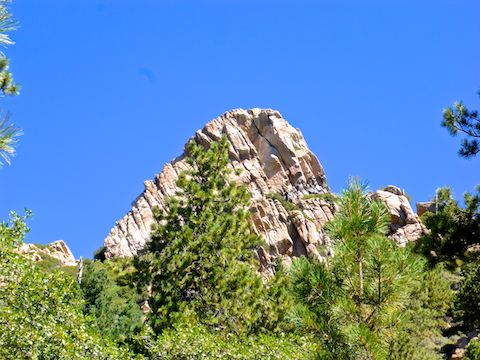
The highlight of the last part of Potato Patch Loop was near a rock formation named “The Gossips”, where I was able to catch that sunburst up top.
Heading down the final set of switchbacks, I kept an eye out for the rattlesnake I had encountered earlier. Thankfully, he did not stick around to have another go at me.
Even though I didn’t summit any of the peaks, that means I now have three other hikes I can do in the area … once I get back in hiking shape.
Directions: From Phoenix, head northwest on US-93. Head west on I-40 for 11 miles to the Love’s Travel Stop. Take exit 59. Follow the Hualapai Mountain Park signs onto DW Ranch Rd., which turns into Mohave County 259. In 5.6 miles, at the T-intersection, turn left onto Hualapai Mountain Rd. In 3.8 miles, the park gate house will be on the right. Current admission is $10. It is 0.7 miles to the trailhead. Mind your speed: It’s tight & very narrow.
GPS File: Potato_Patch_Loop_Hualapai_Mountain_Park
Distance: 5.41 mi.
AEG: 1,084 ft.
Time: 2h 28m
Hiking Video
Hiking Potato Patch Loop, Hualapai Mountains from Preston McMurry on Vimeo.
Arizona Black Rattlesnake Video
Arizona Black Rattlesnake (Crotalus Cerberus) from Preston McMurry on Vimeo.