

I couldn’t find any info on the internet — not even on mindat.org! — for the Paxton Place Mine. Given what was mined at Camp Bird Mine, just over a small ridge, it was probably gold, silver & lead.
I’d never been down Wagoner Rd before, so was surprised to see more people living in there than I expected. The area around Wagoner, and the Hassayampa Bridge, is quite lush. There was actual flow in the river, maybe three feet wide and a couple of inches deep, not moving too fast. The Bridge is steel truss, with a wood plank surface. As with several other bridges on Wagoner Rd, it is single lane. There was no traffic on the road until mid-morning, long after I’d started hiking, but much of it is big pickups pulling horse trailers. Also, it is an open range. On the road, we encountered one cow, three elk, several bunny rabbits, several jack rabbits, and a squirrel. So, I took care with my driving.
From the trailhead, Towers Mountain was plainly visible in the central Bradshaw Mountains, about nine miles northeast.
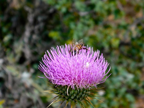
I had planned to make a loop of Paxton Place, a half dozen springs, and Camp Bird Mine, but ended up just doing this due to the stabby nature of the bushwhacking: After checking out the mines above Paxton Place, I had been stabbed enough for one day. The cat claw is both healthy (very green) and quite vicious on these hills. Many more attractive plants also thrive in the area: I have never seen so many New Mexico Thistle. Tall ones, too. They are everywhere: On top of hills, on hill sides, in washes. The Paxton Place wash had numerous Mexican Gold Poppy. There were many other tiny flowers about whose names I have no clue, particularly a semi-fluted purple one with long yellow middle thingies. (“Thingy” is a technical botany term. ![]() )
)
Since I finished a bit early, we decided to check out the Walnut Grove School and cemetery. The thing that stuck out to me was that the swingset would not pass safety-Nazi muster in today’s litigous society. But I’m certain it was boatloads of fun for the kids. ![]() The other thing was that the latrine building — not an outhouse — had flush toilets and running water. (I did not check functionality.) The school was locked. My wife spotted a wanted poster inside, so at least that part is similar to modern schools.
The other thing was that the latrine building — not an outhouse — had flush toilets and running water. (I did not check functionality.) The school was locked. My wife spotted a wanted poster inside, so at least that part is similar to modern schools. ![]()
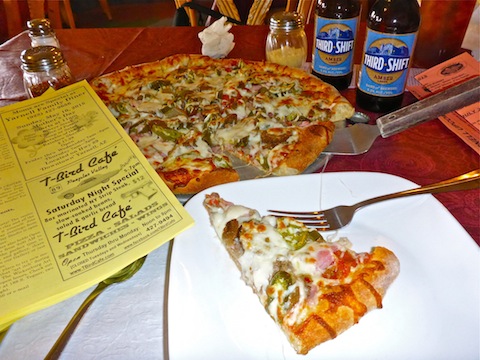
We weren’t sure where the Walnut Grove Cemetery was, so we headed back into Peeples Valley for lunch at the T-Bird Cafe, their pizza being the main reason I hike in this area. ![]()
GPS File: Paxton_Place_Mine
Distance: 5.98 mi.
AEG: 822 ft.
Time: 2h 31m
Hike Video
Paxton Place Mine Exploring, Bradshaw Mountains from Preston McMurry on Vimeo.