Christmas Camp to Fortymile Desert Tank
FR 8003, from AZ 238, near the Estrella Siding, to Christmas Camp at North Tank, was very smooth, though some deep areas might make it difficult for cars. The deep areas were either actual powdered dirt or a very fine gravel that was smaller than pea gravel, but larger than grains of sand. There were animal tracks everywhere, especially in the powdered dirt, but also even in the hard pack to the side of the road. There was literally 0 AEG from the highway to the tank. I’ve never seen that: Usually there is at least some slight ups when going down. My first AEG came when I climbed the tank’s berm.
From Mile Marker 0, it is 5.5 miles and 250 AEG to the FR 8002 intersection. The trail is mostly easy to follow but, if you lose it, the hard pack is easy to walk on, and the only cacti are a few scattered barrel cactus. 90% of the non-wash vegetation is creosote; the rest bursage or brittlebush.
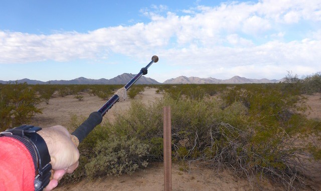
While technically the Mormon Battalion trail is also FR 8003, motorized traffic is not allowed. I saw a ton of human prints on the trail, as well as a fair number of horse prints. It was odd to see so many human prints, for being in the middle of nowhere, and not altogether scenic with the nearest mountains being several miles away.
The older wooden markers were placed by the Kimball Stake, while the metal cow skull markers mostly seem to have been placed by Bryan Jarman as a 1987 Eagle Scout project for the East Stake. Troop 507 placed an additional plate under one marker in 2002. The skull marks are supposedly every mile, but I found two that were only a quarter mile apart.
The east trailhead registry / de Anza sign is at the intersection of FR 8003 and FR 8002, which appears to be open back to AZ 238. There are “No motorized traffic” signs all up & down FR 8002, while they are also spaced every 100 yards or so west along FR 8003 (the Mormon Battalion / Butterfield trail). So, driving appears to be okay, as long as you stay on designated forest roads. On an otherwise shadeless hike, a rather large palo verde provides welcome mid-day relief at the intersection.
From the intersection to the top of the pass is 150 feet in 1.5 miles, which qualifies as “steep” on this hike. After leaving the intersection the vegetation changes to occotillo, saguaro and hedgehog cacti. The sign announcing Butterfield Trail Campsite is still misplaced two miles east, just before the top of the pass. I saw several interesting saguaros, including one that looked like a squid, and several others which looked like they were having quite a party.
It drizzled from 1245, just after I arrived at Happy Camp, until about 1305, after I started up the saddle between Estrella BM and Hill 2065. The many washes before and after that saddle were not deep, but had quite steep sides. The key was to stay midway up the slope. Despite the saddle having a healthy field of cholla, I adroitly avoided puncture. (Until I sat down for a break, and got a few in my rear.)
The final half mile followed a fence to the clearing on AZ 238, just east of Shawmut. By sheer luck, I came out at the exact point my wife was waiting for me.
I took 132 pictures and 30 audio notes. ![]()
Was hoping my Garmin 62S-estimated 16.7 miles would at least be close, allowing me to break a personal mileage record, and indeed it held up. Barely. ![]()
GPS File: Mormon_Bn_Trail
Distance: 15.51 miles
AEG: 615 ft.
Time: 5h 43m
Hike Video
Mormon Battalion Trail from Preston McMurry on Vimeo.
