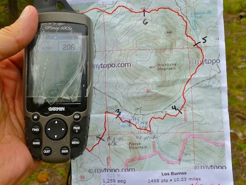
Not sure how the 14-mile full loop could be only 500 AEG when I did 800+ on just the 10-mile medium loop …
Anyway, I barely slept on Saturday night. I slept about three hours, then my aching knee made it hard to get back to sleep. So, after I finally gave up and got out of bed, I had to make a decision: Do the two scheduled 6.5 milers (Ice Cave Trail and Timber Mesa Trail) today and hope the knee help up for the 10+ miles of Los Burros on Monday morning, or do my weekend’s main event today. Given the location of this triplog, you know the decision I made. Good one too, as otherwise I would not have gotten back to Phoenix until after 8 p.m. Monday, due to a late start and this hike being so long (for me … Joe or Booneman might have done laps.) So, sleepless, blistered and with aching knee, off I went.
I had hash and hashbrowns at Darbi’s Cafe, as the trip was as much about trying some new restaurants as it was hiking. Good eats.

I drove past the turn in McNary and had to double back. I don’t know how the road usually is, but it is the worst washboarding I have ever experienced. 5-10 mph at best, in a normal car, for all seven miles. (If I had known how bad it would be, I probably would not have gone.) ![]()
By the time I got to the trailhead, it was about 10 a.m. Nice temps, but sun felt much warmer, maybe because of the thinner air?
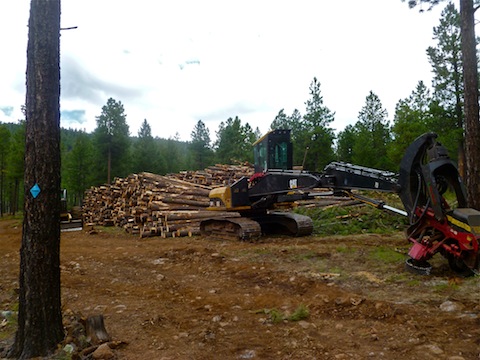
Lots of tree clearing going on throughout the whole hike, but especially between Hill 8022, Hill 8304 and Pierce Mountain. Really nice trail surface most of the way, and it showed evidence of MTBs and horses in the 48 hours since the last rain.
A very large elk darted across the trail in the saddle west of Pierce Mountain. It disappeared before I could get a picture. I waited awhile, hoping for more elk, but did not see any. (It had no antlers, so I assumed it was female, and I was under the impression females tend to hang out together when not in breeding season.)

The highpoint of the normal 10-mile loop is 8300 feet, on the small ridge .8 miles north of the logging operation. By noon, it had clouded over, and thunder was in the east again. (I found out later from the motel owner, who lives in Eagar, that there was very heavy rain between Pinetop and Eagar.) No rain at all on Los Burros, though. When I took my first break, I was disappointed to discover my Darbi’s Blondie Bar was missing. ![]() At least I had a Circle K murderwich to get me by.
At least I had a Circle K murderwich to get me by.
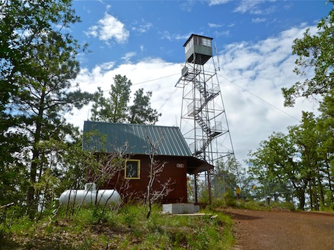
After eight miles, I arrived at the Lake Mountain split, which is also the connector trail to Four Springs Trail. I was feeling good, knee not hurting, and blister not feeling any worse. (I deliberately walked more on my toes to avoid any excess heel rub.) Since I felt so good, I decided to go up Lake Mountain, which adds about 600 feet to the AEG. In doing so, I set my personal best for high hiking elevation of 8529 feet (at the lookout). No one home, and tower fenced and camera’d. I waved. ![]() No water in the lake, which is an obvious volcanic caldera, but great views! Best flower display of the hike was along the gravel road down from the lookout.
No water in the lake, which is an obvious volcanic caldera, but great views! Best flower display of the hike was along the gravel road down from the lookout.

Passing over the Hill 8022 ridge, I heard an odd sound. Then realized it was my cell phone. ![]() You get great reception out there.
You get great reception out there.
I only saw humans four times the whole way: An old guy trailer camping at the trailhead, some logger/rancher types on ATVs near the logging operation, some guy with a dog and truck on the Brown Wash jeep trail, and a couple on horses going up the gravel road to the Lake Mountain lookout. (Me across wash to Dog & Truck Guy: “Howdy!!!”, in the hope if he was shooting he would not think I was a deer coming up the trail.)
I finished at 3:50 p.m. Post hike BP was 129/78, pulse 120. (Scary part was it was still elevated three hours later.) Blister was quarter-sized, but felt no worse, and neither did my knee. It took 35 minutes to drive the seven miles back to McNary. After showering, I had dinner at Los Corrales. (Great salsa and service.)
Distance: 12.78 mi.
AEG: 1,567 ft.
Time: 4h 39m
