

After finishing my early morning hike to First Forest Point, I drove around the traffic circle to the other end of the Jasper Point trailhead to do this hike. which is also known as First Road Trail. I guess that’s lazy, but I planned to do three hikes for 12.0 miles today, one hike (on two trails) for 7.0 miles on Friday, then two hikes for 10.5 miles on Saturday. (Before heading home around dinner time.) That’s pretty ambitious for a 53-year old fat man. I earned my 200 yards of laziness. ![]()
Because they share the same trailhead, and the National Park Service’s “Off the Beaten Path” program allows off-trail hiking, you could do Jasper Forest Road and First Forest Point as one larger loop: 1) Head off the gentle back (west) slope of First Forest Point, around the north end of the mesa, then head east to the north end of Jasper Forest Road, following it back to the trailhead for a ~6.5 mi. loop, or 2) return off First Forest Point, as I did, to the water vault, then take the jeep trail north to Eagle Nest Rock, before heading northeast to the end of Jasper Forest Road, following it back to the trailhead for a ~7.25 mi. hike.
After getting the lay of the land from the OP, I headed east, down a tiny drainage, along a well-defined footpath. When I got to the bottom of the drainage, by the park road, I turned northwest. I was on the recommended route — the actual old road bed — but quickly lost it. No big: You’d have to try real hard to get lost on this hike. Being legally off the beaten path just meant I found more cool petrified wood! ![]()
I ended up about a quarter mile west of the road bed, before cutting across a dry island to another wash, then heading west a bit more before following a spur straight east to join up with the road bed at topographic map found section corner x5485, at the foot of the bluff.
As I headed northeast up the now obvious road bed, I saw what I thought was a small cabin. It was actually a culvert. ![]() (I counted four culverts.)
(I counted four culverts.)
Having reached the end of the road, it was easy track it back to the paved road, before turning up the small drainage to the trailhead.
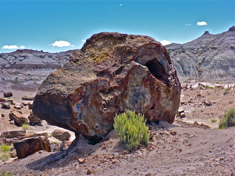
While you can find cool stuff that other people — who strictly stick to trails — don’t, on this hike I found two extremely cool things by following the First Road Trail back: First was a 45″ diameter petrified wood specimen, which impressed me for a few minutes until I found a petrified log that was nearly 50% bigger. I measure it heel-to-toe at five and a half shoe lengths, or about 66″! ![]()
After a quick refresh at the Jasper Point trailhead, I hopped back in my car, and headed up the park road to north end of the Petrified Forest at the historic Painted Desert Inn, to hike Onyx Bridge. (Fixing in my mind, as I drove by, the trailhead for Friday’s Historic Blue Forest Trail / Billings Gap Overlook hike.)
GPS File: Jasper_Forest_Road
Distance: 2.84 mi.
AEG: 184 ft.
Time: 1h 09m
Hike Video
Jasper Forest Road, Petrified Forest from Preston McMurry on Vimeo.
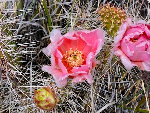
The Petrified Forest is becoming more and more interesting. Nice flowers and music.
Yep! Even though I didn’t get to do everything I planned, that just means I have an excuse to go back.