

This is the third straight year I’ve hiked an Ice Age Trail segment: In 2015, I hiked from Glenbeulah to Parnell Tower, completing a route my Boy Scout troop failed to finish — due to deer season — back in November, 1972. In 2016, I hiked from Parnell Tower to Crooked Lake. This year, I planned to continue south, from Crooked Lake to New Fane, which is only about six miles, throwing in a loop around Mauthe Lake to give me a more healthy ten miles or so.
When my wife dropped me off at Crooked Lake, I heard thunder, but there was no way I was not hiking.
From Crooked Lake, I walked back down the dirt access road to County SS, picking up the Ice Age Trail on the south side of the road. I had gone no more than 50 yds. into the woods, when it started drizzling, and did not let up until I got to Mauthe Lake 75 minutes later. Thankfully, the heavy canopy kept most of the drizzle off me.
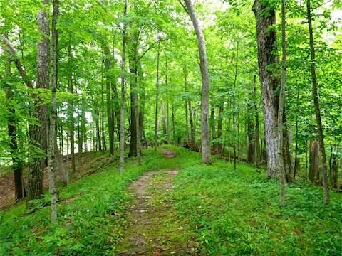
As on the two Ice Age Trail segments north of Croooked Lake, the trail basically follows the “high line” of a low ridge, the better to avoid the swampy kettles — the depressions that give Kettle Moraine State Park its name — that dot the ridge’s flanks.
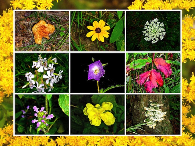
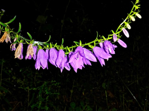
Unlike the two previous segments, there were a metric shit ton of flowers between Crooked Lake and Mauthe Lake. Between Mauthe Lake and County S the flowers nearly disappeared, before exploding once again between County S and County DD, just east of New Fane. Like the roads of Sheboygan County, the majority of the flowers were the fluffy white species, that usually has dozens of clusters on a given plant. The flower looks similar to a Hostess Sno Ball.
The Ice Age Trail between Crooked Lake and New Fane is mostly very smooth, enabling me to spend more time looking for #flowerporn than ankle breakers. Sometimes it is wide, but mostly it is narrow. It is frequently over grown with grass, but still distinguishable if you look for bent grass. There are regular muddy patches, particularly near this segment’s four small, wooden, bridges.
The Ice Age Trail crosses the first two bridges just before it passes by Forest Lake, barely visible through the trees. Soon after, the trail crosses County GGG / Kettle Moraine Scenic Drive.
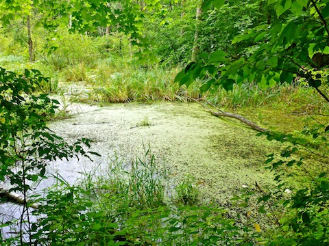
As the Ice Age Trail approaches Mauthe Lake, it skirts a camping area, and an especially swampy kettle known as Mallard Hole Lake. That’s where I unfortunately began encountering the eagle-sized mosquitoes which would plague me the remainder of my hike. (The drizzle had washed away the Off! with which I had doused myself at Crooked Lake.)
After crossing the third bridge, the Ice Age Trail breaks out into the open at the entrance to Mauthe Lake Recreation Area. There’s a pit toilet at the entrance. There’s no fee to walk in, but vehicle admission is $8/day with Wisconsin plates, $11/day for out of state plates, or $5 for a quick one hour visit.
I walked up the access drive, meeting my wife near the beach house / concession stand. The beach house also has toilet facilities, but since no one was around, I did not bother checking to see if it was unlocked. I had been hoping to hike the Tamarack Circle Nature Trail around Mauthe Lake, but as the sky was 100% overcast, and lighting thus so poor, I did not bother. Instead, I refilled my water bottle, kissed my wife, and headed back towards the entrance.
It took me awhile to find where the Ice Age Trail continues south of the Mauthe Lake entrance. It is 75 yds. northwest of the front gate, and 75 yds. southwest of the pit toilet, near the brown sanitary disposal sign.
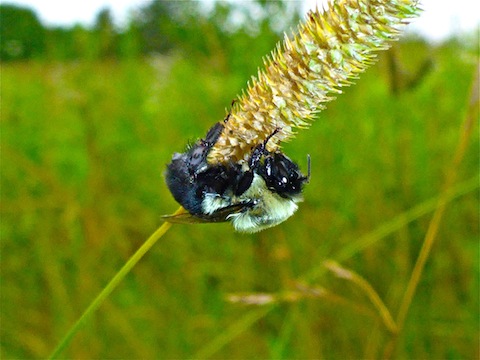
The Ice Age Trail then enters the Milwaukee River & Swamp State Natural Area. I spotted a bedraggled bee trying to stay dry on the lee side of a flower. The fourth bridge crosses a creek feeding the marsh.
Like I said earlier, there were almost no flowers between Mauthe Lake and County GGG, but I did start spotting many varieties of tree & ground fungi. To photograph the fungi, or anything else, for the final hour of my hike, I had to do it quick, lest I be eaten alive by mosquitoes. Quick walking kept them from finding safe purchase. I also hit on the idea of using my sweat rag as neck cover, since the rag’s swirling motion kept the bastards off my head & neck.
Shelter #2 is about a mile south of the Mauthe Lake access road. It is a wood building with a dirt floor. Basically, enough to keep you dry at night if you are doing a long distance hike. There is an outhouse near the shelter. The Ice Age Trail splits just north of Shelter #2, then rejoins just south of it, so if you do not see the shelter, you took the incorrect split.
The Ice Age Trail crosses County S just south of Shelter #2. A mile south of County S, the trail bends to the west, which is different than the topo, which shows the trail continuing south. My GPS track, below, shows the actual route.
Just as New Fane comes into view, on a small bluff overlooking the East Branch of the Milwaukee River and New Fane Mill Pond, there is a bench. It may look like there is a trail down the bluff from the bench, but it leads to private property. Stay on the Ice Age Trail, which soon descends to County DD.
The Ice Age Trail continues — for almost 1,000 miles — south and west of County DD. As there is no good pullout near the trail on County DD, I had arranged to meet my wife in New Fane, at the Rusty Spur Saloon.
I headed west into town, on a road which had been torn up to lay new sewer lines. Signs said local traffic only, so I hoped my wife would be there. Indeed she was, and a good thing too, as I was within 50 ft. of our rental car when the skies opened up and the deluge began.
Good thing I skipped the Tamarack Circle Nature Trail, as if I hadn’t, I would have spent the final hour of my hike being soaked to the bone, undoubtedly followed by a fever the next few days, which would have prevented me from accomplishing my main objective of the week: Spending the next three days at Road America watching the IMSA WeatherTech SportsCar Championship.
If you hike from Crooked Lake to Mauthe Lake, and back, it will be a six mile, 600 AEG hike. If you hike from Crooked Lake to New Fane, rehydrate at the Rusty Spur Saloon, then hike back, it will be a 13 mile, 1200 AEG hike. Throwing in the Tamarack Circle Nature Trail will add three miles and 100 AEG to your excursion.
GPS File: Crooked_Lake_To_New_Fane
Distance: 8.02 mi.
AEG: 612 ft.
Time: 2h 37m
Hike Video
Hiking Ice Age Trail: Crooked Lake to New Fane from Preston McMurry on Vimeo.