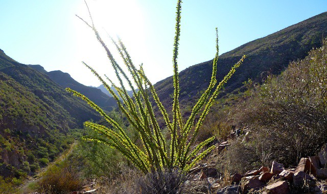
I decided to do some exploring of Aravaipa’s side canyons and mountains, mostly without first hiking up the creek. First up was a trip up Holy Joe Canyon to an abandoned mine then, time permitting, traversing the crest of Satathite Mountain.
My wife and I stayed the weekend at Across the Creek, a favorite B&B of ours. My wife has walked the creek with me before, but with her bad feet, and this being more off the grid, I was going to go solo. Was. The night before at dinner, with several other guests, the natural subject came up of what everybody was doing the next day (Saturday). I outlined my plan. One of the other guests said, “Oh, I’ll go with you” and “Six miles? We can do that in two or three hours!” I’m thinking, you have no idea how rough it might be, but did not want to be unfriendly.
Next morning I meet up with the lady, who looked more outfitted for a Phoenix canal walk. ![]() She offered me the use of one of her poles, and I’m like no thanx, I prefer being able to use my hands. So, a few minutes into the hike we get to a barb wire fence. No big deal, under I go. (Don’t want to catch the boys by going over it.) My “partner” hesitated, but went under too. We continue walking along the side of the creek for a few minutes, coming to a four foot ledge. Four feet. I climb over, but she stops, says it is too much for her, and turns back. I’m no Edward Abbey, but I’m thinking, are you kidding? And you wanted to do a rugged six mile hike in two hours? Egads.
She offered me the use of one of her poles, and I’m like no thanx, I prefer being able to use my hands. So, a few minutes into the hike we get to a barb wire fence. No big deal, under I go. (Don’t want to catch the boys by going over it.) My “partner” hesitated, but went under too. We continue walking along the side of the creek for a few minutes, coming to a four foot ledge. Four feet. I climb over, but she stops, says it is too much for her, and turns back. I’m no Edward Abbey, but I’m thinking, are you kidding? And you wanted to do a rugged six mile hike in two hours? Egads.
I continued up the creek, then turned south into Holy Joe Canyon. About a quarter mile into the canyon was a 40 foot rock wall. I probably could have climbed up it, but was not sure how I could get safely down it, as I was already thinking I would skip the Satathite Mountain portion of the trip. I back tracked towards Aravaipa Creek, eventually finding a rocky, steep, old mining road that paralled the south side of Holy Joe. At the saddle, was a wide flat area. I looked around, eventually finding a goat trail down a draw east of the saddle. Got to the bottom, waypointed and cairned the goat trail, then checked out the top of the wall. Would be sweet with a pool and running water, but no such luck.
Made good time further east in Holy Joe Canyon, until I came to a second rock wall. Not as high as the first, but looked harder to get up. Searched around for a bypass, but could not find one, even after back tracking. Bummer. Headed back to my casita at Across the Creek for some ice cold Coors Light.
Now that I know a quick way around the first rock wall, my next trip into Holy Joe I can spend more time looking for a bypass to the second wall.
This upcoming week is another trip Aravaipa, either up Brandenburg Wash (south of Aravaipa), possibly to the top of Flat Top Mountain, or maybe up the jeep trail to the top of Brandenburg Mountain.
Distance: 5.27 mi.
AEG: 793 ft.
Time: 2h 28m
