

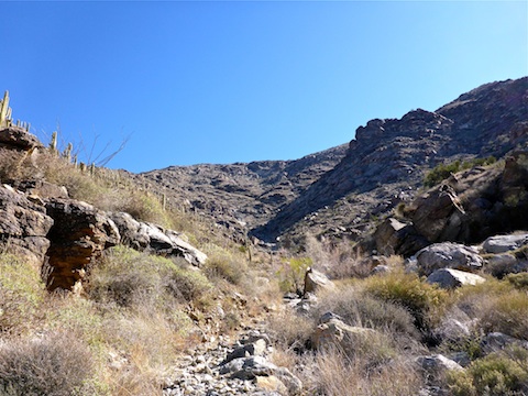
Harquahala Peak is the highest point in the Harquahala Mountains, which stretch from Aguila, in the far west end of Maricopa County, to Salome, in La Paz County, Arizona. At 5,681 ft., Harquahala Peak is over 3,000 ft. above the surrounding terrain. There are two ways up: The first, from the south, requiring “four low” (4WD), is ~10 miles of dirt from Eagle Eye Rd., southwest of Aguila. It gets so steep, they’ve actually cemented a section, otherwise there would be no grip. I actually saw a video where motorcycles turned back. ![]() The other way is from the north, ~2 miles of tame — but not car drivable! — dirt from U.S. 60 to a trailhead at the wilderness boundary.
The other way is from the north, ~2 miles of tame — but not car drivable! — dirt from U.S. 60 to a trailhead at the wilderness boundary.
The TH has a pit toilet, sign in stand, and info kiosk with topo and elevation profile. The first mile, to the dry tank is 350 AEG; the next three miles to the collapsed mine cabins, are each about 700 AEG; then the trail pitches up to 900+ AEG the final mile or so. If you take it slow & steady, you shouldn’t really feel any strain until you start climbing above the mine cabins.
The dry tank at .75 mi. was the “base camp” for the Smithsonian Observatory that was built on top of Harquahala Peak in 1920. (And operated until 1925, when they moved it to California.) The hiking trail is the old pack trail. There was no Summit Rd. back then.
I left home a few hours later than planned. I prefer to start hiking at first light, but did not hit the trail until 0945. Despite supposedly being 56°, it was quite chilly due to being very windy. I wore my windbreaker until I got to to the top of the first set of switchbacks, where the trail starts through a shady, brushy area, at about 3.25 mi. Though the leaves were tiny, they were deciduous, and some had turned brown and fallen on the trail. I took my first break there.
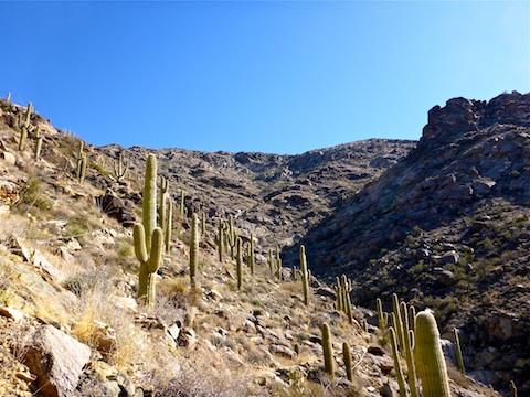
The trail has many step ups, and is rocky in a few spots, but for the most part is smooth, intelligently placed, and not tilted — an occasional concern, with steep drop offs in several places.
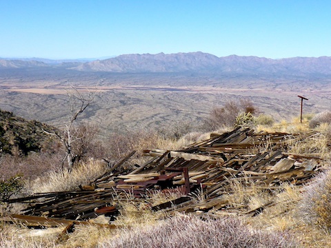
The mining cabins were a surprise, but also a bummer as they were collapsed. I only saw two artifacts: a sink-like contraption and the wheel from an ore cart. I had climbing to do, and did not spend much time searching, so I did not spot any shafts or adits. (The topo shows none at the camp location, though there are some on the far side of the summit.)
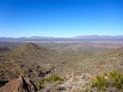
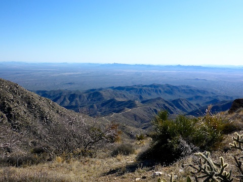
Halfway between the mining camp and the summit is a saddle, and the first view of the Summit Road, stretching into the distance. I spotted what looked like a VW Microbus making the climb! ![]()
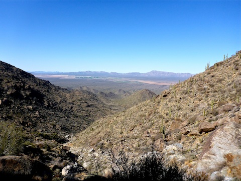
I labored up the final 500 ft. I’m not sure I could have climbed any more, as my vision was starting to do wierd things, probably more due to exhaustion than dehydration. I have to be honest: I was proud of myself, as that is the most I have climbed since the 3,497 AEG of Ballantine Cabin Loop four years ago to the day. ![]()
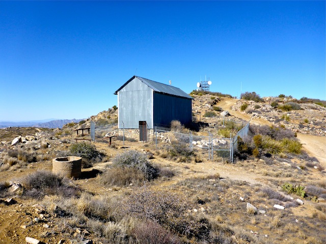
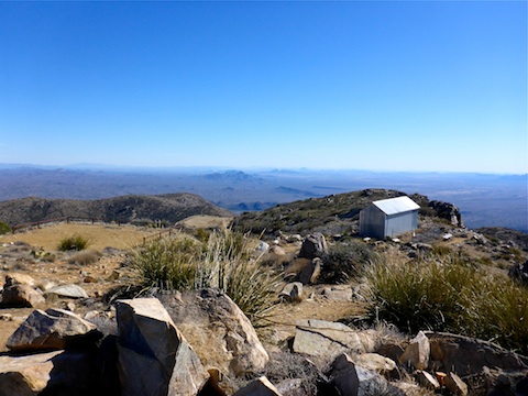
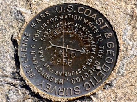
The summit has several parking areas, several benches, a picnic table, a windsock, reference mark, antenna farm, many informative historical signs, and the old observatory — which is unfortunately fenced off. ![]()
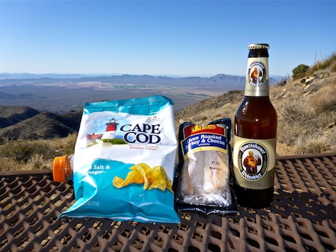
The two guys in the van arrived just after me: It was actually a Subaru, with 4WD, and they had to use four low, and even pile rocks in their rear end, to get up. A father & son in a Jeep were just behind them. After I chatted with everyone, I ate lunch: vinegar chips and a gas station turkey murderwich. (My favorite!) My summit brew was Franziskaner Weissbier.
I left the summit at 1430. I made what I felt was good time down the steepest parts, but the last two miles seemed to drag on, and on, and on.
I returned to the TH at 1715. I opted to pee — for the first time in nine hours ![]() — in the desert, rather than the pit toilet. It was dark gold. On the way back to Wickenburg, I guzzled my traditional post hike V-8, a Gatorade G2, and a water. At the Wickenburg Mickey D’s, I loaded up my fries with three packets of salt. I was surprised I not only avoided cramps all the way home — where I arrived about 1945 — but also all night long. Wierd thing is, the sorest part of my body is my shoulders.
— in the desert, rather than the pit toilet. It was dark gold. On the way back to Wickenburg, I guzzled my traditional post hike V-8, a Gatorade G2, and a water. At the Wickenburg Mickey D’s, I loaded up my fries with three packets of salt. I was surprised I not only avoided cramps all the way home — where I arrived about 1945 — but also all night long. Wierd thing is, the sorest part of my body is my shoulders.
GPS File: Harquahala_Peak
Distance: 10.69 mi.
AEG: 3,378 ft.
Time: 5h 20m
Slide Show
Drive Video
Hike Video
Harquahala Peak from Preston McMurry on Vimeo.
Steep climbs will get my shoulders occasionally too if I’m using poles. Nice write up! Will put it on my list.
Thanx, Matt! Yeah, my shoulders sometimes get sore too, though it’s more from carrying a kitchen sink pack, over a longer period of time, than distance. At least in my case.