

Three and a half years ago, I hiked from Glen Oaks to Hill 6276, overlooking Wilhoit. I was concerned about wildfire as, at the time, the Doce Fire was raging across Granite Mountain towards Prescott, which could have easily been Gatlinburg, where the Chimney Tops 2 fire burns as I type. (And where 14 people have died, and at least 1,400 structures have been damaged.) That Prescott was saved was down to the valiant effort of hundreds of firefighters, including their hometown heroes, the Granite Mountain Hotshots.
On my way to and from the hike, I passed through Yarnell and Peeples Valley. I thought my wife would really enjoy the beautiful ranch land in Peeples Valley, and just maybe some antiquing in Yarnell as well. A few days later, we spent an afternoon in the area.
A few days after that, the Yarnell Hill Fire started and the Granite Mountain Hotshots met their fate. (I got shivers typing that.)
Over the following year, I thought about hiking the burn area, to try to get some idea of how such a tragedy had occured, but eventually I decided it really wouldn’t be right to intrude.
Earlier this year, I heard about the creation of the Granite Mountain Hotshots Memorial State Park, and the construction of a trail to the “deployment site”, where a “burnover” led to the death of 19 of 20 hotshots. (Lookout Brendan McDonough was the lone survivor.)
The state park opened on November 29, but that day was rightfully reserved for the hotshots’ families.
Today, me and my hiking / mine hunting buddy Paul (aka PrescottStyle ) — who was a neighbor to several of the Granite Mountain Hotshots — hiked the memorial trail.
Although the Granite Mountain Hotshots Memorial State Park does not have any formal toilet facilities, currently there are several porta potties in the parking lot, 2.5 miles south of Yarnell, on southbound AZ-89. There was also a park ranger there, handing out brochures, providing updates on trail conditions, and accepting donations to build a statue at the trailhead.
Officially, there are two trails: The Hotshots Trail and the Journey Trail. The Hotshots Trail is 2.5 miles, and 1200 AEG, from AZ-89 to the observation deck, which overlooks the deployment site. The Journey Trail descends 450 ft. in a mile, from the observation deck to the deployment site. Overall, the round trip is 7.0 miles and 1800 AEG, taking at least four hours.
The trail is well laid out, with many switchbacks, and the surface is perfect. The volunteer trail crew did a magnificent job constructing it.
Every 600 feet or so, there is polished granite plaque honoring one of the fallen hotshots. They are placed in order of seniority, from superintendent Eric Marsh, above the trailhead, to Sean Misner, near the observation deck. Each plaque has a laser-etched photo and a family-written memorial message. The attached GPS file gives the exact location of each memorial.
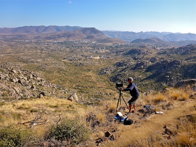
Informational displays, and rest benches, are scattered along the trail. There is also a bench, as well as shade, at the observation deck. (It will be quite hot on the memorial trail during the summer months.)
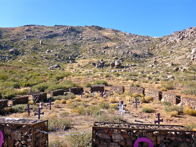
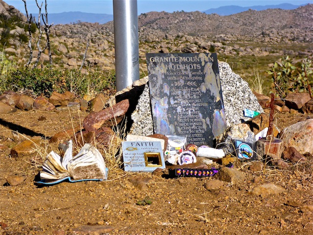
The deployment site is surrounded by 19 gabions (a rock-filled cage), connected by chains, symbolizing the hotshots’ eternal bond. Inside the ring of gabions, there is one cross for each hotshot, placed where he fell. A bit off to the side is a flag pole, at the base of which visitors are allowed to leave mementos.
Physically, I could have hiked the trail quicker, but I wanted to honor the hotshots, and so took my time, taking a moment to reflect and read each memorial. I got teary-eyed a few times. Like Paul said, the hike was tough, but not physically.
The video, below, is long, but I think it would be worth your time to watch, pausing frequently to reflect, as Paul and I did, upon the sacrifice the Granite Mountain Hotshots made.
To paraphrase Grant McKee’s memorial: Their bright light will forever shine upon us.
GPS File: Granite_Mountain_Hotshots_Memorial_State_Park
Distance: 8.24 mi.
AEG: 1,817 ft.
Time: 3h 58m
Granite Mountain Hotshots Memorial State Park Video
Granite Mountain Hotshots Memorial State Park from Preston McMurry on Vimeo.
Good job buddy,this hike to the Boy’s last stand is proving to be quite cathartic for me. I feel a little weight being lifted from my heart.. still more work to do!
I know which ridgeline to face to say “howdy” to our selfless heroes when I’m out hiking.
Thank you. Paul
I’m humbled. Thank you.
Very moving and haunting video. Very well done. The music was an excellent choice.
Albinoni’s Adagio was actually the first piece I considered. (Barber’s Adagio being rather over done.)