Directions: Red Mountain Freeway (202), exit Power Rd. (Go south on Power to McDowell to get a Tonto day pass at the Valero or Shell, even at 6:00 a.m.) North on Power / Bush Hwy 9.5 miles. Slow as you aproach the Salt River bridge, turning left immediately after into the Blue Point recreation area. It’s very dark out there early, so watch out for critters and cops. (There’s a sheriff’s sub station at the Usery Pass Rd intersection.)
I started hiking at 0700. It was supposedly 45 at dawn, but felt like 40. Pretty chilly. Rising to sunny low 60s. Drank coffee until it got light enough to walk without a head lamp. Took two steps … son of a buck. Forgot my hiking shoes. I was in loafers. ![]() I quickly surveyed my options: 1) Drive 90 minutes home and call it a day. Shortest hike ever. 2) Drive 90 minutes home, get shoes, drive back, hike. Pain in the tutkis. 3) Hike anyway. Monty, I’ll take door #3! Trail surface was rocky. It was a bit slippery with non-hiking soles, but actually kind of comfortable. I had to be careful though not stub my toes on any rocks, lest I tear the loafers open. Birds were chirping in the reeds, and I heard, but did not see, one dive into the river for dinner. Red Mountain looked gorgeous as the first sun hit it.
I quickly surveyed my options: 1) Drive 90 minutes home and call it a day. Shortest hike ever. 2) Drive 90 minutes home, get shoes, drive back, hike. Pain in the tutkis. 3) Hike anyway. Monty, I’ll take door #3! Trail surface was rocky. It was a bit slippery with non-hiking soles, but actually kind of comfortable. I had to be careful though not stub my toes on any rocks, lest I tear the loafers open. Birds were chirping in the reeds, and I heard, but did not see, one dive into the river for dinner. Red Mountain looked gorgeous as the first sun hit it.
I turned north into the main wash. Deep sand, slow going. It was that way for the next three miles. Maybe mid-way up the wash was a very large, inbred looking “Kentucky Cactus”. (So called because it is descended from sister-cousins and mother-uncles.) Where the wash begins opening up, just before it turns east, is the lime kiln.
After the lime kiln, the wash splits, and you actually want to take the northerly split. The easterly split, which I accidentally got onto, turns south into the mountains’ inner bowl. (If you see a little red barrel cactus in the middle of the wash, you you got on the easterly bit.) Might make for interesting exploration, but I wanted to stay on track. I turned north, cutting across a flat ridge, staying just west of Hill 2259. It was actually quicker going, because it was granite, not sand. Lots of cactus there, but easy to negotiate. Got back onto the main trail.
Lots of horse tracks, and other animals too. I positively identified deer tracks, others not sure. Where the trail finally leaves the wash, and begins a very slight climb, there are several very large ocotillos. Just after this the trail splits: North towards Stewart Mountain, south along the ridgeline. In a few hundred yards will be your first view of Saguaro Lake. The trail descends into a series of small slot canyons, before intersecting with the Petroglyph Loop. Turn south into the “Garden of Eden”. (I call it that, because it has a date palm — only one I’ve seen so far in the wild — and is otherwise grassy and lush.) Watch out for posses riding up from the ranch. And watch out for their droppings. Normally horse poo does not bother me, but in some places it was so thick it was just gross, and hard to negotiate.
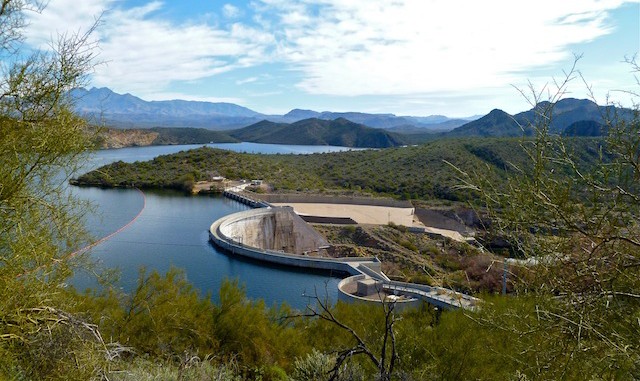
After the Garden of Eden, there is a huge culvert under the Bush Highway. The official description is clear if you are just doing the 7-mile Goldfield Ovens Loop, but its not obvious what to do if you are also doing the Petroglyphs Loop counterclockwise. As a result, I went straight, going through the riparian area south of the SRP housing area. (Watch out for guard dogs surprising you from inside the fence.) This is a pleasant extra half mile or so, but if you want to stay “on trail”, turn east along the pavement. If you go through the riparian area, the trail ends at the corral. Cross the fence to get back on the road. Go east past Saguaro Lake Ranch Resort — Kellerman’s it ain’t — until just after last metal shack. Go up the horse trail, the only climb of any sort, really, of the whole morning. Great view of Stewart Mountain Dam from the top of the climb.
Cross west back over the Bush Highway. Just after the Petroglyph Loop turns south, there is a small granite quarry. I was looking all along the trail for petroglyphs, but did not see any. Bummer. I rejoined the Goldfield Ovens Loop, passing back through the Garden of Eden, back through the culvert, and this time turned west reconnecting with the official description.
My loafers got a bit wore down on the surface, but otherwise held up fine, and feet did not feel any more beat up than normal. Would not recommend hiking in loafers for everyone, though. :mrgeen:
GPS File: Goldfield_Ovens_Loop
Distance: 11.25 mi.
AEG: 1,300 ft.
Time: 3h 17m
Hike Video
(I combined this and my 2014 trip into one video.)
Goldfield Ovens Figure 8, Saguaro Lake from Preston McMurry on Vimeo.
