

Back in Aravaipa for a second straight weekend. (We had a Aravaipa property owners meeting/picnic later in the morning, so hiking there made perfect sense.) Plan was to peak Flat Top Mountain, then continue to The Basin.
I started off just past the one lane bridge, where those weird shaped bricks are in the road. Probably to prevent erosion, as that is the creek’s closest non-flood approach to the road, maybe 25 feet.
I meant to start at 0700, but did not arrive until 0715. I spent a bit of time looking for a dry crossing, and settled on hopping rocks. Bad idea. I landed unbalanced, slipped, and popped by ACL-less right knee for the first time that day. (The second time would be simply walking back down the wash, not even stepping on a rock or anything.)
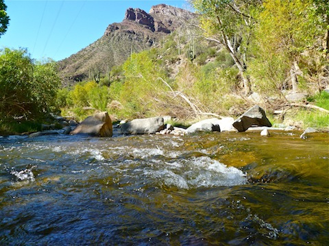
I decided to walk across the creek, which isn’t that wide anyway. I worked my way through the dead fall to Brandenburg Wash, and started up the jeep trail. I found myself on the inside of a locked gate. No idea how that happened. I crawled under, looked back at sign: It was Nature Conservancy land. They’re neighbors, so hope they don’t mind. ![]()
The walk up the jeep trail/wash was a slow, steady climb. Lots of off-road vehicle tracks on the trail. I saw bunny scat, javelina prints, goat prints, coyote prints, and more I could not identify in the somewhat sandy surface. There might be an alternate route up Flat Top Mountain, but the easiest approach is to climb it’s smaller neighbor, then continue west to the 3666ft top. I reached the saddle at the east end of Little Flat Top about 0900. Knew I did not have time to peak Flat Top and reach the The Basin, so I decided to do Flat Top. (I had a hard end time of 1100, in order to meet my wife back at the start point.)
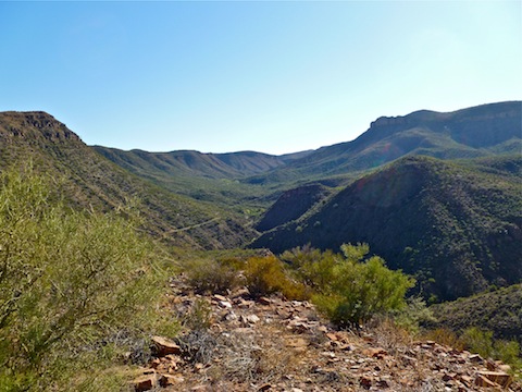
Little Flat Top is only about 280 feet above the trail, but it is steep, with some very loose sections. I got to the top, admired the great views, and chugged some Gatorade — or “G” as they now call it. ![]()
I would have continued on to Flat Top, but did not want to scare my wife by being late, so I bailed back down Brandenburg Wash to meet her. Unfortunately, she forgot the beer, so the picnic would have to wait while I drove back to Dudleyville for the ice cold taste of Coors Light. I had a great time at the picnic with some good folks. (Mostly because Crazy Emily is not invited. ![]() )
)