

My right knee was a bit achey after hiking Fraser Canyon & Randolph Canyon — particularly rocky Randolph — two weeks ago, so I took last Friday off to rest it. Besides, I had my 50 miles for May. (I’ve hiked at least fifty miles per month, every month, forty-two straight months since December, 2015.) In the interim, I kept my knee loose walking to the post office, or around my neighborhood.
Besides, last Friday it was snowing on the Mogollon Rim!
After the coldest May in 40 years, Summer is finally creeping up on Arizona. Friday was predicted to hit 100° in Phoenix, and be a pleasant 75° on the Mogollon Rim. 🌤
So, I planned my first canyon crawl of the year for Box Canyon, which lies between General Springs and Fred Haught Canyon. A Figure 8 / double loop, starting by hiking north down Box Canyon; then south, up the next unnamed canyon east; then north, down the next unnamed canyon east, to Fred Haught Canyon and cabin, before returning to the trailhead via FR 95F. About 10 miles and 1000 AEG.
I always plan my canyon crawls so that the hard part is outbound, while the return is (preferably) on a forest road or (hopefully) an easy, unobstructed, canyon, such as Fred Haught Canyon.
The drive in on Rim Rd. / FR 300 was the worst I’ve ever experienced. There were more, and bigger, pot holes, plus multiple deep cross cuts in the road. It was so bad that for the first time, I saw a “car not allowed” type sign at the turn off from AZ-87 onto Rim Road. Somehow, someone got a Fiat 500(!) — you know, with tiny kids’ tricycle tires — into Kehl Spring Campground. That’s nuts. Rim Road was so bad, we took FR 141H and FR 141 back to AZ-87 after I returned from my hike. Seriously, they ought to consider paving Rim Road. 🚜
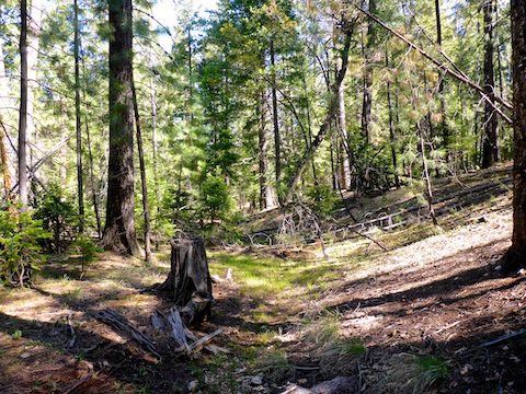
Canyon crawling Box Canyon starts by heading out the back of the trailhead, past the fire rings, aiming for the low point in the terrain which, at the trailhead, is an almost imperceptible crease.
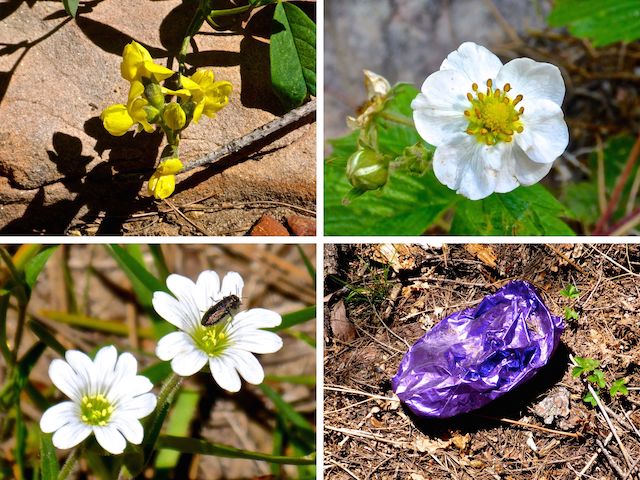
The first ½ mile, Box Canyon is wide, shallow and mellow. The canyon bottom is a dry, gravelly, creek bed, maybe three feet across. After a ½ mile, I started encountering small, shallow, pools with no trickle, which were easily avoided. The first pool was also where I spotted the first mylar balloon (of five on the day). God doesn’t pluck them from the sky, you know. I hope your Valentines Day sucked. 🎈🖕
Box Canyon was so mellow, I was thinking I might skate all the way to General Springs Canyon. It did not help that I was misreading my Crappy Garmin 62S GPS, thinking I had gone about twice as far as I had.
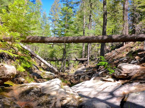
At the ¾ mile mark, Box Canyon began tightening up, with deadfall, that at least initially was easily avoided.
A mile down Box Canyon, I came to the first pour. Though not nearly as large as the pour I found off McCarty Draw, it had an overhang and was too high for me to descend. I bypassed it to the right.
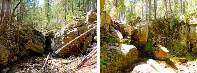
The second pour is only 150 yds. further down Box Canyon. I bypassed it to the left, then backtracked to its base. The second pour was wider, higher, more verdant, and had a slight, but audible, flow. I had places to go, or I could have sat on the moss, under the overhang, all day. 😌
After a mile of canyon crawling, Box Canyon finally began opening up. A creek meandered between flat, grassy banks. I found a good back support rock, and sat down for a shady break.
Walking on rocks, and limboing under deadfall, had my right knee aching. I considered my options: I could continue my hike as planned, or I could cut my hike short, either doing half the Figure 8, or heading up the bluff to FR 395, then back to the trailhead. I compromised, deciding on half the Figure 8. 🤔
From my break spot, the creek meandered back & forth across the cienega for the final ¾ of a mile to General Springs Canyon. I had to cross the creek several times, but I always managed to find a narrow spot I was able to step across. The pools also got larger, one of which had fairly loud flow.
When I reached the mouth of Box Canyon, I turned east along General Springs Canyon, on the south bank, opposite Arizona Trail Segment #27.
I had already been hiking for 3½ hours, so even though I had decided to do half the Figure 8, I cut that even shorter, heading up a rocky draw on that unnamed canyon’s flank.
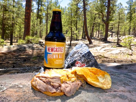
Though rocky, the draw was actually an easy ascent, and there were a number of large flat areas that would make great camp spots. I took my lunch break there. Two day old Arby’s Classic Beef & Cheddar never tasted so good! 🍔
Properly refreshed with a hiking beer — Newcastle Brown Ale, apparently now contract brewed by Lagunitas — I pounded up the 200 ft. bluff to FR 395, and two miles back to the trailhead in only 45 minutes, aching knee and all.
Directions: From Phoenix, head north on AZ-87, the Beeline Highway, through Payson, Pine and Strawberry. (Alternately, take I-17 north, then AZ-260 east.) 2.6 miles north of AZ-260, turn right onto Rim Rd. / FR 300. Rim Rd. is dirt and, at its western end, twisty and very bumpy. I would not do it in a car. In 13 miles, turn left onto FR 95. In another mile, turn left onto FR 395. Park by the fire rings.
GPS File: Box_Canyon_Loop
Distance: 5.93 mi.
AEG: 631 ft.
Time: 3h 04m
Hiking Video
Hiking Box Canyon, Mogollon Rim from Preston McMurry on Vimeo.