

Will the wind ever remember,
The names it has blown in the past?
Wind is my least favorite form of weather.
Always has been, dating back to walking across the campus at NAU in Flagstaff, a very windy city, carrying a portfolio, trying to keep the wind from bending it in half, ruining a project. Bite me, wind.
I shot mostly video, especially on the “stem” of the loop, the Historic Blue Forest Trail. I really should have shot more stills, but my original concept was to publish two videos: One for the stem and one for the Billings Gap Overlook loop of the Blue Mesa summit. But putting two trails, short they might be, into one production would make the final cut too long. I try to keep my videos under five minutes; even shorter if possible. That means few, if any, segments over 4.5 seconds (3.5 seconds, plus a half second overlapped fade at each end). If there is a longer segment, it is usually a panorama, or some (hopefully) interesting or amusing bit of narration.
Narration.
Oh boy, was it windy. ![]()
Every bit as bad as last year at the Grand Canyon, on the summit of Cedar Mountain, but more sustained. All day long, from when I started around 0900, until I finished sometime after 1400. Waiting for the wind to die down to start a narrated scene, ate up time, as did having to do a bit over when the wind inevitably overwhelmed the narration. I pretty much yelled my dialogue. Even so, reviewing my footage at home, stuff I thought would at least be passable, or tolerable, was inaudible. (As in if I listened really close, I might be able to tell that I was talking, but have not the faintest what I was saying.)
Even where there was no narration, or where I could have muted the narration in favor of music, the camera would be shaking not just due to the minute vibrations caused by walking, but because of the wind blowing against the camera, pushing it around. Even many of my stills were blurry due to the wind. (So much so, I had to fiddle the photos in post to a much greater degree than normal.)
Besides making my creative process a pain, there was the very real danger the wind would cause physical pain. Even of the permanent sort. Between .80 miles and 1.3 miles, almost to the paved Blue Mesa Loop, the trail gets very narrow, either clinging to a hillside, or traversing a razorback spur. The sides are very steep, and there are no obstacles to brake a potential fall: No trees, no rocks, not even cacti. Just more gravel to speed your descent. If you go over the side, you are going all the way to the bottom. (Which will be 100-300 feet down.) There are no hand holds to speak of. Tourists and casual hikers should not attempt that section, even if the wind is neglible.
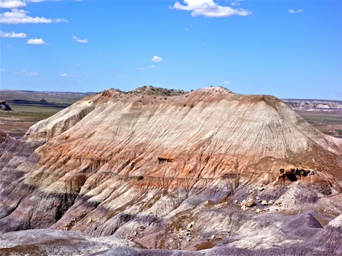
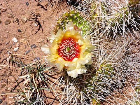
Speaking of trees, there is such a small amount of vegetation along the Historic Blue Forest Trail, that the small cluster of cedar trees at the trail’s highpoint are a very useful navigation aid. However difficult the footing may be, the trail is actually very easy to follow.
The Historic Blue Forest Trail starts at the northbound pullout opposite The Teepees. The first half mile is on a wide, old, CCC-built gravel road, at the end of which is is illegible wooden sign, which probably also dates to the 1930s. From there, the trail goes up 100 ft. of swithbacks, crosses a plateau for a quarter mile, then begins the iffy sections.
At a mile, the trail splits. There is another sign there, but it is also illegible. Stay left. If you explore right, as I did, up 50 ft. of switchbacks is a nice, and safe, observation point (OP 1). After your photo op, you can either rejoin the main trail, or cross the narrowest razorback of all to OP2. It is so narrow, that on my return I froze for several minutes as the wind was simply too much to make my way safely back across it. (Even when I did cross, quickly before another blast, it made me quite nervous.) There is some sort of bolt at OP 2, but no identification plate to indicate it’s purpose, like you see on reference marks. I taped a pano, but did it in two ~180° segments and sitting down, as the last thing I wanted to do was stumble, or be blown, over the side.
For much of the hike you are in view of tourists along the park road, or at one of the auto pullouts on Blue Mesa. Reaching the cedar grove is not only a good place to relax for a minute in an area with decent footing, it’s also good cover if you need to whiz. (The only bathrooms I saw in the Petrified Forest were at the north and south visitor centers; there were none at the various pullouts and motor vehicle OPs.)
From the cedar grove, it is a steep, slippery and narrow descent to the paved Blue Mesa Trail. If you choose to do that tourist-friendly loop, it will only add .30 miles to your distance. The final couple hundred yards are up the very steep paved path to the covered picnic area on Blue Mesa, which marks both the end of the Historic Blue Mesa Trail, and also the start of the Billings Gap Overlook hike. Historic Blue Forest Trail is ~1.70 miles, one way, with no diversions.
Semis on I-40, 20 miles northeast, are easily visible from the picnic area.
While its official name is the “Billings Gap Overlook” loop, in reality it is a loop of the summit of Blue Mesa, of which views of Billings Gap forms but a small part.
If all you are hiking is Billings Gap Overlook, park at the third pullout on the one-way loop road. If, like me, you are doing the full lasso, including Historic Blue Mesa Trail, walk .20 miles clockwise, along the road. At the third pullout, there will be an obvious foot trail heading southeast into the grass.
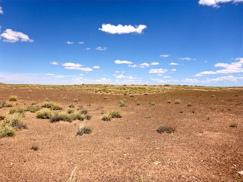
At .10 miles, by the head of a north facing canyon, I started cross country to the south. I went down a drainage for a quarter mile, but as I wanted to hike the mesa rim, when the drainage started to get deeper, I exitted it.
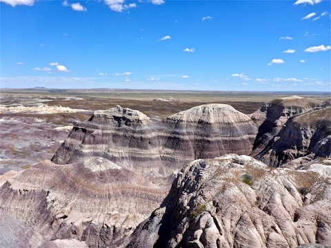
From there, I stayed as close to edge of Blue Mesa’s rim as possible, without being too close to the edge in the now even more obnoxiously stiff winds. I explored, or traced the edge of, every outcropping, no shortcuts, all the way around the mesa. Not that you would want to take a shortcut, as the mesa’s interior is devoid of features or interest. ![]()
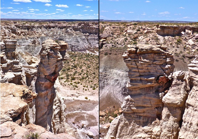
There’s some decent views along Blue Mesa’s rim, but very little petrified wood. Most of the specimens are on the mesa’s lower south slope. (Which the “Off the Beaten Path” Red Basin Clam Beds hike explores.) However, I did spot one interesting petrified log that went through a hoodoo. Despite its force, the wind did not javelin the log through the hoodoo, erosion just happend to reveal it that way. Though I would not be surprised if the erosion had occured since I woke up that morning. ![]()
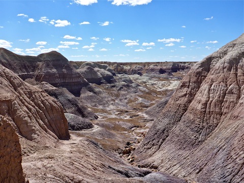
Seriously, the wind was getting so bad, that I felt grit stinging my face. To make matters worse, it was not blowing in one direction, but swirling. Several times I thought I was pointing the right way for a whiz, only to have the wind unfortunately shift. As bad as that was, it got even more embarassing Saturday morning while hiking Onyx Bridge. ![]()
I stopped for lunch at the Billings Gap Overlook, which is just an unmarked, general location 2.40 miles into the loop counterclockwise (as I did it), or 1.2 miles clockwise. The wind blew my glasses out of my pocket. ![]()
Billings Gap Overlook is Blue Mesa’s 5608 ft. high point. About halfway back to the trailhead, I started picking up human prints. I even passed a German couple headed out to the overlook.
After airing out my feet back at the covered picnic area, I hightailed it back down-up-down Historic Blue Forest Trail to The Teepees, then “home” to the Globetrotter Lodge in Holbrook. (Which looks like an old motel from the outside, but is more like a bed & breakfast on the inside.)
GPS Files: Historic_Blue_Forest_Trail & Billings_Gap_Overlook
Distance: 7.91 mi.
AEG: 930 ft. (Crappy Garmin 62S claimed 2600 feet!)
Time: 3h 25m
Hike Video
Hiking Blue Forest Trail, Petrified Forest from Preston McMurry on Vimeo.
Sounds like a harrowing hike with all that wind!