

Last week I explored Big Stick Mine, on the Santa Maria River, about a two hour drive from my home in Sunnyslope. So, this week it is back to the Valley of the Sun for another ‘Locals Hike’. (The term I use for trail-only hikes of moderate length & elevation gain, that might be of interest to Phoenix’s winter visitors, or other less adventurous hikers.)
This week’s ‘Locals Hike‘ was a loop from First Water Trailhead: I would head southeast on Dutchman’s Trail #104, over Parker Pass, 4.3 miles to the foot of Palomino Mountain, then head northwest on Black Mesa Trail #241 past Yellow Peak and Black Mesa 2.8 miles to Garden Valley, before taking Second Water Trail #236 1.8 miles back to the trailhead.
Besides my climb up Palomino Mountain to Aylor’s Arch, I have been through Garden Valley at least a half dozen times. (Less than many folks, for whom the Superstition Mountains are a home away from home.) So, Black Mesa Trail #241 would be my only new segment.
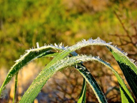
It was chilly when I started hiking southeast from the First Water Trailhead on Dutchman’s Trail #104. The first ⅓ of a mile, sightly downhill, to the Second Water Trail #236 intersection is slickrock. The intersection is signed. At the base of the sign were two rocks (see above) painted like ladybugs. There was some writing on the bottom: “Arizona Rocks [F] F.A.” My wife’s nickname is ‘Lovebug’, but I left the rocks behind, because I did not know what they were for. Any ideas? 🤔
The next four miles of Dutchman’s Trail #104 had constantly varying trail surface, but nothing too bad. There were many muddy spots, especially on the way up to Parker Pass. Or they would have been mud, but were frozen over. I had fun punching holes in the ice with my hiking poles. The trail crossed a dry drainage a half dozen times; once I got misdirected for a minute. No big.
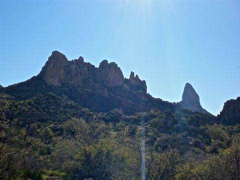
Weavers Needle made its first appearance, just the tip, crossing a meadow just north of Parker Pass. The best view of Weavers Needle was at Parker Pass itself, though I could only see the top half of the spire. I’ve actually seen it from as far as 43 miles away, while hiking Bronco Trail #245 to Seven Springs, but the closer I got to Weavers Needle the less of it I saw. By the time I got to the base of Palomino Mountain, all I could see was the summit.
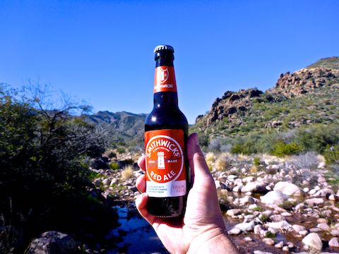
Just before the base of Palomino Mountain, Dutchman’s Trail #104 crosses West Boulder Creek. It wasn’t deep, but was running pretty good. I was able to cross it without getting my feet wet.
At the base of Palomino Mountain there is a trail intersection that resembles a freeway spaghetti interchange. Dutchman’s Trail #104 actually twists south for another 14 miles to the Peralta Trailhead. (Doing a First Water TH to Peralta TH thru hike via Peralta Trail #102 is only half that distance, so much more doable as a one day shuttle hike.) Boulder Trail #103 heads north towards Battleship Mountain and, seven miles later, Canyon Lake. Bull Pass Trail #129 head over, yes, Bull Pass to La Barge Canyon. Finally, Black Mesa Trail #241 loops back to the northwest.
Despite it only being 10:00 a.m. when I arrived at the spaghetti, there were already a half dozen people there. I ended up chatting with a Canadian fellow for 20 minutes, before heading up Black Mesa Trail #241. He was from the Yukon! 🥶
The climb from the spaghetti intersection up Black Mesa Trail #241 to Yellow Peak is the steepest of the day, but at 300 ft. in just under a ½ mile not all that bad. It does get rocky in spots, and there are a few step ups. If you look back from the top of the climb, you have the best view of Weavers Needle you will get all day. But remember to look back! ⛰📷
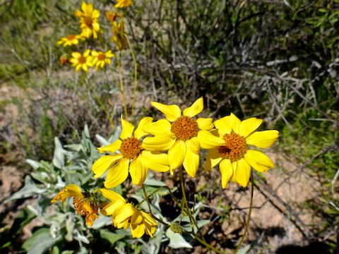
Yellow Peak is obvious because it is actually yellow. A strong hiker could bushwhack the extra 500 ft. to the summit of Yellow Peak, no problem.
From Yellow Peak, Black Mesa Trail zigs left past the southern tip of Black Mesa, which actually appears typically Arizona dusty grey & green when you first spot it. The trail surface begins improving. In a few minutes, as the trail zags back to the right, heading up a short canyon, you can see the black boulders which crest Black Mesa, giving it its name. It’s only 150 mild feet to the summit.
After crossing a barren area with several old campfire rings, Black Mesa Trail begins descending down a narrow canyon towards Garden Valley.
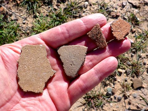
By the time I reached Garden Valley, I had to pee something fierce. Luckily, there was very large palo verde I could hide behind. I dumped my red hat and blaze orange backpack, so no one could see me through the tree. (By noon, there were quite a few people about Garden Valley.) When I returned to my gear, I noticed I had dropped it in the middle of rich deposit of indian pottery sherds. Most of the sherds were undecorated grey or umber. The largest was maybe 2″ across. ⚱️
After checking out the sherds, I turned west onto Second Water Trail #236. From Garden Valley it descends 170 ft. in a ½ mile to a verdant creek crossing, before winding around a few small hills, and skirting some rocky outcroppings, another mile back to Dutchman’s Trail #104.
Back at Dutchman’s Trail #104, I forgot to check if the ladybug rocks were still there, so intent was I on diddybopping back to the First Water Trailhead. (I did the 1.8 miles from Garden Valley in only 40 minutes.) 🏃🏻♂️💨
Directions: Depending on which part of the Valley you are travelling from, either take the Red Mountain Freeway / Loop 202 or US-60. If you are driving Loop 202 east, take exit 27. Go east on University Dr. for 5.5 miles, then turn left onto Apache Trail / AZ-88 for 5.0 miles. If you are driving US-60 east, take exit 196. Go north on Idaho Rd. for 2.3 miles, then turn right onto Apache Trail / AZ-88 for 5.2 miles. Regardless of which freeway you take, just past Lost Dutchman State Park, turn right onto First Water Rd. The trailhead is at the end of the road in 2.6 bumpy miles. If the First Water Trailhead is full, park a half mile back in the horse lot. Both have pit toilets.
GPS File: Black_Mesa_Loop
Distance: 9.79 mi.
AEG: 1,145 ft.
Time: 3h 56m
Hiking Video
Hiking Dutchman Trail & Black Mesa Trail from Preston McMurry on Vimeo.