Had not been hiking much in the last two weeks due to a family medical situation. Finally got out today, despite refrigerator needing attention. I was starting to feel bloated, so I had to get out anyway, and thanx to my wife staying behind I was able to.
When we travel west on I-10, we usually stop at the rest stop west of Tonopah. I’ve never had occasion to use the stalls until today. ![]() It was so vile, I turned around at the Salome Rd exit to hit the east bound stop on the opposite side of I-10. It was marginally better. Luckily, I had a large bottle of alcohol cleanser in my emergency kit, and I liberally swabbed the seat. After I was done, I repeated the liberal swabbing on my nether regions to hopefully kill off any cooties. I really feel for you gals that have to use those! Still, it was not as bad as the outhouse on the Cree reservation in northern Canada, nor the latrine at the Pakistani infantry battalion in Bosnia!
It was so vile, I turned around at the Salome Rd exit to hit the east bound stop on the opposite side of I-10. It was marginally better. Luckily, I had a large bottle of alcohol cleanser in my emergency kit, and I liberally swabbed the seat. After I was done, I repeated the liberal swabbing on my nether regions to hopefully kill off any cooties. I really feel for you gals that have to use those! Still, it was not as bad as the outhouse on the Cree reservation in northern Canada, nor the latrine at the Pakistani infantry battalion in Bosnia!
Now heading east, instead of doubling back on I-10, I got off at Tonopah, taking Indian School Rd. — you read that correctly — west to the Salome Rd. exit, where I followed the default driving instructions to the trailhead. The easy dirt ends after seven miles, at the first wilderness sign, which currently also has a port-a-potty. Wish I’d know that earlier. ![]() Couldn’t be any worse than the rest stop. From there, I split right on the pipeline road. For a SUV, it was no problem, though speed generally needs to be kept to 20 mph or less. Cars could do it, but watch out for sand in the washes and sometimes small ledges entering/exitting the washes. There is a graffiti‘d tank at 3 miles, after which the road actually gets smoother. At four miles, at the second wilderness sign, turn left on the trailhead road. The road curves around a small hill. If I were driving a car, I would stop just short of the hill. It’s only another half mile to the trailhead / wilderness boundary / third wilderness sign.
Couldn’t be any worse than the rest stop. From there, I split right on the pipeline road. For a SUV, it was no problem, though speed generally needs to be kept to 20 mph or less. Cars could do it, but watch out for sand in the washes and sometimes small ledges entering/exitting the washes. There is a graffiti‘d tank at 3 miles, after which the road actually gets smoother. At four miles, at the second wilderness sign, turn left on the trailhead road. The road curves around a small hill. If I were driving a car, I would stop just short of the hill. It’s only another half mile to the trailhead / wilderness boundary / third wilderness sign.

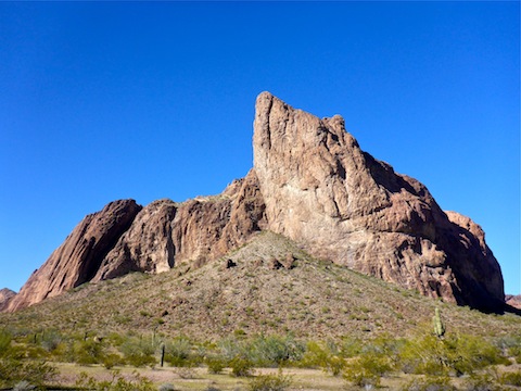
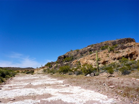
I went clockwise around Courthouse Rock, checking out a “rain apron” (learned a new word), and several old mines. Only found one identifiable shaft, and it was mostly collapsed. The ocotillo on the east side of Courthouse Rock were flowering more abundantly than those on the west of the formation. Some were stunning. There were some small purple flowers, but mostly it was brittlebush and creosote providing what color there was. There were no clouds, and no shade. The jeep trail I was on began curving away from my intended route (wrabbitdog’s uploaded route), so I began cutting west across washes towards the “official” route. The washes are not big, but the constant up & down is slow & tiring. I would not have wanted to continue on wrabbitdog’s route. Eventually, I found a cairned foot trail, following that the rest of the way to the petroglyph zone.
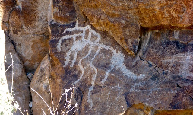
Not sure where, exactly, the petroglyphs were, I first checked out a small canyon a few hundred yards northeast of the small, dark hill. I found one small panel, but more importantly, I found shade. I ate lunch and cooled off. Then I began working my way towards the small hill. I started on its east edge, working counterclockwise. I began encountering extensive panels on its northwest corner, and the petroglyphs continued around to the southern side. Despite looking for snakes, I failed to see one which gave me a “Hey, I’m over here, please don’t come closer” rattle. (As opposed to a angrier sound, it just felt more like a friendly warning — if that makes sense? — and perhaps from a smaller snake.) Whoever did the petroglyphs really liked their checkerboard shapes. I also found some samples from the, presumably, 1920s and 30s. I then checked, with no success, a half mile up the canyon southeast of the small hill.

Hot flashing once I stood up too quick, it was time to head back. I followed the old jeep trail, following it left (northwest) where it crossed the wash, sloping up. It appeared to be curling away from the trailhead’s direction, so I dropped back into the wash, following the wash a bit, before picking up another cairned old jeep trail back to the trailhead. (Turns out, the old jeep trail I started back on, and the one I finished on, are the same.) It was 91° when I finished.
I used some ice in a sandwich bag to ice down my sun burnt neck & head as I drove back on the pipeline road. When I got back to Harquahala Valley Rd., rather than turning left towards I-10, I continued east on paved Courthouse Rd. After a brief stop in Tonopah, I stayed on that same road, and Baseline Rd., all the way into Buckeye. Wierdest thing all day was spotting a taxi (!) 12 miles west of Tonopah on that little country road.
GPS File: Ben_Avery_Trail
Distance: 10.77 mi.
AEG: 784 ft.
Time: 4h 33m
Hike Video
Indian Spring Petroglyphs, Eagletail Mountains from Preston McMurry on Vimeo.
