

GPS gave me a reading of 5.48 miles and 1346 AEG. Haz gave me a 5.04 miles, but no AEG, as it does not yet support Ordnance Survey maps. ![]() So, figuring the AEG is most likely off, I rounded it down by the same percentage as the distance, .9197, to give a “true” 1238 AEG. Not that big a difference, but don’t want to unfairly threaten imike’s AEG totals.
So, figuring the AEG is most likely off, I rounded it down by the same percentage as the distance, .9197, to give a “true” 1238 AEG. Not that big a difference, but don’t want to unfairly threaten imike’s AEG totals. ![]()
My extra distance on the hike is due to walking to & from our hotel on Bridge St. It was only a mile, and would result in more exercise, and maybe I would see some cool stuff in the Old Town, and besides no way was I driving in Scotland. Especially in those narrow streets. You really got to watch out, whether you are driving (for other drivers, or pedestrians suddenly jaywalking) or when you are walking (for drivers whipping around corners — and remember: Always Look Right!). Also, difference in distance due to taking a slightly different route, once I actually got to the park.
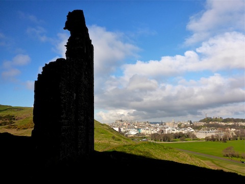
I started a little after 7:00 a.m., walking down Canongate, which is a continuation by another name of High St., but on the east side of Bridge St. It’s called The Royal Mile as it ends at the roundabout in front of Holyrood Palace. Then it was a few hundred feet south on Horse Wynd, past the Scottish Parliament to Holyrood Park. This is when I discovered I had left my water behind. ![]() The Tesco Express-type shops — think QT minus the gas pumps — were not open at that hour, and no way was I wasting an hour round trip returning to the hotel, as we had Edinburgh Castle yet to do that day, so I soldiered on. It was cold, which helped keep water loss down, but on the other hand it was sunny. As sunny as it got our whole trip. Also, it was windy, which increases water loss. Or at least thirst.
The Tesco Express-type shops — think QT minus the gas pumps — were not open at that hour, and no way was I wasting an hour round trip returning to the hotel, as we had Edinburgh Castle yet to do that day, so I soldiered on. It was cold, which helped keep water loss down, but on the other hand it was sunny. As sunny as it got our whole trip. Also, it was windy, which increases water loss. Or at least thirst.
When I got to the park I discovered two things: 1) There is no “gents” (i.e. bathroom) in the parking area ![]() , or up in the park. The park’s big enough, with enough bushes, that you should be able to find a private spot. Just be careful of the pricklers.
, or up in the park. The park’s big enough, with enough bushes, that you should be able to find a private spot. Just be careful of the pricklers. ![]() And 2) Radical Rd. was closed off. (It is a path of broken pavement that passes below the Salisbury Crags on the way up to Arthurs Seat.) Closures must be common, as I’ve seen other people mention it.
And 2) Radical Rd. was closed off. (It is a path of broken pavement that passes below the Salisbury Crags on the way up to Arthurs Seat.) Closures must be common, as I’ve seen other people mention it.
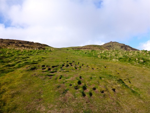
So, instead I headed east up the well-defined path to St. Anthony’s Chapel. About two hundred yards before I got there, I diverted left, off path, in favor of scrambling up the small bluff. Easy stuff, but I didn’t want to just stroll.
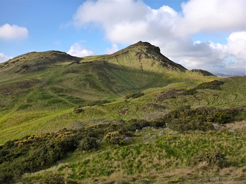
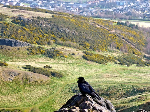
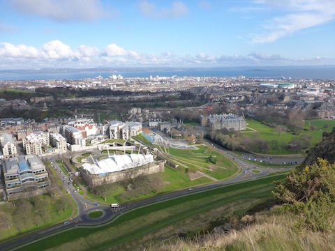
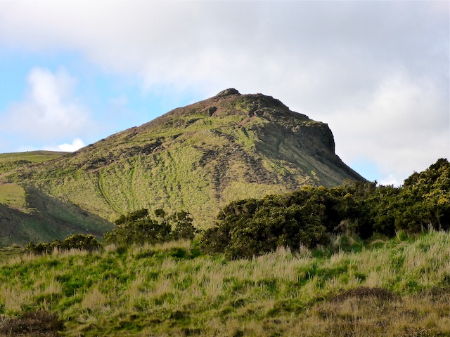
After the chapel, rather than turn south along the path to Hunters Bog, I continued east, travelling from high point to high point along the ridge which forms the east border of the park’s “bowl”, Whinny Hill (see posted route). Eventually my route brought me to a point directly east of Arthurs Seat, just above the Dunsapie Loch car park. The climb up to the summit was moderately steep; no big deal.
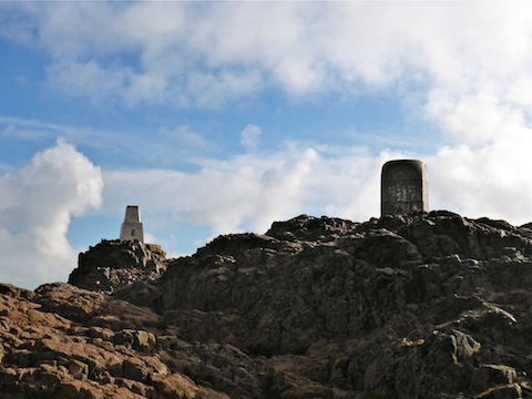
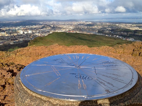
Awesome views from the summit! ![]()
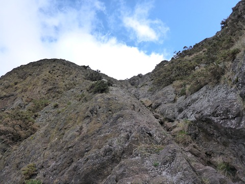
After much picture and video taking, I headed south off Arthurs Seat to a saddle. I had noticed a crack in the cliff, and wondered if there might be a safe way down. Turns out there was a faint foot path and, though steep, it did not look dangerous, so over I went. Basically, my route down the crack parallels switchbacks off Nether Hill, but 75 yards north of the maintained trail. I only slipped twice; no damage. ![]() Got to the bottom, where the drainage meets the switchbacks, then headed up the Salisbury Crags.
Got to the bottom, where the drainage meets the switchbacks, then headed up the Salisbury Crags.
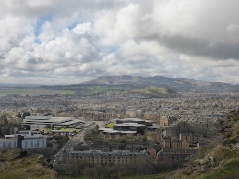
On the way I followed a dog, nimbly avoiding his attempt at a urinary diversion. ![]() As I travelled north along the cliff, I saw some guys hanging over the edge throwing knocking rocks off. I guess the maintenance crew explains the “Do Not Enter” at the base of Radical Rd. I followed the Salisbury Crags northeast, and gradually downwards, and honestly that was the slipperiest part of the hike, as it was wet grass.
As I travelled north along the cliff, I saw some guys hanging over the edge throwing knocking rocks off. I guess the maintenance crew explains the “Do Not Enter” at the base of Radical Rd. I followed the Salisbury Crags northeast, and gradually downwards, and honestly that was the slipperiest part of the hike, as it was wet grass.
Got to the bottom okay, headed north up Holyrood Gait, then west on Holyrood Rd. stopping at the first Tesco Express I saw to guzzle two quick Lucozades. ![]() Cut through the St. John Street wynd back to Canongate, then uphill back to my hotel.
Cut through the St. John Street wynd back to Canongate, then uphill back to my hotel.
GPS File: Arthur’s Seat
Distance: 5.04 mi.
AEG: 1,238 ft.
Time: 2h 2m
Slide Show
Hike Video
Hiking Arthur’s Seat, Scotland from Preston McMurry on Vimeo.